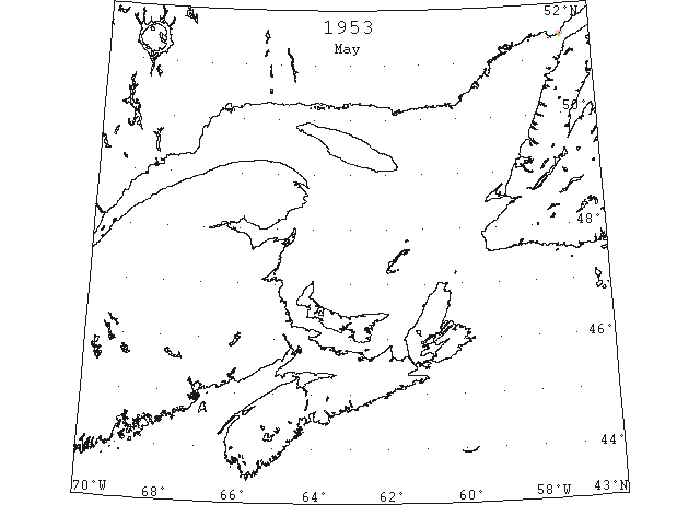
1953 Season
Dec 13 Last eastbound steamer through the Strait of Belle Isle. (WBB)
Dec 24 Last departure of the season from Quebec. (WBB)
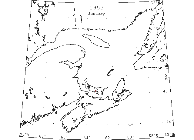
Jan 5 Lots of loose ice in Charlottetown Harbour. (Pat 5 Jan p4 c2)
Jan 15 Ferryboat “Montague” still making regular trips to Lower Montague. (Pat 15 Jan p10 c4)
Jan 31 Georgetown Harbour free of ice. SS “Lake” 100 ton steamer left Georgetown for Newfoundland. Roads open all winter. (Pat 31 Jan p1 c2)
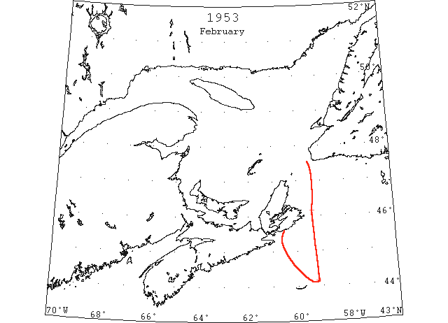
Feb 24 “Louisburg” southern limits open field ice, Gulf of St. Lawrence, 44°09’N 59°13’W to 46°09’N 59°22’W to north. (IIP p16#27)
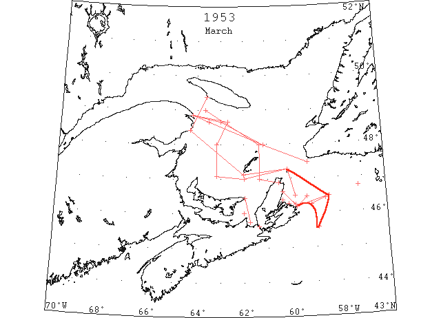
Mar On 3 March close pack ice in the Gulf of St. Lawrence area extended inshore of a line from Cape des Rosiers to 48°40’N 62°50’W, south to a position E of North Point, PEI, to St. Paul Island. By the 10th practically the whole area of the gulf W of 62°W was covered with newly formed ice which was to be the maximum ice limits for the year in that area. By the 24th there had been considerable improvement in the ice conditions in the gulf. At that time the steamer track between Cape Ray and Fame Point was practically clear, and the pack ice in the western and southwestern Gulf was now reported as open pack. By the 30th the St. Lawrence River was navigable to Montreal, and by the 31st the steamer track between Fame Point and Cape Ray was clear except for loosely scattered strings of drift ice to 30 miles E of Cape des Rosiers. (IIP p11)
Mar 3 USCG plane: limits of open pack ice, gulf area, Cape Smoky to 46°15’N 59°49’W to 46°15’N 59°10’W to 46°25’N 58°35’W thence NW. (IIP p16#37)
Mar 3 Can. DOT: Limits of newly formed ice, Cape des Rosiers to 48°40’N 62°40’W to 48°00’N 63°10’W to 47°05’N 63°10’W to 47°00’N 62°00’W to St. Paul Island to 46°28’N 58°25’W to Flint Island to Cape Smoky. (IIP p17#38)
Mar 11 Can. DOT: Almost complete coverage of gulf north of 46°00’N and W of 62°00’W. (IIP p17#49)
Mar 11 Can. DOT: Strait of Canso close pack ice. (IIP p17#50)
Mar 11 “Eastore” large patches drift ice 45°34’N 58°53’W. (IIP p17#52)
Mar 12 Can. DOT: no change from March 11. (IIP p18#62)
Mar 18 Can. DOT: Gulf ice, close pack ranging to open pack within these limits, Cape des Rosiers to 49°00’N 63°40’W to 48°00’N 61°20’W to 47°00’N 61°20’W to Cape North. (IIP p19#123)
Mar 18 Can. DOT: Large field loose drift ice, St. Paul Island to 46°30’N 59°50’W. (IIP p19#124)
Mar 18 Can. DOT: field ice 3 to 5 miles wide 25 miles long extends NE from Flint Island. (IIP p19#125)
Mar 18 “Gripsholm” strings of slush ice 46°45’N 57°10’W. (IIP p19#127)
Mar 20 Halifax: Small field close pack ice S of Cihoux Island. (IIP p20#147)
Mar 24 Can DOT: Limits of open pack, 50% coverage, St. Paul Island to 5 miles S of Magdalen Island to Cape D’Espoir to Southwest Point, Anticosti Island. (IIP p21#199)
Mar 24 Can. DOT: Small patches loose drift ice off Low Point, approaches to Sydney Harbour. (IIP p22#200)
Mar 30 Can. DOT: Some scattered ice along the line Cape des Rosiers to 48°40’N 63°00’W to 10 miles N of Bird Rocks to 10 miles off Cape Ray. (IIP p24#281)
Mar 30 Can. DOT: Strait of Canso clear to Hastings. Open ice George Bay, thence to East Point. PEI some scattered ice. (IIP p24#282)
Mar 31 Can. DOT: Some scattered ice between Rosiers and 48°40’N 63°30’W thence to 10 miles off Bird Rocks thence to 10 miles off Cape Ray. (IIP p24#289)
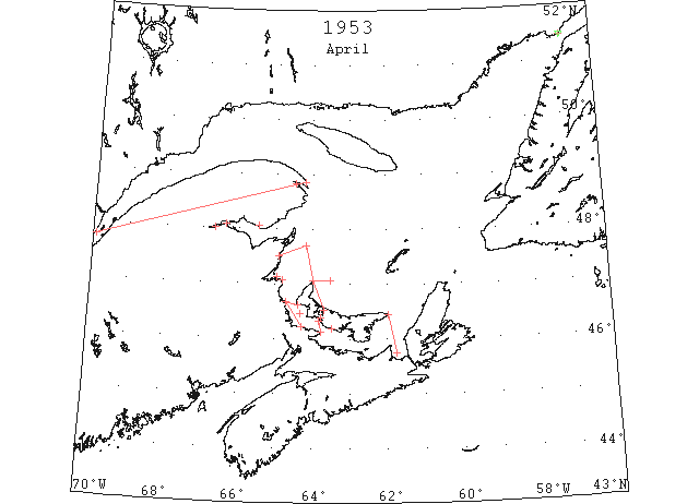
Apr In the Gulf of St. Lawrence the rapid disintegration of ice that began in the third week of March continued in April. Observation on the 1st showed that the steamer track from Cabot Strait to the St. Lawrence River was clear of all ice. The St. Lawrence River was reported navigable to Montreal by reinforced vessels. The only ice remaining in the gulf was close packed ice in Northumberland Strait north to Chaleur Bay and open pack ice from the Strait of Canso to East Point, PEI. A day later the St. Lawrence River had only some light scattered ice and was therefore reported navigable to all ships. This early opening date is almost without precedent. By the 15th all routes and ports in the River and Gulf of St. Lawrence were reported open to navigation except the Strait of Belle Isle. The only remaining ice was some loosely scattered ice in the western portion of Northumberland Strait which persisted until the 24th. (IIP p12-13)
Apr 1 Can. DOT: Open ice in George Bay thence scattered drift ice to East Point, PEI. (IIP p24#292)
Apr 1 First arrival of season at Quebec. (WBB)
Apr 2 Can. DOT: Light broken ice, Quebec to Cape Salmon thence eastward to Rosiers. (IIP p24#295)
Apr 4 Can. DOT: Some scattered ice from Quebec to Cape Salmon. (IIP p24#305)
Apr 4 Can. DOT: Strip of ice along north shore PEI from Malpeque to North Point with scattered strings extending eastward from North Point 20 miles. (IIP p24#306)
Apr 4 Can. DOT: Scattered loose ice, North Point to 20 miles SE Miscou Island to New Brunswick coast to end of visibility 25 miles. (IIP p24#307)
Apr 4 Can. DOT: Loose ice in Gaspe Harbour and entrance to Bonaventure. (IIP p24#308)
Apr 6 Can. DOT: Light scattered ice, Quebec to Cape Salmon. (IIP p25#318)
Apr 6 Can. DOT: Loose ice along the line Cape North to 20 miles off Miscou Island; close pack at Escuminac Point, New Brunswick. (IIP p25#319)
Apr 7 Can DOT: Considerable broken ice Saguenay River to Port Alfred. (IIP p25#329
Apr 8 Can DOT: Scattered ice in the area North Point, PEI to 20 miles SE of Miscou Island to New Brunswick coast; close packed at Escuminac. (IIP p25#332)
Apr 10 Can. DOT: Strip of ice 1 to 10 miles wide from Cape Bald to Richibucto, Gulf of St. Lawrence. (IIP p25#340)
Apr 11 Can. DOT: Strip of ice 1 to 2 miles wide extends N from Cape Bald to Richibucto. Heavy pack at Escuminac. (IIP p26#345)
Apr 11 Can. DOT: Ice in Campbellton and Dalhousie Harbours, Chaleur Bay. (IIP p26#346)
Apr 11 Can. DOT: Narrow strip along coast between North Point and Malpeque, PEI. (IIP p26#347)
Apr 15 Can. DOT: Only known ice liable to obstruct navigation is located between lines: Tormentine to Seacow Head and West Point, PEI and Richibucto. Within this area 75% loose ice moving southward. (IIP p27#401)
Apr 15 Can. DOT: 5% ice off Point Escuminac, Miramichi Bay; inner bay loose ice. (IIP p27#402)
Apr 16 Can. DOT: Eastern limits of field ice at Victoria, PEI. (IIP p27#408)
Apr 17 Can. DOT: All routes and ports Gulf and River St. Lawrence clear except western part of Northumberland Strait. (IIP p27#400)
Apr 18 Can. DOT: Conditions same as reported before. (IIP p27#433)
Apr 20 Can. DOT: All Gulf routes clear except ice in western part of Northumberland Strait. (IIP p28#446)
Apr 21 Can. DOT: Point Amour, heavy close pack ice with 4 bergs. (IIP p28#448)
Apr 22 Can. DOT: Only ice in gulf scattered strings along PEI coast westward from Summerside. (IIP p28#451)
Apr 22 Can. DOT: Point Amour, 5 bergs in sight. (IIP p28#452)
Apr 23 Can DOT: No change Gulf of St. Lawrence since 22nd. (IIP p28#476)
Apr 24 Can. DOT: All routes to Great Lakes and local gulf ports now clear of all ice except through Strait of Belle Isle. (IIP p28#484)
Apr 24 Can. DOT: Point Amour, 7 bergs in heavy open pack ice. (IIP p28#485)
Apr 25 Can DOT: No change Gulf of St. Lawrence since 22nd. (IIP p28#489)
Apr 26 Can. DOT: No new information Gulf of St. Lawrence. (IIP p28#493)
Apr 26 Can DOT: All gulf routes and ports clear except Strait of Belle Isle. (IIP p29#514)
Apr 26 Can DOT: Strait of Belle Isle, open pack ice extends W to Point Amour. (IIP p29#518)
Apr 28 Can. DOT: No new information Gulf of St. Lawrence. (IIP p29#533)
Apr 29 Can. DOT: Point Amour, heavy open pack; several bergs and growlers. (IIP p29#535)
May 1 Can. DOT: All gulf routes and ports clear except Strait of Belle Isle. (IIP p29#545)
May 1 Can. DOT: Point Amour, loose ice in sight all around. (IIP p29#536)
May 4 USN Plane: Open from Cape Norman to Eddies Cove thence pack ice to Amour Point. (IIP p31#615)
May 4 Lobsters close to shore due to fine open spring with no ice in vicinity of fishing grounds for past several weeks. (Pat 4 May p5 c4)
May 5 USN Plane: Strings of field ice on Southern shore from entrance to Barbe Bay and patches past Savage Point. (IIP p31#635)
May 16 First Westbound steamer through the strait of Belle Isle. (WBB)
May 17 Point Amour: 25 bergs and many growlers between Point Amour and Belle Isle. (IIP p33#794)