1928 Season
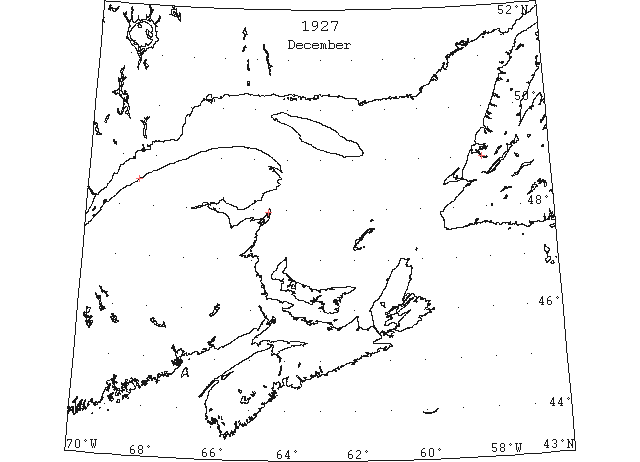
Dec (beginning) Pilotage officer, Father Point: Ice starts making. (CIS IC0708)
Dec 4 Last eastbound steamer through the Strait of Belle Isle. (WBB)
Dec 6 Last departure of the season from Quebec. (WBB)
Dec 7 At Red Bay the survey, party sent down by the government to survey Pinware timber, came aboard after spending nearly two months traveling the country in that vicinity. Slob ice is beginning to make and some of the secure harbors and bays are frozen over. The “Sagona” will probably make two more trips after which she will probably load herring for New York direct, if they are available for her. (TWS, p.5).
Dec 18 J.A. Ward, Lightkeeper, Miscou Point, New Brunswick: Closing date. (CIS IC0756_2)
Dec 31 SS “Betty” loading potatoes at Georgetown, sailed Saturday (Dec. 31st). (Pat 3 Jan 1928 p8 c3)
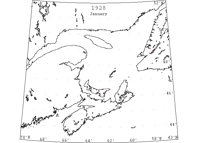
Jan 4 Rocky Point ferry operating. (Pat 4 Jan p5 c6)
Jan 4 Steamer “Italia” sailed last night (from Charlottetown) for Georgetown. (Pat 5 Jan p8 c3)
Jan 10 Steamer “Italia” sailed from Georgetown yesterday for Charleston. This is the latest for any steamer loading produce to leave the Island. (Pat 11 Jan p8 c4)
Jan 11 Some half dozen motor boats came in from Woods Island and along the north shore of Humber Arm yesterday, but owing to the slob ice were unable to get to the docks in Curling harbor. They succeeded in landing at Petrie’s Point. (TWS, p.2).
Jan 11 The Humber River has been well frozen for nearly two weeks, and splendid skating was had there. One could travel for a distance of three miles on perfectly smooth ice. (TWS, p.2).
Jan 11 Charlottetown – the ferry steamer “Hillsboro” is making her usual trip today, the harbour being perfectly free of ice. This is the latest day in the season on which she has run. (Pat 11 Jan p5 c3)
Jan 16 The steamer “Hillsboro” left for Rocky Point, having some difficulty with the ice. This is her latest trip on record but the old ferry Southport in 1892 ran up to February 4th and resumed her spring work on March 17th. (Pat 16 Jan 1928 p8 c4)
Jan 17 Lightkeeper, East Point, PEI: Ice formed in vicinity. (CIS IC0993)
Jan 18 People crossed on ice from Curling to Summerside on Monday, for the first time this season. (TWS, p.3)
Jan 19 Lightkeeper on Panmure Island reports no ice yet, the Gulf being as clear as in July, not any ice along the shore. Georgetown – the ferry boat is still running on Cardigan and Georgetown ferries, not a cake of ice to be seen yet. (Pat 19 Jan p3 c1)
Jan 28 Caught by the Gulf of St. Lawrence ice when the wind changes the course of the icefield and caught the men as they were attempting to carry mail to Pictou Island. (Pat 28 Jan p1 c3)
Jan 28 Georgetown – both ferry boats have gone to winter quarters. (Pat 28 Jan p2 c1)
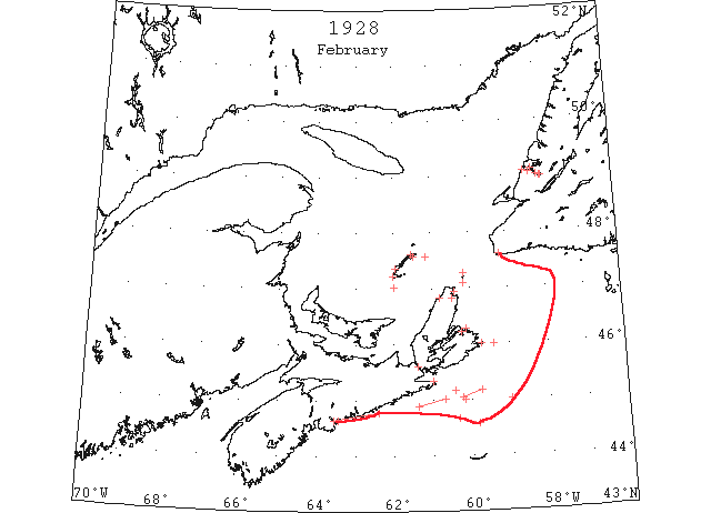
Feb Field ice from the Gulf of St. Lawrence was reported from between Cape Breton and Sable Island. (IIP p60)
Feb (early) Pilotage officer, Father Point: River clear of ice. (CIS 0708_2)
Feb 2 Latest reports from the Strait of Belle Isle, announces heavy local ice everywhere, moving northwest. (HH 02/02/1928 p11#)
Feb 6 Grosse Isle, light close packed ice everywhere. Amherst, light open ice in distance. Old Harry. no ice in sight. Pleasant Bay, light open ice in distance. Point Tupper, heavy open ice. Gaspe Bay, no ice in sight. Scatarie, light open ice in distance. (HH 07/02/1928 p14#2)
Feb 8 We have the first sign of ice for the season this week, but nothing, however, to interfere with the Cabot Strait service, and up to the present the steamer “Caribou” has been making good runs between Port aux Basques and North Sydney. (TWS, p.2)
Feb 8 Black Point [?], close packed ice. St. Paul, heavy close packed ice. Grindstone, clear. Grosse Isle, heavy close packed ice moving to north. Old Harry, no ice in sight. Amherst, heavy close packed ice. Pleasant Bay, open ice everywhere. Asby Bay, clear, calm. Point Tupper, heavy close packed ice. Scatterie, close packed ice everywhere. (HH 08/02/1928 p11#3)
Feb 10 St. Paul Island, heavy close packed ice. Point Tupper, light open ice, distant. Amherst, heavy open ice. Pleasant Bay, light close packed ice in shore. Etang du Nord, heavy open ice stationary. Scatari, heavy open ice everywhere. (HH 10/02/1928 p11#8)
Feb 11 St. Paul Island, light open ice everywhere. Point Tupper, light open ice everywhere. Aspy Bay, light close packed in shore. Scatari, light close packed ice everywhere. Flat Point, light close packed ice stationary. Grosse Isle, close packed ice moving to west. Old Harry, heavy open ice. Pleasant Bay, light open ice everywhere. (HH 11/02/1928 p25#1)
Feb 12 45°10’N 59°45’W to 45°03’N 60°15’W Field ice (IIP P39#5)
Feb 13 45°01’N 60°42’W to 44°53’N 61°23’W Patches of drift ice. [SS “Estonia” (HB)] (IIP P39#8)
Feb 14 St. Paul Island, light close packed ice everywhere. Aspy Bay, heavy close packed ice everywhere. Scatari, light close packed ice inshore. Flat Point, light open ice everywhere. Amherst, heavy close packed ice. Old Harry, heavy open ice, distant. Pleasant Bay, light close packed ice everywhere. Etang du Nord, heavy close packed ice. (HH 14/02/1928 p15#8)
Feb 15 44°40’N 60°20’W to 44°35’N 59°50’W Open field ice (IIP P39#9)
Feb 15 The drift ice is now inshore and the Bay of Islands is filled for the first time this season. (TWS, p.2).
Feb 15 Teams are now able to cross on ice from Woods Island, and several were up the Arm to Curling the past week. (TWS, p.2).
Feb 15 The SS “Silvia City” sailed from P. A. B. last Sunday for Sydney and docked at Sydney safely. She has twice proceeded to Louisburg accompanied by one of the Canadian Govt. Ice Patrols. (TWS, p.3)
Feb 15 St. Paul Island, light close packed ice everywhere. Point Tupper, light open ice, distant. Scatari, light open ice everywhere, northward. Flat Point, light close packed ice everywhere, moving to east. Amherst Island, heavy open ice distant. Grosse Isle, heavy open ice, moving to east. Old Harry, heavy open ice, distant. Pleasant Bay, heavy close packed ice. Etang du Nord, heavy close packed ice. (HH 15/02/1928 p13#3)
Feb 17 St. Paul Island – Light close packed ice everywhere. Aspy Bay – Light close packed ice in shore. (HH 17/02/1928 p13#8)
Feb 18 SS “Arabic” passed through considerable ice of the Nova Scotia coast. (NYMR)
Feb 18 45°00’N 59°00’W Heavy field ice (IIP P39#10)
Feb 19 45°00’N 60°10’W Heavy field ice (IIP P39#11)
Feb 21 Information that a heavy field of ice extended along the southern half of Canso Bank, was received today from the steamer “Bannack” said ice reached to the horizon in all directions. (HH 21/02/1928 p11#6)
Feb 22 On Tuesday last the “Caribou” had some difficulty in getting through the slob ice in Sydney Bight, it being so thick that the ship would almost become “bogged” but as soon as the hard ice was reached progress was scarcely impeded. (TWS, p.2).
Feb 22 The airplane to locate the seals in the Gulf, in command of Pilot Caldwell, arrived and alighted on Grand Bay ice at 3:30 this afternoon, completing a non stop flight from St. John’s. (TWS, p.2)
Feb 22 St. Paul’s Island – Light close packed ice everywhere. Point Tupper – Light open ice everywhere. Scatari – Light close packed ice distant north and east. Canso – Light open ice in shore. Aspy Bay – Light close packed ice everywhere. Flat Point – Light close packed ice. Amherst – Clear, Light, heavy close packed ice. Grosse Isle – Heavy open ice. Old Harry – No ice in sight. Pleasant Bay – heavy open ice. (HH 22/02/1928 p11#5)
Feb 23 Chebucto Head – clear. St. Paul’s Island – heavy close packed ice everywhere. Flat Point – Light close packed ice everywhere. Point Tupper – Light open ice in shore. Aspy Bay – Heavy close packed ice everywhere. Scatari – Light open ice in shore. Light close-packed ice distant north and east. Amherst –Heavy close packed ice. Grosse Isle – Heavy close packed ice moving to east. Old Harry – Clear. No ice in sight. Pleasant Bay – heavy close packed ice. Etang du Nord – Heavy close packed ice. (HH 23/02/1928 p13#1,2)
Feb 24 St. Paul’s Island – Heavy close packed ice. Point Tupper – Light open ice distant. Aspy Bay – Heavy close packed ice. Scatari – Light open ice everywhere. Flat Point, Light open ice everywhere. Amherst – Heavy close packed ice. Grosse Isle – Heavy open ice. Old Harry – Heavy open ice. Pleasant Bay – Light close packed ice in shore. Etang du Nord – Heavy open ice. (HH 24/02/1928 p13#3)
Feb 28 St. Paul’s Island – Heavy close packed ice. Point Tupper – Light open ice everywhere. Aspy Bay – Heavy open ice distant. Scatari – Light open ice in shore. Flat Point – Light open in shore. Amherst – Heavy close packed ice. Grosse Isle – Heavy open ice moving to northwest. Pleasant Bay – No ice in sight. Etang du Nord – Heavy close packed ice. (HH 28/02/1928 p11#1)
Feb 28 Fifty –nine hours was taken by the liner “Rosalind,” on her voyage to Halifax from St. John’s. The “Rosalind” was delayed by stormy weather and in passing through a large field of drift ice encountered on Monday. (HH 29/02/1928 p15#1)
Feb 29 Passengers arriving by “Caribou” say there is not much ice in the Gulf yet, although some seals have been seen this past week. (TWS, p.2)
Feb 29 The Gulf ice is close along shore and fishing is suspended in the meantime. (TWS, p.2).
When the wind veered to the S. E. on Thursday the drift ice entered the harbor and overran the gas buoy. Previous to its entry, harbor master Gillam worked with all speed to detach the light which we understand is a valuable part of the outfit, and succeeded in removing it in the nick of time. Out experience is that when the drift ice reaches Cape Ray it is time to remove anything from the water that would be subject to damage. We believe the department was advised to remove the buoys in December. (TWS, p.2)
Feb 29 St. Paul’s Island – Heavy open ice. Point Tupper – Light open ice everywhere. Aspy Bay – No ice in sight. Scatari – Light open ice everywhere. Flat Point – Light open ice inshore. Pleasant Bay – Light open ice in shore. Etang du Nord – Heavy close packed ice. Amherst Island, Grosse Isle, Old Harry – Light northwest wind; clear. (HH 29/02/1928 p15#2)

Mar Field ice reached its greatest southerly extension for the year during March. There were two reports of the Gulf of St. Lawrence pack from between Sable Island and Cape Breton Island. The most southerly report was one of this ice from the vicinity of 44°30’N 60°00’W. The Canadian authorities in the Dept. of Marine and Fisheries at the present writing have more detailed information in this sector. (IIP p61)
Mar 1 44°38’N 60°00’W to 44°38’N 60°20’W Broken field and slab ice (IIP P39#22)
Mar 1 St. Paul’s Island – Heavy close packed ice everywhere. Point Tupper – Light open ice everywhere. Aspy Bay – Heavy close packed ice distant. Scatari –Light open ice everywhere moving north and east. Flat Point – light close packed ice in shore. Grosse Isle – Heavy open ice, moving to east. Old Harry – Heavy open ice, distant. Pleasant Bay – Heavy close packed ice. (HH 01/03/1928 p15#1)
Mar 3 St. Paul’s Island – Heavy open ice distant. Point Tupper – Light close packed ice in shore. Aspy Bay – Heavy open ice everywhere. Scatari – Light open ice in shore. Flat Point – Light open ice distant. Cape Breton Coast – Heavy close packed ice everywhere northeast. Amherst Island – Heavy close packed ice. Old Harry – Heavy open ice moving to east. Pleasant Bay – No ice in sight. Etang du Nord – Heavy close packed ice. (HH 03/03/1928 p23#1)
Mar 5 St. Paul’s Island – Heavy close packed ice everywhere. Point Tupper – Heavy close packed ice north, light open ice distant, south. Aspy Bay – Heavy close packed ice distant. Scatari – No ice in sight. Flat Point – light open ice distant north. Amherst Island – Heavy close packed ice. Grosse Isle and Old Harry – Heavy open ice moving to east. Pleasant Bay – heavy close packed ice in shore. Etang du Nord – Heavy close packed ice. (HH 05/03/1928 p13#2)
Mar 7 St. Paul’s Island – Heavy close packed ice. Flat Point – No ice in sight. Point Tupper – No ice in sight. Aspy Bay – Heavy close packed ice distant. Scatari – Light open ice everywhere. Amherst Island – Heavy close packed ice. Grosse Isle – Heavy open ice moving to east. Old Harry – Heavy open ice distant. Pleasant Bay – No ice in sight. Etang du Nord – Heavy close packed ice. (HH 07/03/1928 p11#2)
Mar 10 St. Paul’s Island – Heavy close packed ice. Flat Point – No ice in sight. Point Tupper – Heavy close packed ice north of Hastings; heavy open ice south. Aspy Bay – Heavy close packed ice distant. Scatari – No ice in sight. Amherst Island – Heavy open ice distant two miles. Grosse Isle – Heavy close packed ice moving to east. Old Harry – Heavy open ice distant. Pleasant Bay – Heavy close packed ice in shore; no ice in sight in bay. Etang du Nord – Heavy close packed ice. (HH 10/03/1928 p23#1)
Mar 12 St. Paul’s Island – Heavy close packed ice. Flat Point – Light open ice distant. Point Tupper – Light open ice in shore. Aspy Bay – Heavy close packed ice distant. Scatari – Light open ice everywhere. Grosse Isle – Heavy close packed ice stationary. Old Harry – Heavy close packed ice distant. Pleasant Bay – Heavy close packed ice in shore. Etang du Nord – Heavy close packed ice. (HH 12/03/1928 p13#2)
Mar 13 44°57’N 60°55’W to 45°31’N 58°07’W Heavy and light field ice (IIP P40#34)
Mar 13 From 44°58’N 60°55’W to 45°31’N 58°07’W heavy field ice. (HB #2012 Mar 28)
Mar 14 The personnel of the “Caribou” reports very heavy ice in the Cabot Strait and some sheets measuring many miles in size. A heavy S. E. gale is now required to improve conditions. On Thursday the “Terra Nova” and “Neptune” could be sighted from here [?] and apparently making slow progress. (TWS, p.2)
Mar 14 Point Tupper – Heavy close packed ice north; heavy open ice south. Aspy Bay – Heavy close packed ice. Cape Ray – Heavy open ice. Grosse Isle – Heavy open ice distant moving to north. Old Harry – Heavy close packed ice. Pleasant Bay – No ice in sight. (HH 14/03/1928 p13#2)
Mar 16 St. Paul’s Island – Heavy close packed ice. Flat Point – Heavy close packed ice. Point Tupper – Heavy open ice. Aspy Bay – Heavy close packed ice. Scatari – Heavy close packed ice everywhere. Amherst Bay, Pleasant Bay, Etang du Nord – heavy fall of snow. Grosse Isle, Old Harry – heavy fall of snow. (HH 16/03/1928 p13#1)
Mar 19 St. Paul’s Island – Heavy close packed ice. Flat Point – Heavy open ice distant. Point Tupper – Heavy open north and south. Aspy Bay – Heavy close packed ice distant. Scatari – Heavy close packed ice north and east; heavy open south. Amherst Island – Heavy close packed ice. Grosse Isle – Heavy open ice moving to east. Old Harry – Heavy open ice distant. Pleasant Bay – Heavy close packed ice in shore. Etang du Nord – Heavy close packed ice. (HH 19/03/1928 p13#1)
Mar 21 The SS “Caribou” was unable to get away from Port aux Basques on Monday night because of heavy ice packed in on the land and she had not sailed up to late yesterday. (TWS, p.2)
Mar 21 Only one day last week were the fishermen able to get on the fishing grounds because of ice. They found codfish scarce. (TWS, p.2).
Mar 21 Cape Ray reports many old seals in the water, but no young ones sighted on the ice. (TWS, p.2).
Mar 21 Several parties have been harvesting ice the past week. The blocks time to about 22 inches of good solid ice. (TWS, p.2)
Mar 21 St. Paul’s Island – Heavy close packed ice. Flat Point – No ice in sight. Point Tupper – Light open ice distant. Aspy Bay – Heavy close packed ice. Scatari – Heavy open ice. Amherst Island – Heavy close packed ice. Grosse Isle – Heavy open distant ice, moving east. Old Harry – Heavy closed packed ice moving east. Pleasant Bay – Heavy open ice everywhere. Etang du Nord – Heavy open ice. (HH 21/03/1928 p11#1)
Mar 24 Flat Point – No ice in sight. St. Paul’s Island – Light open ice distant. Point Tupper – Light open ice distant north and south. Aspy Bay – No ice in sight. Scatari – No ice in sight. Amherst Island – No visibility. Grosse Isle, Old Harry, Pleasant Bay – heavy close packed ice in shore. Etang du Nord – No visibility. (HH 24/03/1928 p23#2)
Mar 26 Lightkeeper, East Point, PEI: Spring breakup. (CIS IC0993_2)
Mar 27 Flat Point – Light open ice everywhere. St. Paul’s Island – Heavy close packed ice everywhere. Point Tupper – Heavy open ice distant. Aspy Bay – Heavy close packed ice everywhere. Scatari – Heavy open ice everywhere. Amherst Island – Heavy open ice distant. Grosse Isle and Old Harry –Heavy open ice moving to east. Pleasant Bay – Heavy close packed ice in shore. Etang du Nord – Heavy open ice. (HH 27/03/1928 p13#1,2)
Mar 28 The change of wind on Friday cleared the ice off the coast. Some fishing boats were out on Saturday but did very little. (TWS, p.2)
Mar 30 Flat Point, Scatari – No ice in sight. St. Paul’s Island – Light close packed ice in shore. Point Tupper – Light open ice distant. Aspy Bay – No ice in sight. Amherst Island – No ice in sight Heavy sea. Grosse Isle –Heavy open ice in shore, moving to east. Old Harry – No ice in sight. Etang du Nord – Southwest, heavy close packed ice in shore. Heavy open ice distant, moving to the east. (HH 30/03/1928 p12#1)
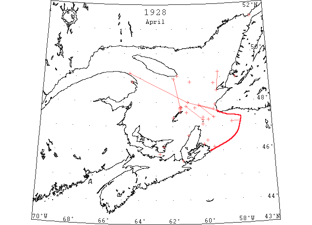
Apr On April 12 the “Montcalm” began the Canadian Ice Patrol in the Gulf of St. Lawrence. A day or two later the first steamer bound for the gulf and river ports was noted approaching the Banks. (IIP p13)
Apr The Canadian ice patrol service was inaugurated on April 12. On the 13th this service broadcast that there was field ice from the longitude of Cape Breton Island to Cape Race, the fields being heavy to the E and lighter to the W. (IIP p61)
Apr 1 J.A. Ward, Lightkeeper, Miscou Point, New Brunswick: Opening date. (CIS IC0756_2)
Apr 3 Lightkeeper, East Point, PEI: Clear of ice. (CIS IC0993_3)
Apr 3 Flat Point – Heavy open ice distant. St. Paul’s Island – Light open ice in shore, south-east; heavy close packed ice everywhere. Point Tupper – Light open ice everywhere, moving north and south. Aspy Bay – No ice in sight. Scatari –Light open ice everywhere. Grosse Isle – Heavy open ice moving to east. Old Harry, Heavy open ice distant, moving to the east. Pleasant Bay – No ice in sight. Etang du Nord – Light open ice everywhere. (HH 03/04/1928 p13#3)
Apr 4 Spring is fast underway in the Codroy Valley and Grand River ice is so damaged that there are little hopes of the annual horse races taking place. (TWS, p.1).
Apr 4 Word was received here today of the loss of the schooner “Guide”, Capt. Ed. Seeley, of this port. The schooner was driven in by ice and wind on Friday night and became a total wreck. (TWS, p.2)
Apr 6 Flat Point – Heavy open ice distant St. Paul’s Island – Split and heavy close packed ice to northwest and west of Island; elsewhere, light open ice everywhere. Point Tupper – North heavy close packed ice; south, heavy open ice. Aspy Bay – Light open ice distant. Scatari – Heavy open ice distant northeast. Amherst Island – No ice in sight. Grosse Isle – Heavy open ice moving to the north. Old Harry and Pleasant Bay – No ice in sight. Etang du Nord – Heavy open ice. (HH 06/04/1928 p9#2)
Apr 10 Flat Point – Light close packed ice in shore. St. Paul’s Island – Slob ice southwest and west. No ice in sight elsewhere. Point Tupper – No ice in sight. Aspy Bay – No ice in sight. Scatari – No ice in sight. Grosse Isle – Ice about mile in shore. Pleasant Bay – No ice in sight. Etang du Nord – About a quarter mile ice in shore. (HH 10/04/1928 p19#2)
Apr 12 Flat Point and St. Paul’s Island – No ice in sight. Point Tupper – Light open ice everywhere. Aspy Bay – No ice in sight. Scatari – Heavy open ice northeast; moving to south. Amherst Island – No ice in sight. Grosse Isle – About ten miles of broken ice in shore. Old Harry and Pleasant Bay – No ice in sight. Etang du Nord, About 100 yards of broken ice in shore. Bryon Island – Heavy close packed ice everywhere north. (HH 12/04/1928 p14#2)
Apr 14 Flat Point – No ice in sight. St. Paul Island – light open ice in distance, east. Point Tupper – No ice in sight. Amherst Island, Grosse Isle, Old Harry, Pleasant Bay, Etang du Nord – Light southwest wind, foggy. (HH 14/04/1928 p24#2)
Apr 14 Cunard Anchor and Anchor Donaldson Lines have again led all other competitive lines in the numbers of passengers carried both to and from Halifax during the winter season which closes this week end with navigation being again opened on the St. Lawrence waterway, when their Canadian sailings will be directed to Quebec and Montreal. (HH 14/04/1928 p24#1)
Apr 15 On Saturday last, April 15th, the steamer “Robie M” arrived from Pictou. Navigation opening about three weeks earlier than last year. On the 2nd May last year the “Canadian Snapper” was the first steamer to reach this port. The schooner “J.E. Collins” also arrived on Saturday from Murray Harbour. (Pat 16 Apr 1928 p8 c3)
Apr 16 Flat Point – No ice in sight. St. Paul’s Island – No ice in sight. Point Tupper – No ice in sight. Aspy Bay – No ice in sight. Amherst Island – No ice in sight. Grosse Isle, Old Harry – No ice in sight. Pleasant Bay, Etang du Nord – No ice in sight. (HH 16/04/1928 p13#2)
Apr 17 The good steamer “Harland” resumes its regular trips tomorrow, leaving from Victoria. This is much earlier than last year. (Pat 17 Apr p8 c3)
Apr 17? About a week ago the ferry steamer “Montague” plying between Georgetown and Lower Montague had several planks driven in by the ice and sank at the wharf. (Pat 24 Apr p8 c3)
Apr 18 The Humbermouth port is now clear of ice, and the I .P. and P. Co. booms are being put in place at the mouth of the river. (TWS,p.2).
The ice in Humber Arm is fast disappearing. Yesterday the water was down to Petipas’ Cove on Summerside and Leggo’s Point at Curling. Another day or two of warm sun will likely clear the Arm and open the Bay to navigation. (TWS, p.2)
Apr 18 Scatari – Light open ice in shore. Cape Ray – Light close packed ice everywhere, moving southeast. All Magdalen Islands – No ice in sight. (HH 18/04/1928 p15#2)
Apr 18 Reports From “Montcalm.” North Sydney, Intercepted from “Montcalm” from Cape Ray, 10 miles N E magnetic from Bird Rock, very light open ice. From last mentioned position on course of Fame Point, heavy and light open ice. Heath Point, heavy close packed ice everywhere. All points Magdalen Islands report no ice in sight. On course Magdalen Island to North Point, PEI., thence to Miscou Island and Gaspe, no ice. Recommended course for vessels bound river ports Burgeo Bank to 10 miles west of Cape Ray, thence 10 miles N E Bird Rock, ice which will be encountered from Bird Rock to Fame Point is close packed in places and should be navigated with caution. Montreal to Lake St. Peter, ice still holding. Quebec to Fame Point, no ice. Sydney Harbor, clear. Light drift ice reported Northumberland Straits, vicinity Summerside. Escuminace, Point Tupper, Pictou, Port Hood, Tracadie, Borden, Tormentine, Cheticamp, no ice. “Terra Nova” reports position 20 miles NNW Cape St. George, heavy close packed ice, St. Paul, no ice in sight. From 48°50’N 60°55’W our position 8 a.m. passed through field, heavy and light open ice. (HH 20/04/1928 p13#3)
Apr 19 First arrival of season at Quebec. (WBB)
Apr 20 Flat Point – No ice in sight. St. Paul’s Island – No ice in sight. Point Tupper – No ice in sight. Aspy Bay – No ice in sight. Scatari – No ice in sight. Grosse Isle – Light open ice distant 7 to 8 miles, moving to east. All other stations, no ice in sight. Reports From “Montcalm.” field of heavy close packed ice and open ice. Northern edge 43[48?]°57’N 61°56’W extending to Magdalen Islands heavy close packed ice reported on west coast Newfoundland, and believed same is continuation of above mentioned field. As this field has not yet been patrolled west of 48°14’N 61°34’W its western edge has not yet been determined. All ships should avoid this field. Ice reported yesterday in vicinity Burgeo Bank extending approximately 20 miles in western direction. Recommended course vessels bound river ports from 10 miles N E magnetic from St. Paul’s to 47°00’N to 61°44’W thence to 20 miles N E magnetic. From North Point, PEI to Bonaventure Island and Gaspe on this course isolated growlers may be met. Every precaution should be taken to avoid them as some are quite large and dangerous. Gaspe to Quebec, no ice. Lake St. Peter to Montreal channel not open yet. Sydney Harbor, open. Light drift ice reported Northumberland Straits, vicinity Summerside. Escuminace, Anticosti, all points, St. Paul’s, Richibucto, Tracadie, Pictou, Flat Point, Scatari, Point Tupper, Tormentine, no ice in sight. Magdalen Islands about 7 or 8 miles open ice in shore moving easterly. All other points no ice. Cheticamp, light ice. Cape Ray yesterday scattered ice. “Montcalm” 8 a.m. 47°18’N 59°54’W light N E winds, cloudy, no ice sighted form Cape North to present position. (HH 21/04/1928 p26#2)
Apr 24 CGS “Montcalm” between 47°53’N 60°23’W and 47°23’N 59°30’W heavy and light broken ice extending northeastward and south of this course as far as could be seen. (NYMR)
Apr 24 Canadian Signal Service: Montreal to Sorel- Very little ice. Three Rivers to Quebec- Broken ice with large pieces. (NYMR 2 May p. 13, col. 3)
Apr 24 CGS “Montcalm” patrolled between lat 47°53’N lon 60°23’W and lat 47°23’N lon 59°30’W; heavy and light broken ice extends northeast and south of this course as far as could be seen. Point Amour- Heavy close packed ice everywhere. Belle Isle- Heavy open ice in the straits, open to the east; 2 bergs. (NYMR 2 May p. 13, col. 3)
Apr 24 Point Amour, heavy close packed ice everywhere. (HB #2017 May 2)
Apr 24 Flat Point, Point Tupper, Aspy Bay, Cape Ray – No ice in sight. St. Paul’s Island – slob ice north; no ice in sight elsewhere. Scatari – No ice in sight. Amherst Island – No ice in sight. Grosse Isle, Old Harry – Light open ice in distance. Pleasant Bay – No ice in sight. Etang du Nord – One mile light open ice in shore north side. “Montcalm”: Field of loose ice with numerous heavy pieces approximately 47°46’N 6[0]°37’W about 1 mile and a half in width extending to W. and E. as far as can be seen. Field heavy and light broken ice from 47°53’N 60°23’W to 47°43’N 59°30’W extending N E and S of this course as far as can be seen. This field drifting towards westward. Field of heavy and light broken ice extending from Cape Breton coast. Recommended course vessels bound River ports entering Gulf by Cabot Straits 10 miles E magnetic from St. Paul Island to 10 miles E magnetic from Bird Rock, thence to Gaspe coast. Ships on this course may encounter field of heavy and broken ice between St. Paul and Bird Rock. As there are numerous pieces heavy pans in all fields, every precaution should be taken to avoid them or not to strike with force. Vessels bound River through Strait of Canso to East Point, PEI., thence to Gaspe coast. Ships passing on the course yesterday report sighted no ice. Quebec to Three Rivers, scattered ice passing down. Three Rivers to Montreal channel not yet open. Vessels not expected proceed Montreal before Wednesday. Sydney harbor open. Gaspe Harbor not yet open. “Montcalm” 8 a.m.6 miles N W magnetic from Cape Ray. (HH 25/04/1928 p17#2)
Apr 25 The ice in Humber Arm broke up on Sunday out as far as Meadows Point, and that evening several motor boats were on the Arm. (TWS, p.2)
Apr 25 The SS “Mondoc,” E bound from Swansea, for Montreal, was obliged to put into port for harbor yesterday owing to ice conditions in the Gulf. (HH 26/04/1928 p13#1)
Apr 25 “Montcalm”: Recommended course bound river ports entering gulf through Cabot Straits, 10 miles E magnetic St Paul’s Island to10 miles E magnetic, Bird rock, thence to Gaspe coast. Ice fields may be encountered between St. Pauls and Bird Rock, but believe same can be avoided by following eastern or western edge, a heavy swell is running in Gulf today and ships are advised not to enter any ice met as it would be very dangerous. Vessels bound river ports through Straits of Canso should shape course from Northern entrance to East Point, PEI, thence to Gaspe coast. Vessels passing on this course have sighted no ice. Fame Point to Quebec no ice. Sydney Harbor open. Gaspe Harbor not yet open. Anticosti all points Cape Ray, Cheticamp, Souris, Pictou, Point Tupper no ice. (HH 26/04/1928 p13 #3)
Apr 26 “Montcalm”: Recommended courses vessels bound river ports entering Gulf through Cabot Straits from 10 miles E magnetic from St. Pauls Island to 10 miles E magnetic from Bird Rock thence to Gaspe coast only ice sighted on this course yesterday was field broken ice Bird Rock bearing south 80 W. Distance 14 miles stretching E and W direction. Believe can be avoided by passing on eastern or western edge. Vessels bound river ports through Straits of Canso should shape courses from northern entrance to East Point, PEI., thence on Gaspe Coast; no ice will be met on this course. Fame Point to Quebec, no ice. Sydney Harbor open. Vessels bound St. Lawrence from Sydney should shape course to pass between Cape North and St. Pauls Island, thence to 10 miles E magnetic from Bird Rock and Gaspe coast. Richibucto, Flat Point, Scatari, Anticosti, all points, St. Pauls Island, Point Tupper, Souris, Summerside, Pictou, Cape Ray, Magdalen Islands, no ice. “Montcalm” 8 a.m., 47°14’N 60°30’W. patrolling Cape North to Bird Rock. (HH 27/04/1928 p13#5)
Apr 27 “Montcalm” Recommended course bound river ports entering Gulf through Cabot Straits from Burgeo Bank to 10 miles E magnetic from St Paul’s Island thence to10 miles E magnetic from Bird Rock, thence to Gaspe Coast. Field of light broken ice may be encountered in vicinity of Bird Rock but can be avoided by passing eastern or western edge. Vessels bound river ports through Strait of Canso should shape course from northern entrance to East Point, PEI., thence on Gaspe Coast. No ice will be met on this course. Fame Point to Quebec, no ice. Quebec to Montreal, channel open yesterday. Sydney Harbor open. Vessels bound St. Lawrence from Sydney should shape course to pass between Cape North and St. Paul thence to 10 miles E magnetic from Bird Rock and Gaspe coast. Richibucto, Flat Point, Scatari, Anticosti, all points, St. Pauls Point Tupper, Souris, Summerside, Pictou, Cape Ray, Magdalen Islands, all points, no ice. “Montcalm” 8 a.m., off St. Paul North E. (HH 28/04/1928 p24#2)
Apr 28 Owing to fine weather and the absence of ice along the coast, Fishery Inspector Gallant states that he expects that all gear will be in the water. (Pat 28 Apr p8 c2)
Apr 30 Point Amour, heavy close packed ice everywhere. (HB #2018 May 9)
Apr 30 “Montcalm”: Recommended course bound river ports through Cabot Straits from10 miles W magnetic from Cape Ray to10 miles E magnetic, from Bird Rock, thence to Fame Point. No ice reported on this course last three days. Vessels bound river ports through Gut of Canso will meet no ice. Field heavy close packed ice on west coast Newfoundland, apparently from Cape St. George toward north northeast direction extending 30 miles northwest magnetic from Bay of Islands. No ice Sydney to St. Paul. “Montcalm” 8 a.m. off Louisburg. (HH 01/05/1928 p17#2)
May The only field ice report to be received by the ice patrol during the month was one of the St. Lawrence pack that by then had dwindled inshore to the vicinity of 47°40’N 60°00’W. The ice season in the gulf was open and light and terminated unusually early. (IIP p.62)
May 2 The storm of last Tuesday night, 24th April, broke up the ice at outer part of Humber Arm and opened the Bay to navigation. (TWS, p.3).
May 2 Canadian Signal Service: Point Amour- Heavy close packed ice everywhere. (NYMR. 9 May p. 13, col. 3)
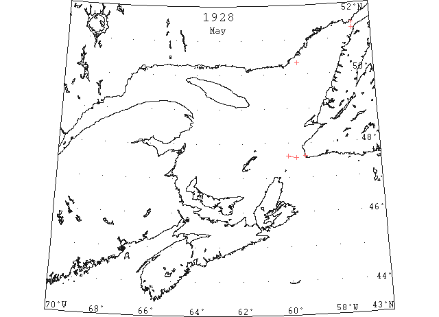
May 5 47°37’N 60°00’W to 47°34’N 59°40’W Field ice to northward (IIP P43#293)
May 8 Canadian Signal Service:- Cape Ray- Light open ice inshore. Point Amour Light open ice everywhere. Harrington- Heavy close packed ice distant. (NYMR 16 May p. 13, col. 3)
May 9 C.G.S. “Mikula” : Ice on W coast of Newfoundland is moving out fast due to strong winds. (HB #2020 May 23)
May 10 Point Amour, heavy open ice everywhere. (HB #2020 May 23)
May 11 Georgetown – ferry running May 11th (Pat 7 Apr 1934 p7 c7)
May 21 Point Amour, heavy open ice distant. (HB #2021 May 29)
May 28 Point Amour, heavy open ice distant; numerous bergs and growlers. (HB #2022 Jun 6)
Jun 5 Point Amour, numerous bergs and growlers. (HB #2023 Jun 13)
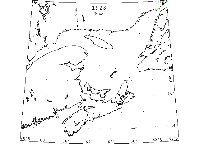
Jun 7 “Dan” first vessel of the season through the Strait of Belle Isle. (RG42 Vol.371)
Jun 7 First Westbound steamer through the strait of Belle Isle. (WBB)
Jun 16 Point Amour, numerous bergs and growlers. (HB #2025 Jun 27)
Jun 21 51°53’N 56°00’W to 51°22’N 57°10’W. 9 bergs along shore. (IIP, P49 #698).