1926 Season
Ice conditions in the Gulf of St. Lawrence this year were very open. (IIP p17)
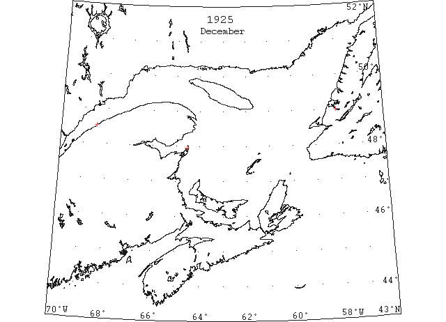
Dec (beginning) Pilotage officer, Father Point: Ice starts making. (CIS IC0708)
Dec 14 Last eastbound steamer through the Strait of Belle Isle. (WBB)
Dec 19 Last departure of the season from Quebec. (WBB)
Dec 20 J.A. Ward, Lightkeeper, Miscou Point, New Brunswick: Closing date. (CIS IC0756_2)
Dec 23 The frost of Sun. night made a thin coating of ice in Humber Arm (TWS, pg. 6, Col. 5)
Dec 30 During the past few weeks a thin coating of ice has been formed over the Humber Arm. (TWS, pg. 3, Col. 4)
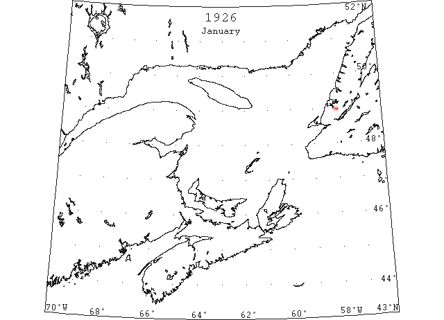
Jan 4 Since Thursday night (January 4th), the Gulf of St. Lawrence all along the North Shore has turned into ice far out as the eye can see. Seldom or never has the Gulf filled with ice in so short a time. (Pat 13 Jan p8 c5)
Jan 6 The severe frost of Sun. and Mon. has hardened up the ice in the Humber Arm, thus forming a bridge between Curling and Summerside. (TWS, pg. 1, Col. 2)
Jan 6 The SS “George I.” made a round trip on the Bay on Thur., it being last for the season. On Sat. the “George I.”. attempted to cross Humber Arm from Summerside but was unable to negotiate a passage through the ice. The ice in the Humber Arm extends down to Meadows point, but the outer part of Bay of Islands is free and there is no account of any drift ice on the coast. (TWS, pg. 2, Col. 3)
Jan 13 The SS “Newton Bay” landed a large amount of freight on the ice at Curling on Mon. The SS “Humber Arm” cut a channel in the ice down the Humber Arm on Thur. The steamers “Beothuk” and “Newton Bay” arrived at outer part of Humber Arm Sun. morning and proceeded to negotiate a passage through the ice. The SS “Humber Arm” went down from Corner Brook opening up a channel enabling the former ship to proceed to Corner Brook and the “Newton Bay” to Curling. People crossing the Arm over the ice were put to considerable inconvenience on Sun. through the steamers cutting channels through the ice. (TWS, pg. 2, Col. 1)
Jan 23 Panmure Island – Lighthouse and fog alarm are closed down for the season. (Pat 23 Jan p3 c2)
Jan 27 The Caribou encountered some slob ice in the Gulf on Sun. and Mon. (TWS, pg. 2, Col. 1)
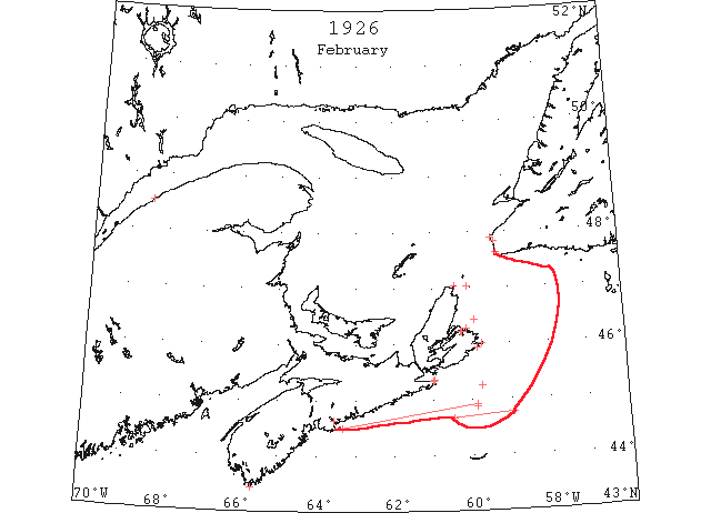
Feb 8 North Sydney, the steamers “Beothic” and “Montcalm” are still held in the ice off Low Point. The Cabot Strait is practically blocked with sheet ice, particularly on the Cape Breton side. There is considerable open water on the Cape Ray shore. (HH 11/02/1956 p9#2)
Feb 10 Cape Race: Field ice 44°53’N 59°52’W. (IIP p21#4)
Feb 10 The port at North Sydney is blocked with ice, and as a result the SS “Caribou” had gone to Louisburg the last few trips. (TWS, pg. 2, Col. 3)
Feb 13 Mention of gulf ice.
Feb 13 Feb 13, lat 44°55’N, lon 59°52’W, to lat 44°30’N lon 63°20’W, Stmr. “Stavangerfjord” (Nor), passed through patches of drift and sludge ice. (NYMR 3 Mar p. 13, col. 5)
Feb 15 Cape Race: Field ice Bull Head to Canso. (IIP p21#5)
Feb 19 Cape Race: Heavy field ice 44°46’N 58°57’W to 44°40’N 60°28’W. (IIP p21#8)
Feb 19 The “Eldsborg,” 861 tons net, was caught in the ice off Louisburg for two days and in attempting to reach the open sea broke three of the four blades off her propeller. With only one blade left, she finally extricated herself and made for Halifax, but in her crippled condition progress to port was slow. (HH 19/02/1925 p9#6)
Feb 21 Cape Race: Field ice 45°15’N 59°44’W. (IIP p21#11)
Feb 22 The steamer “Beothic,” bound for St. John’s, Nfld., is still jammed in the packed ice of Low Point with adverse winds still prevailing. The steamer had been in the same position for the past three weeks. (HH 25/02/1926 p9#6)
Feb 22 Louisburg, no ice in sight. Cape Ray, ice making fast; heavy open ice everywhere. Flat Point, heavy close packed ice distant. East Scatarie, ice making fast, heavy open ice distant. (HH 27/02/1926 p10#5)
Feb 24 The drift ice reached land for the first time on 9th inst. No water can be seen today from Codroy or Searston. (TWS, pg. 2, Col. 4)
Feb 24 Money Point, heavy close packed ice. Louisburg, no ice in sight. Flat Point, heavy close packed ice distant. Scatarie, light close packed ice. (HH 27/02/1926 p10#5)
Feb 26 Money Point, light close packed ice distant. Flat Point, no ice in sight. Sydney harbor, light close packed ice stationary. East Scatarie, no ice in sight. (HH 03/03/1926 p14#5)
Feb 27 Money Point, heavy close packed ice everywhere. Cape Ray, heavy open ice everywhere. Louisburg. no ice in sight. Scatarie, light open ice in shore. (HH 03/03/1926 p14#5)
Feb 27 Barrington Passage, immense fields of ice will greatly hamper operations for the opening of lobster season on Monday if present conditions are not relieved. A large number of fishermen have been unable to reach the outlying islands as yet. Steamer “Percy Cann,” was compelled to return here and has been in port several days, after ineffectual efforts to break through the ice barrier which had practically blocked the western coast. On Friday the ferry boat “Col Ralston,” attempted to leave Clark’s Harbor and was soon caught in the ice and disabled. It is reported that her rudder is broken. (HH 01/03/1926 p3#4)
Feb (end) Pilotage officer, Father Point: Ice disappearing fast. (CIS IC0708_2)
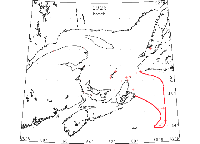
Mar 2 Cape Race: Field ice 45°07’N 57°13’W to 45°05’N 57°42’W. (IIP p21#15)
Mar 3 The SS “Caribou” made North Sydney on her last trip across the Cabot Strait, and arrived at Port aux Basques from there at mid-night on Mon. (TWS, pg. 3, Col. 2)
Mar 10 The weather the past few days has been quite mild. It is raining today, and the ice is pretty well cleared of snow. We hope to see the ice harden up before it gets unsafe so the horsemen will try out their speedy ones. (TWS, pg. 2, Col. 1)
Mar 12 Heavy Ice. Around the eastern end of Prince Edward Island, that part of Northumberland Strait and the Gulf of St. Lawrence, the ice is of equal volume to that of other years. The many changes of wind show very little open water. (HH 12/03/1926 p9#4)
Mar 13 The icebreakers “Lady Grey” and “Mikula” were opening a channel in the ice between Three Rivers and Montreal on March 13. (NYMR, p. 11, col. 1)
Mar 18 Very heavy pack ice is running down the Strait of Northumberland and is interfering with navigation at Cape Tormentine. The ice in outer Shediac Bay and harbor is weakening steadily, much of it having gone below the surface of the water. Deep snow for weeks has prevented frost strengthening the old ice and there is every indication that Shediac harbor will be open earlier than usual this year. (HH 18/03/1926 p11#1)
Mar 18 North Sydney, it is feared the steamer “Caribou” will have much difficulty in negotiating the passage across `the Cabot Strait. In some place the ice is rafted several feet deep. The steamer “Viking” is still held prisoner in the immense ice floes which extend many miles off St. Paul’s Island. As a matter of fact, the Gulf is filled with heavy pans of ice and the “Viking” is doomed to remain in her present position many days to come unless a change favorable springs up in the wind. The steamer has been off St. Paul’s Island now pretty nearly a week unable to proceed anywhere. (HH 23/03/1926 p11#6 & 26/03/1926 p11#3)
Mar 19 Cape Race: Field ice 45°00’N 58°20’W to 45°30’N 57°40’W. (IIP p21#21)
Mar 20 Cape Salmon, heavy open ice. Father Point, packed ice everywhere. Fame Point, heavy open ice everywhere. Magdalen Islands, Amherst, heavy close packed ice. Grosse Isle and Old Harry, heavy open ice. St. Paul’s Island, heavy open ice. Money Point, heavy close packed ice everywhere. Louisburg, no ice in sight. Cape Ray, heavy close packed ice everywhere. Flat Point, heavy close packed ice everywhere. Scatarie, heavy close packed ice everywhere. (HH 20/03/1926 p7#6)
Mar 21 Field ice in lat 43°55’N, lon 58°06’W. (NYMR, p. 12, col. 3)
Mar 22 Cape Race: Field ice 44°35’N 57°20’W. (IIP p21#22)
Mar 22 Magdalen Islands, Etang du Nord, Grosse Isle, and Old Harry, heavy open ice. Pleasant Bay, large lake of water extending from Entry Island to within half mile of Grindstone breakwater. St. Paul’s Island, heavy open ice. Money Point, heavy close packed ice. Louisburg, no ice in sight. Flat Point, heavy close packed ice everywhere. Scatarie, heavy close packed ice everywhere. (HH 22/03/1926 p9#8)
Mar 23 SS “Stavangerfjord” from 44°20’N 57°08’W to 44°03’N 57°40’W [ice field?] a large field of ice (HB)
Mar 24 Ice conditions have interfered of late with fishery operations at Channel and Port aux Basques. (TWS, pg. 4, Col. 2)
Mar 25 The “Viking” is still held a prisoner in the immense ice fields some twenty miles off Cape North. (HH 25/03/1926 p9#6)
Mar 27 US coastguard cutter, lat 42°44’N lon 59°28’W [?] no ice reported today. (NYMR 7 Apr p. 13, col. 1)
Mar 31 Matane, clear west; heavy close packed ice in shore. Fame Point, heavy open ice everywhere. Pointe Esuminae, heavy open ice everywhere. Magdalen Islands, Etang du Nord and Amherst heavy close packed ice. Grosse Isle and Old Harry, heavy open ice. St. Paul’s Island, light loose packed ice everywhere. Few lanes open water to eastward. Money Point, heavy close packed ice, stationary. Louisburg, no ice in sight. Cape Ray, heavy close packed ice distant. Sealer “Viking” position [20] miles west north west of here jammed. Ice conditions unusual close packed everywhere. Flat Point, heavy close packed ice distant. Scatarie, heavy close packed ice distant. (HH 05/04/1926 p9#5)
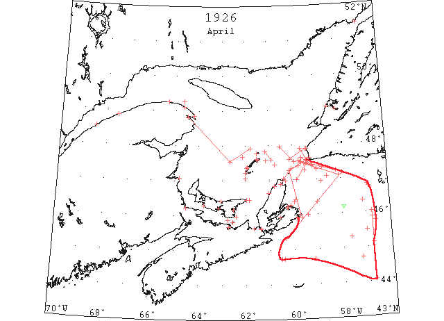
Apr Capt. R. Geary, Marine Supt., Bowaters, Nfld: In the spring of 1926, the SS “Corner Brook” left Halifax on the 8th April, bound for Corner Brook. Ice was encountered in the Cabot Straits, extending from shore to shore. On the morning of the 10th April she was jammed off Cape Ray for several hours in very heavy ice. … she arrived off the Bay of Islands on 25th April, the ice had rafted at the entrance to the Bay to a depth of over 20 feet and no further progress could then be made. Early in May an easterly wind broke up the ice barrier and the vessel entered the bay by butting but progress was very slow. Reached Corner Brook evening of May 8th; by the 10th no ice was left in the Gulf. (CIS IC0736_4-IC0736_6)
Apr 1 Cape Race: Heavy ice field 44°42’N 57°15’W. (IIP p22#53)
Apr 1 J.A. Ward, Lightkeeper, Miscou Point, New Brunswick: Opening date. (CIS IC0756_2)
Apr 1 The recent southerly winds have opened up the drift ice off the Sydneys and a few more days of such weather should enable steamers make both Sydney and North Sydney. (HH 01/04/1926 p11#5)
Apr 7 The ice in the Codroy Valley area is cutting out fast. (TWS, p.1)
Apr 7 Father Point, light open ice everywhere. Cape Magdalen, heavy open ice. Fame Point, heavy open ice everywhere. Cap des Rosiers, heavy close packed ice inshore. Point Escuminac, heavy open ice everywhere. Magdalen Islands, Amherst and Etang du Nord, Mantane packed ice. Grosse Isle and Old Harry heavy open ice distant. St. Paul’s Island, light close packed ice everywhere. Money Point, heavy close packed ice. Louisburg, heavy closed packed distant. Cape Ray, heavy open ice everywhere. Flat Point, heavy close packed ice. Scatarie, heavy close packed ice everywhere. (HH 07/04/1926 p14#3)
Apr 8 St Paul’s Is: Light open ice everywhere; Cape Ray: Heavy close packed ice everywhere.
Apr 8 Canadian Signal Service: Montreal to Sorel ice still holding. Some light open ice passing down between Three Rivers and Quebec. Father Point- Light open ice inshore. Fame Point- Light open ice distant. Point Escuminac- Heavy close packed ice inshore. Magdalen Islands- Grosse Isle and Etang du Nord, heavy close packed ice. St. Pauls Island- Light open ice everywhere. Money Point- Heavy close packed ice. Cape Ray- Heavy close packed ice everywhere. Flat Point- Heavy close packed ice distant. Scatari- Heavy open ice everywhere, stationary. (NYMR 14 Apr p. 13, col. 5)
Apr 8 Father Point, light open ice inshore. Cape Magdalen, light loose packed ice in shore. Fame Point, snowing north. Magdalen Islands, blinding snow storm. Louisburg, heavy close packed ice distant. Cape Ray, hail storm. Flat Point, heavy close packed ice distant. (HH 08/04/1926 p11#6)
Apr 12 “Alaunia” Field ice (St. Lawrence) 44°43’N 60°32’W. (IIP p22#68)
Apr 12 L’Islet, no ice in sight. Father Point, some light ice in shore. Little Metis, no ice in sight. Cape Magdalen, no ice in sight. Fame Point, no ice in sight. Point Escuminac, heavy open ice everywhere. Magdalen Islands, Old Harry, Etang du Nord, Grosse Isle, heavy open ice. Amherst heavy open ice distant. Pleasant Bay, close packed ice. St. Paul’s Island, light open ice everywhere. Cape Ray, heavy close packed ice distant. Louisburg, heavy close packed distant. Pictou, heavy open ice east and west of Pictou Island. Scatarie, heavy close packed ice everywhere. (HH 13/04/1926 p14#5)
Apr 13 “Alaunia” Field ice (St. Lawrence) 44°44’N 60°26’W. (IIP p22#69)
Apr 13 “City of Kimberly” Field ice (St. Lawrence) 44°44’N 59°10’W. (IIP p22#70)
Apr 13 Father Point: light ice. Point Escuminac: heavy open ice. Magdalen Islands: Amherst and Étang du Nord, heavy close-packed ice. Grosse Isle: heavy open ice inshore. St. Paul Island: heavy close-packed ice inshore southwest, light open ice inshore northeast. Cape Ray: heavy open ice everywhere. Flat Point: heavy close-packed ice distant. Louisburg, N.S.: heavy close-packed ice distant. Scatari: heavy close-packed ice distant. Point Amour: heavy close-packed ice everywhere. Belle Isle: heavy open ice distant. (HB 1911 Apr 21 CSS)
Apr 13 The following radiogram was received from the US CGC “Modoc”: field ice from the St. Lawrence reported to-day in 44°44’N 60°26’W. (HB 1911 Apr 21)
Apr 14 “Alaunia” Field ice (St. Lawrence) 44°04’N 56°47’W. (IIP p22#71)
Apr 14 “Alaunia” informed the IIP vessel that she was stuck fast in an ice field, April 13, which was located to the S and W of the entrance to the Gulf of St. Lawrence (Cabot Strait). Later this same day the ship discovered a lead and freed herself in open water. Everything was all right with her when on April 14 she sent the patrol a message that she had left behind the last of the St. Lawrence fields and was proceeding eastward past Cape Race. (IIP p6)
Apr 14 SS “Kyle” reports heavy unbroken sheet extending from the coast of Newfoundland to Scatari Is. (NYMR)
Apr 14 The following radiogram was received from the US CGC “Modoc”: another [ice] field in 44°04’N 56°47’W. (HB 1911 Apr 21)
Apr 15 North Sydney, the ice-breaker “Montcalm,” which sailed from here Monday, bound for St. Paul’s Island and the Magdalens is having a hard time. From Monday evening till Tuesday morning she drifted to leeward some twenty miles and was still bucking it this forenoon. (HH 19/04/1926 p9#2)
Apr 15 North Side – The ice is in solid to the shore and packed by the high tide. (Pat 15 Apr p6 c4)
Apr 15? Blue water may be seen in the distance from Point du Chene, N.B. but otherwise the harbour gives it all the appearance of mid winter. The season is said to be much later than last year – Moncton Transcript. (Pat 15 Apr p8 c4)
Apr 16 Quebec, that the eighteen trans-Atlantic liners, now on the ocean bound for Montreal and Quebec, will be forced to discharge their passengers and cargo at Halifax or Saint John, seemed altogether likely from the latest ice conditions in the St. Lawrence. The ice in the Gulf still forms an almost impassable barrier to navigation. It appears probable that navigation will not open until the beginning of May. The present state of affairs is comparable to that existing in 1923 when about forty steamers were bottled up by the ice off Newfoundland. (HH 17/04/1926 p26#1)
Apr 16 Father Point, no ice. Little Metis, no ice. Point Escuminac, open ice. Magdalen Islands, Grindstone clear, southwest. Heavy close packed ice. Amherst, Etang du Nord, Grosse Isle, Old Harry thick snow. Pleasant Bay, about four miles of ice west end. Cape Tormentine, NB, light open ice distant. Souri, PEI. no ice in sight. Cheticamp, packed ice in shore. Pictou, heavy close packed ice east and west. Louisburg, no ice in sight. Mulgrave, no ice in sight. Money Point, heavy close packed ice. Point Tupper, open ice. Flat Point, heavy close packed ice distant Scatarins [sic], no ice in sight. Point Amour, heavy close packed ice everywhere stationary. (HH 20/04/1926 p14#3)
Apr 16 SS “Montcalm” left Sydney April 12th for the Magdalenes and is trying to force a passage through the heavy ice between St. Paul’s Island and Cape North – broke a blade on her propeller and was carried by ice to Scoterie. When she had worked loose she proceeded towards the Newfoundland coast, got round the ice and arrived off the Magdalenes. She found it impossible to reach Grindstone Island by the regular route and was obliged to proceed via Bird Rock and Anticoste to the northward of the Magdalenes and came round to the westward. She arrived in Grindstone on 16th. She left that night with the intention of proceeding to Souris by the summer route but found that impossible. In order to reach that port, she was obliged to go round the Magdalenes via Bird Rock and thence towards the Gaspe Coast. She was fortunate in finding a strip of open water 10 miles wide on the north side of the Island. She reports extremely heavy ice in the Gulf. (Pat 19 Apr p1 c3)
Apr 16 Money Point: heavy close-packed ice. Cape Ray: heavy close-packed ice everywhere. Flat Point: packed ice distant. Scatari: heavy open ice. (HB 1912 Apr 28 CSS)
Apr 17 SS “Cyrus Field” entered field ice in 45°45’N 56°39’W; in heavy field ice 45°30’N 57°W; in field ice 45°18’N 57°40’W; field ice 45°08’N 56°47’W; cleared ice Apr 18. 46°02’N 56°47’W; sighted ice about 10 miles S of last position. (HB #1916 May 26)
Apr 17 Flat Point, heavy close packed ten miles distant. Scatarie, heavy close packed ice everywhere stationary. Cape Ray, heavy close packed ice everywhere stationary. Mulgrave no ice in sight. Point Tupper, light open ice in shore. Louisburg, no ice in sight. Souris, PEI, no ice in sight. Pictou, close packed ice. CGS “Mikula” reports: Cut ice in Gaspe Bay yesterday morning as far as Sandy Beach Block. Left Gaspe last pm and steered to 47°33’N 62°39’W. then to 47°55’N 61°47’W. from there to Bird Rocks seen no ice. From Bird Rocks steering 145 true to 47°35’N 60°54’W met slob ice with occasional growlers through it. 8 a.m. EST position 47°27’N 60°46’W passing through broken and slob ice with occasional growler through it. (HH 17/04/1926 p12#2)
Apr 18 Message from the Canadian ice patrol ship “Mikula” that the gulf and river were navigable to Quebec, about one month earlier than usual. (IIP p17)
Apr 19 CGS “Mikula” patrolled from Baggots Bluff, Anticosti, steering 134 true 45°55’N and 60°35’W. No ice sighted until reaching latter position then sighted strips slob ice west of course to the south east and north. Clear water from 45°55’N to 60°35’W. Altered course to 113 true at eight a.m. position 47°44’N 60°01’W Clear water except few strips slob ice. Ships bound to St. Paul’s Island if ice encountered on this track alter course more easterly to clear. Northumberland Straits and Gut of Canso not yet clear. Reports from Magdalen Islands are heavy type of ice generally. “Mikula” patrolled this morning from St. Paul’s Island to 47°24’N 69[59?]°45’W through heavy open ice. Shot [Slob] ice south and east from this position as far as can see open water. Ice streaming down from Magdalens and the north side Cape Breton is getting across track between St. Paul’s and Cape Ray. Ships bound to Gulf and river ports perhaps had best take track midway between Cape Ray and St. Paul’s Island. Gut of Canso and Northumberland straits not yet navigable. Magdelan Islands area reports general ice heavy close packed and open ice. Louisburg clear of ice. Sydney harbor not yet clear to docks. Ice generally reported and observed is of heavy character but ice conditions continue to improve. (HH 21/04/1926 p15#3)
Apr 19 Magdalen Islands, clear, northwest. Amherst, Etang du Nord, Grosse Isle, heavy close packed ice. Old Harry no ice in sight. Pleasant Bay, close packed ice. St. Paul’s Island, clear west, heavy open ice to south and southeast, clear water five miles to east north east. Scatari, clear, south west, heavy open ice. Cheticamp, clear south west; packed ice in shore. Souris, PEI, clear northeast, no ice in sight. Money Point, clear north west, heavy close packed ice. Point Tupper, clear north, no ice in sight. Flat Point, clear, north. (HH 22/04/1926 p9#3)
Apr 19 The ice in the harbour is beginning to break up along the shores. (Pat 19 Apr p8 c3)
Apr 19 CGS “Montcalm”: about 3 miles southeast of Cape Bear, P.E.I., edge of heavy close-packed ice. (HB 1912 Apr 28 CSS)
Apr 19 CGS “Mikula”: 47°38’N 59°38’W to 47°18’N 59°00’W, passed through strings of light broken ice and slob; from there to 6 miles off Cape Ray, same ice conditions; from Cape Ray to Cape Anguille, for 10 miles offshore, soft broken ice, close-packed. (HB 1912 Apr 28 CSS)
Apr 19 Open water in the centre of the St. Lawrence river from above Nun’s Island down to Hochelaga; from Longue Pointe to Sorel Island the ice is still solid; from Three Rivers to Québec some ice is passing down. The CGS “Jalobert”, pilot tender, left Québec for Father Point on April 19, 1926. (HB 1912 Apr 28 CSS)
Apr 20 Point Escuminac: light close-packed ice. St. Paul Island: heavy close-packed ice everywhere. Magdalen Islands: Grosse Isle, heavy close-packed ice. Point Amour: heavy close-packed ice everywhere. Belle Isle: heavy open ice distant; 84 bergs and numerous growlers. (HB 1912 Apr 28 CSS)
Apr 21 Last year the ice in Humber Arm broke up on the night of 15th April, the last crossing between Summerside and Curling over the ice was five days previous to that. By present appearances the end of April will see ice in Humber Arm this year. (TWS, p.3)
Apr 21 Canso: Yesterday and last night gales drifting ice off Newfoundland coast and into the Gulf. Loose ice and open water in vicinity Cape Ray last evening. Northumberland Straits and Gut of Canso not yet passable. Magdalen area reported heavy close packed and open ice. From 5?°26’N 59°48’W steering 189 true passed through light shot ice. Position 8 a.m. 47°24’N 59°46’W in heavy sheet and rafted ice far as can see all directions. (HH 22/04/1926 p9#3)
Apr 21 Fame Point, no ice. Point Ecuminac, heavy open ice in shore. Money Point, heavy open ice southeast. Point Tupper, no ice in sight. Louisburg, no ice in sight. CGC “Mikula” reports: This a.m. Yesterdays and last night’s drifting ice off Newfoundland Coast and into gulf. Loose ice and open water in vicinity of Cape Ray last evening 8 a.m. position 47°24’N 59°46’W. Weather clearing wind moderate north overcast, visibility 6 to 8 miles. Heavy sheet and rafted ice a far as can be seen in all directions. Point Amour, heavy close packed ice everywhere. Flat Point, heavy open ice distant. St. Paul’s Island, heavy close packed ice everywhere. Scatari, no ice in sight. Tracadia, NS, George Bay, packed ice, no water in sight. Money Point, heavy close packed ice. (HH 24/04/1926 p7#5)
Apr 21 Owing to ice conditions, the special trip from Charlottetown to St. John’s on April 21st (by SS “Ceuta”) has been cancelled. (Pat 22 Apr p5 c3)
Apr 21 Georgetown – the CGS “Montcalm” broke up the harbour on April 21st. She had a little difficulty at the outside of the harbour. (Pat 26 Apr p6 c4)
Apr 22 Canadian Signal Service- Point Escumuinac- Heavy close packed ice. St. Paul Island- Heavy open ice everywhere. Money Point- Heavy close packed ice. Cape Ray- Heavy open ice everywhere. Flat Point- Heavy open ice distant. Point Amour- Heavy close packed ice everywhere. (NYMR 28 Apr p. 13, col. 4)
Apr 22 CGS “Mikalu”: 47°N 59°50’W through heavy open ice to 47°29’N 54[59?]°25’, then N 22°E (mag) through close packed slob and pan ice. From Cape Ray to St. Paul Island ice now heavy and very close packed in places. (NYMR 28 Apr p. 13, col. 4)
Apr 22 Magdalen Islands, clear, northwest. Etang du Nord, Amherst and Grosse Isle heavy close packed ice. Old Harry, heavy open ice distant. Pleasant Bay four miles of ice at west end, east end clear. St. Paul’s Island, clear northwest. Heavy open ice everywhere. Flat Point, heavy open ice distant. Scatari, clear northwest. No ice in sight. Louisburg, no ice in sight. Souris, PEI, no ice in sight. Mulgrave, no ice in sight. Cheticamp, heavy close packed ice in shore. Pictou, open water at west, close packed ice at east. St. Paul’s Island, heavy open ice everywhere. Money Point, heavy close packed ice. Flat Point, heavy open ice distant. Cape Tormentine, NB, heavy close packed ice distant. CGS “Mikula” reports: Today A.M. from 47°00’N 59°50 W steering zig-zag course through heavy close packed pan and slob ice. From Cape Ray to St. Paul’s Island ice now heavy and very close packed in places. Due to recent strong variable winds and poor visibility it is impossible at present to give accurate information as to best route at present. Track about northwesterly 20 miles from Cape Ray following eastern edge of pack should be practically clear water to Quebec. (HH 26/04/1926 p9#3)
Apr 23 Souris, PEI, cloudy northwest; no ice in sight. Pictou, cloudy southwest, open water east and west. CGS “Mikula” reports: Yesterday p.m. the ice on Newfoundland coast generally is of much softer nature than that on Cape Breton side, and by the use of good judgment vessel may pass through by avoiding large pieces. Northumberland Straits, Gut of Canso not yet navigable. Sydney harbor not quite clear to dock. Louisburg clear of ice. Owing to heavy swell heaving through, conditions gradually improving. CGS “Montcalm” reports: Yesterday p.m. cut ice up to wharf at Charlottetown, PEI. CGS “Montcalm” reports: Today 7:30 a.m. position 46°57’N 62°19’W. Fame Point, no ice. Point Escuminac, heavy open ice inshore. St. Paul’s Island, heavy open ice everywhere. Money Point, heavy close packed ice. Point Tupper, NS, clear north, no ice in sight. Flat Point, cloudy, northeast, heavy open ice distant. East Point, PEI, scattered ice five miles inside, open water outside. (HH 27/04/1926 p11#6)
Apr 23 CGS “Montcalm” arrives after battling the ice since April 21st when she left Souris. She was battling the heavy ice on the bar between Governor’s Island and St. Peter’s Island. She left immediately to render assistance to the ice patrol “Mikula” between Cabot Strait and Anticoste Island. (Pat 23 Apr p8 c4)
Apr 23 SS “Oxonian”: from 46°45’N 56°50’W to 46°48’N 56°53’W, encountered small patches of slob ice; and from 47°06’N 58°05’W to 47°30’N 59°37’W, encountered heavy close-packed field ice with occasional patches of open water. The ice was soft and no trouble was experienced in working through it. (HB 1914 May 12)
Apr 24 Scatari: heavy close-packed ice distant. Belle Isle: heavy close-packed ice everywhere; 87 bergs and numerous growlers. (HB 1913 May 5 CSS)
Apr 24 SS “Manchester Regiment”: met a very large ice field, extending north and south; steamed to 25° (true) for 45 miles. The southwestern edge of the field was in 46°20’N 57°07’W. [from April 26 report] (HB 1913 May 5 CSS)
Apr 25 First arrival of season at Quebec. (WBB)
Apr 26 SS “Manchester Regiment” 46°10’N 57°56’W: passed a medium-sized berg. (HB 1913 May 5 CSS)
Apr 26 Sealer “Viking”: about 20 miles NNW of Grindstone, M.I., in heavy open ice. (HB 1913 May 5 CSS)
Apr 26 CGS “Montcalm”: (p.m.) reports that SS “Warkworth” in 47°17’N 59°30’W, making fair progress; SS “Emperor of St. John” in 46°22’N 59°00’W, in thick ice going slowly. (HB 1913 May 5 CSS)
Apr 27 Ital. Steamer “Valfiorita” reports 47°15’N 58°11’W field of soft open ice extending as far as could be seen then to 47°21’N 58°45’W, heavy broken ice. With Cape Ray bearing 340° (true) 14 miles heavy broken ice, close packed in some places, then to 47°31’N 59°40’W, heavy broken pack ice; lat 47°32’N lon 59°55’W heavy broken ice then to 47°57’N 60°32’W, light broken ice with clear zones. (NYMR 5 May p. 13, cols. 4-5)
Apr 27 Magdalen Islands: Étang du Nord, heavy close-packed ice to the westward, open water to the northward; Grosse Isle and Old Harry, heavy open ice. St. Paul Island: heavy open ice with clear spaces northward, southward, and southeastward. Money Point: heavy close-packed ice northeast, open ice to the east and south. Flat Point: heavy close-packed ice inshore. Point Amour: heavy close-packed ice everywhere. (HB 1913 May 5 CSS)
Apr 27 CGS “Montcalm”: reports that SS “Burlington” in 46°57’N 58°50’W, and SS “Wirral” in 47°05’N 58°34’W, are making good progress. Ice conditions appear to be improving. (HB 1913 May 5 CSS)
Apr 27 St. Lawrence River: the river is clear this morning from head of Montréal Harbour down to abreast the signal station at Longue Pointe; thence eastward to Sorel Islands the ice is still holding. Ice shoved yesterday on Lake St. Peter in the centre and on the southern side. From Three Rivers to Portneuf very little ice is passing down; some battures [grounded ice feet] are still holding. From St. Nicholas to Québec scattered ice is passing down. Seven steamers arrived at Québec April 25, 1926. (HB 1913 May 5 CSS)
Apr 28+ SS “Calgarolite”: met first ice on April 28, in 45°20’N 60°20’W; thence to Burgeo Banks, open field ice with an occasional lake; thence to 47°34’N 59°45’W, close-packed ice. [from May 3 report] (HB 1914 May 12)
Apr 29 Magdellen Islands- Amherst, heavy close packed ice; Etang du Nord, Grosse Isle and Old Harry, heavy open ice. St. Paul Island- Open ice northeast. Cape Ray- Heavy close packed ice distant. Money Point- Heavy close packed ice. Flat Point- Heavy open ice distant. Point Amour- Heavy close packed ice everywhere. (NYMR 5 May p. 13, cols. 4-5)
Apr 29 CGS Montcalm, reports Apr 29, patrolling from lat 47°36’N lon 60°07’W to the vicinity of Cape Anguille light open ice and very open. (NYMR 5 May p. 13, cols. 4-5)
Apr 29 Point Escuminac: light open ice inshore. (HB 1913 May 5 CSS)
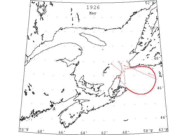
May 1 It is announced that the steamer “Lovat” will make her first regular trip to the Magdalene Islands leaving Halifax on May 1st. (Pat 28 Apr p8 c4)
May 1 The ice which moved off the North Shore last week has returned again. A large pan of ice is reported off Cape Bear and there is still a considerable quantity of ice on the west coast. (Pat 1 May p5 c4)
May 2 CGS “Mikula”: the ice is gradually opening and clearing off the south coast of Newfoundland. (HB 1914 May 12 CSS)
May 2 SS “Canada”: met field ice in 46°38’N 56°45’W, which continued to 47°58’N 69[59?]°35’W. (HB 1914 May 12)
May 2 SS “Montcalm”: met first ice 100 miles east of Cape Ray; from 20 miles east to 20 miles west of Cape Ray, closely packed ice with some very heavy pieces. (HB 1914 May 12)
May 2 SS “Canadian Otter: heavy close-packed to loose ice was encountered from about 15 miles northeast of Flat Point to about 15 miles east of St. Paul Island, thence to 47°57’N 60°25’W. (HB 1914 May 12)
May 3 St. Paul Island: heavy close-packed ice to the south and southeast, heavy open ice to the north. (HB 1914 May 12 CSS)
May 3 SS “Twickenham”: encountered heavy ice from Flint Island to Cape North, then a few miles of clear water, thence heavy ice from south of St. Paul Island to 47°50’N 60°10’W. (HB 1914 May 12)
May 3 SS “Bawtry”: from 46°52’N 56°50’W to 47°03’N 57°25’W, passed scattered field ice; and from 47°30’N 57°41’W to 47°41’N 52[59?]°52’W, passed through field ice, open ice, and light packed ice. (HB 1914 May 12)
May 4 The opening of lobster season delayed until May 4th can now open at once. The ice has cleared away from around the coast. (Pat 29 Apr p1 c4)
May 4 Magdalen Islands: Grosse Isle, heavy open ice. Old Harry, heavy close-packed ice. Cape Ray: light open ice distant. Money Point: ice offshore. Point Amour: heavy close-packed ice everywhere. Belle Isle: heavy close-packed ice distant; 81 bergs and numerous growlers. (HB 1914 May 12 CSS)
May 5 St. Lawrence River- Montreal to Cape St. Michel, some scattered ice is passing down. Bellmouth, ice is on the move since noon. Sorel, ice is on the move for the full width of the river. From Three Rivers to Pointe Citrouille, considerable ice is passing down. (NYMR 5 May p. 13, cols. 4-5)
May 6 The schooner “Lady May” plying between Belle River and Charlottetown arrived today on her first trip of the season. Last year she arrived on April 7th so that she is just about a month late this year. (Pat 6 May 1926, p8 c4)
May 8 The Canadian Signal Service: Etang du Nord, Grosse Isle and Old Harry, scattered ice. Pleasant Bay practically full of loose drift ice. Amherst, no ice in sight. St. Paul’s Island, Mulgrave, Tracadie, Cape Ray- no ice in sight. Cheticamp- Ice moving off. Vessels recommended avoid general vicinity between Bird Rocks and St. Paul’s Island, then between St. Paul’s and Cape North. Ice rotting quickly and strong gale would lend greatly to clear the situation completely. Vessels inward and outward are progressing very favorably on recommended track. (NYMR 12 May p. 13, col. 4)
May 8 [Should this date be 5 Jan 1927?] The SS “Magnhild” will arrive in Georgetown the 8th and will load for St. Pierre and St. John’s, Newfoundland. (Pat 5 Jan 1927[?] p5 c3)
May 10 SS “Alaunia” 48°49’N 62°02’W passed the western end of a long narrow belt of heavy packed ice extending in an easterly direction as far as could be seen and then in a southerly direction for about 3 miles. (HB #1915 May 19)
May 11 Amherst, 10 miles of light close packed ice inshore. (HB #1915 May 19)
May 12 The out wind of Sunday cleared the Humber Arm of ice. (TWS, p.3).
May 12 The last crossing over the ice on Humber Arm this season was last Friday, being three weeks later than that of last year. (TWS, p.3)
May 18 Amherst, about 3 miles of open ice. Point Amour, heavy close packed ice everywhere. (HB #1916 May 26)
May 19 Point Amour, heavy close packed ice everywhere. (HB #1917 Jun 2)
Jun 14 “Leicester” first vessel of the season through the Strait of Belle Isle. (RG42 Vol.371)
Jun 15 Point Amour, heavy close packed ice, many bergs and growlers. (HB #1920 Jun 23)
Jun 21 Point Amour, heavy close packed ice everywhere. (HB #1921 Jun30)
July 3 First Westbound steamer through the strait of Belle Isle. (WBB)