1924 Season
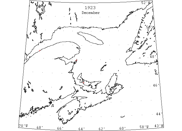
Dec (beginning) Pilotage officer, Father Point: Ice starts making. (CIS IC0708)
Dec 1 Last eastbound steamer through the Strait of Belle Isle. (WBB)
Dec 7 Last departure of the season from Quebec. (WBB)
Dec 20 Summerside Bedeque ferry closed on December 20th. (Pat 22 Dec 1924 p5 c3)
Dec 22 J.A. Ward, Lightkeeper, Miscou Point, New Brunswick: Closing date. (CIS IC0756_2)
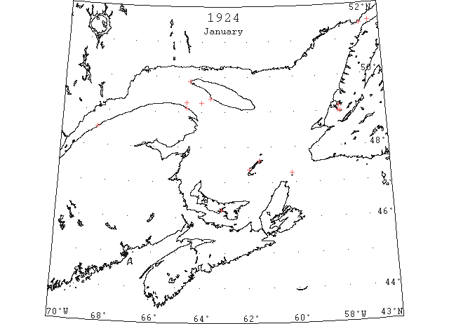
Jan 4 The schooner “Evelyn Miller” is unable to leave port on account of the ice. The “Montcalm” will leave Sydney at one and arrive here tonight. The “Evelyn Miller” will be taken to Souris. (Pat 4 Jan p1 c4)
Jan 4 The harbour is still open with the exception of ice around the wharfs and docks. (Pat 4 Jan p8 c4)
Jan 5 Father Point: packed ice everywhere. (HB 1794 Jan 23 CSS)
Jan 7 Fame Point: light, close-packed ice distant. (HB 1794 Jan 23 CSS)
Jan 8 The CGS “Montcalm” arrived in Souris yesterday with the “Evelyn B. Miller” in tow. There is no ice in the harbour. (Pat 9 Jan p8 c4)
Jan 10 Fame Point: heavy open ice distant. (HB 1794 Jan 23 CSS)
Jan 11 Fame Point: heavy open ice distant. (HB 1794 Jan 23 CSS)
Jan 14 Teams of horses crossing Charlottetown Harbour. Ice 4-5″ thick. (Pat 14 Jan p6 c3)
Jan 14 Fame Point: heavy open ice distant. (HB 1794 Jan 23 CSS)
Jan 15 Fame Point: heavy close-packed ice everywhere. (HB 1795 Jan 30 CSS)
Jan 16 Parties crossed the Humber Arm from Summerside over the ice on Thursday for the first time this season. (TWS, p.2)
Jan 17 The schooner “Evelyn B. Miller” sailed from Souris yesterday for St. Pierre Miquelon. This is said to be the latest date for a sailing vessel to leave any port in P.E. Island. The harbour is as open as in midsummer and if there was any market, vessels might still be going to and fro daily. (Pat 18 Jan p8 c3)
Jan 17 Point Amour: slob ice. (HB 1795 Jan 30 CSS)
Jan 18 Fame Point: heavy close-packed ice everywhere. (HB 1795 Jan 30 CSS)
Jan 19 Fame Point: heavy close-packed ice everywhere. (HB 1795 Jan 30 CSS)
Jan 23 Though ice has been reported in Straits of Belle Isle for some days there is no sign of drift ice at Bay of Islands, and except for that in Humber Arm the bay is quite free. (TWS, p.2)
Jan 23 Fame Point: heavy close-packed ice everywhere. (HB 1796 Feb 6 CSS)
Jan 25 Fame Point: heavy close-packed ice everywhere. Étang du Nord, M.I.: slob ice as far as could be seen. St. Paul Island: light, close-packed ice everywhere. Belle Isle: light, close-packed ice everywhere. (HB 1796 Feb 6 CSS)
Jan 28 Fame Point: heavy close-packed ice everywhere. Grosse Isle, M.I.: light ice as far as can be seen. St. Paul Island: light, close-packed ice everywhere. (HB 1796 Feb 6 CSS)
Jan 29 Fame Point: heavy, close-packed ice everywhere. South Channel, Anticosti Island: heavy open ice everywhere. Étang du Nord, M.I.: light, close-packed ice everywhere. (HB 1797 Feb 13 CSS)
Jan 30 The weather of the past few days indicate the likelihood of the drift ice being near. (TWS, p.2).
Jan 30 Reports from Middle Arm on Monday stated that sheet ice was then filling in the Arm, but it was unknown whether it was that which went out of Humber Arm couple of days previous or the first coming of the drift ice. (TWS, p.2)
Jan 31 Fame Point: heavy, close-packed ice everywhere. Southwest Point, Anticosti Island: heavy, close-packed ice everywhere. West Point: close-packed ice everywhere. (HB 1797 Feb 13 CSS)
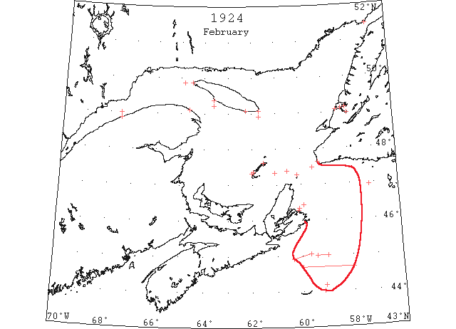
Feb 2 Fame Point: heavy, close-packed ice everywhere. Étang du Nord, M.I.: light, close-packed ice everywhere. Southwest Point, Anticosti Island: light, close-packed ice everywhere. (HB 1797 Feb 13 CSS)
Feb 4 Fame Point: heavy, close-packed ice everywhere. Southwest Point, Anticosti Island: heavy, close-packed ice distant. Grindstone Island: heavy, close-packed ice to the southwestward. (HB 1797 Feb 13 CSS)
Feb 5 Fame Point: heavy, close-packed ice everywhere. Southwest Point, Anticosti Island: heavy, close-packed ice inshore. Cape Ray: light, close-packed ice distant. (HB 1797 Feb 13 CSS)
Feb 6 Advances from Middle Arm on Monday state there was considerable ice at that place. (TWS, p.2).
Reports from Wood Island state that considerable slab ice is in sight there. Lark Hr., however, yesterday reported no ice to be seen from there. (TWS, p.2)
Feb 6 West Point, Anticosti: heavy, close-packed ice everywhere. Southwest Point: heavy, close-packed ice distant. (HB 1798 Feb 20 CSS)
Feb 6 The drift ice is so heavy off the coast of Newfoundland, near the Bay of Islands, that it is impossible for vessels to penetrate it. [New York Herald.] (HB 1798 Feb 20)
Feb 8 West Point, Anticosti: North Channel, light, close-packed ice everywhere; South Channel, close-packed ice. Grosse Isle, M.I.: light, close-packed ice everywhere. Flat Point: light, close-packed ice everywhere, stationary. Point Amour: slob ice. Belle Isle: ice moving southward. (HB 1798 Feb 20 CSS)
Feb 9 West Point, Anticosti: North Channel, light, close-packed ice everywhere; South Channel, close-packed ice. West Point, Anticosti: South Channel, heavy, open ice everywhere. Grosse Isle, M.I.: light, close-packed ice everywhere. Cape Ray: light, open ice distant, moving south. (HB 1798 Feb 20 CSS)
Feb 11 West Point, Anticosti: light, close-packed ice everywhere. Heath Point: close-packed ice everywhere. Grosse Isle, M.I.: light, close-packed ice everywhere. Cape Ray: light, open ice distant, moving south. Flat Point: light, open ice everywhere. Point Amour: light, close-packed ice everywhere. Belle Isle: heavy, close-packed ice distant; nine bergs. (HB 1798 Feb 20 CSS)
Feb 11 CGS “Montcalm” 47°23’N 60°34’W: ice heavy; jammed in ice all day yesterday. (HB 1798 Feb 20 CSS)
Feb 12 Fame Point: heavy, close-packed ice everywhere. Grosse Isle, M.I.: close-packed ice everywhere. Flat Point: light, open ice everywhere. (HB 1799 Feb 27 CSS)
Feb 13 The SS “Curlew” was unable to get away owing to the bay filling with drift ice. She will have to remain until a break occurs. (TWS, p.2).
Feb 13 The schooner “Hazel R. Hinds” was refloated last week, but will have to remain at Woods Island until spring, on account of the presence of drift ice. (TWS, p.2).
Feb 13 “Sachem” 45°03’N 59°41’W to 44°54’N 60°22’W scattered patches of slob ice. (NYMR)
Feb 13 SS “Sachem”: 45°03’N 59°41’W to 44°54’N 60°22’W, scattered patches of slob ice. (HB 1799 Feb 27)
Feb 13 Fame Point: heavy, close-packed ice everywhere. West Point, Anticosti: light, open ice everywhere. Grosse Isle, M.I.: close-packed ice everywhere. Flat Point: light, close-packed ice everywhere. (HB 1799 Feb 27 CSS)
Feb 13 CGS “Montcalm” 47°20’N 61°03’W: jammed in heavy ice since yesterday noon. (HB 1799 Feb 27 CSS)
Feb 14 Fame Point: heavy, close-packed ice everywhere. Southwest Point, Anticosti: light, close-packed ice everywhere. Grosse Isle, M.I.: close-packed ice everywhere. Cape Ray: light, open ice everywhere. (HB 1799 Feb 27 CSS)
Feb 14 CGS “Montcalm”: about 5 miles north-northeast of Flat Point very heavy, close-packed ice. (HB 1799 Feb 27 CSS)
Feb 15 Fame Point: heavy, close-packed ice everywhere. Southwest Point, Anticosti: light, close-packed ice everywhere. Flat Point: light, close-packed ice everywhere. Point Amour: light, close-packed ice everywhere. (HB 1799 Feb 27 CSS)
Feb 16 Fame Point: heavy, close-packed ice everywhere. West Point, Anticosti: light, close-packed ice everywhere. Southwest Point, Anticosti: light, close-packed ice everywhere. Cape Ray: light, open ice everywhere. Point Amour: light, close-packed ice everywhere. Belle Isle: ice moving east. (HB 1799 Feb 27 CSS)
Feb 17 45°00’N 59°25’W to 59°00’W, heavy slob ice extending toward the northwest. (NYMR, p.13, col.5)
Feb 17 SS “Veendam”: 45°00’N 59°25’W to 59°00’W, heavy slob ice extending toward the northwest. (HB 1801 Mar 12) [Note the sudden apparent jump to the east on Feb 18 and again on Feb 20 (second report) to 23. All these observations may be on the Grand Banks?]
Feb 18 SS “Veendam” 46°57’N 47°12’W[sic = 57°12’W?]: an ice field about 8 miles long. (HB 1801 Mar 12) [Note the sudden apparent jump to the east on Feb 18 and again on Feb 20 (second report) to 23. Some of these observations may be on the Grand Banks or may refer to different ships]
Feb 19 44°10’N 59°06’W ice field. (NYMR).
Feb 19 SS “Eastern Sword” about 44°01’N 59°10’W. [Est. from HGS #100 Mar 5]
Feb 19 SS “Gustavsholm” 44°10’N 59°06’W: passed an ice field extending about 3 miles to the eastward and westward. (HB 1800 Mar 5)
Feb 20 44°40’N, between 60°00’W and 58°00’W, heavy slob ice extending northward and southward as far as could be seen. (NYMR, p.13, col.5)
Feb 20 SS “Veendam”: in 44°40’N, between 60°W and 58°W, heavy slob ice extending northward and southward as far as could be seen. (HB 1801 Mar 12) [Note the sudden apparent jump to the east on Feb 18 and again on Feb 20 (second report) to 23. Some of these observations may be on the Grand Banks or may refer to different ships]
Feb 20 SS “Veendam”: 46°21’N 47°12’W to 46°10’N 47°20’W, an ice field. (HB 1801 Mar 12) [Some of these observations may be on the Grand Banks or may refer to different ships]
Feb 21 Matane: light open ice everywhere. Flat Point: light close-packed ice everywhere, moving north. Point Amour: heavy open ice distant. Belle Isle: heavy open ice distant. (HB 1800 Mar 5 CSS)
Feb 22 Matane: heavy close-packed ice everywhere. West Point: light open ice everywhere. Southwest Point: close-packed ice everywhere. South Point: light close-packed ice everywhere. Heath Point: heavy close-packed ice everywhere. Étang du Nord: close-packed ice. Grosse Isle, M.I.: open ice, moving east. St. Paul Island: light close-packed ice everywhere. (HB 1800 Mar 5 CSS)
Feb 25 Matane: heavy close-packed ice everywhere. West Point: light open ice inshore. Southwest Point: heavy close-packed ice distant. Heath Point: heavy close-packed ice everywhere. Grosse Isle, M.I.: open ice everywhere. West Point, M.I.: close-packed ice everywhere. St. Paul Island: light open ice everywhere. Cape Ray: light open ice everywhere. (HB 1800 Mar 5 CSS)
Feb 27 Matane: light open ice distant. Fame Point: heavy close-packed ice everywhere. West Point: light close-packed ice everywhere. Southwest Point: heavy close-packed ice everywhere. South Point: light close-packed ice everywhere. Grosse Isle, M.I.: close-packed ice. West Point, M.I.: close-packed ice everywhere. St. Paul Island: heavy close-packed ice everywhere. Cape Ray: light open ice distant. Flat Point: light close-packed ice distant. (HB 1801 Mar 12 CSS)
Feb 28 Fame Point: heavy close-packed ice everywhere. West Point: light close-packed ice distant. Southwest Point: light close-packed ice everywhere. South Point: light close-packed ice everywhere. Heath Point: heavy close-packed ice distant. Flat Point: light close-packed ice everywhere. Point Amour: heavy close-packed ice everywhere. (HB 1801 Mar 12 CSS)
Feb 29 Fame Point: heavy close-packed ice everywhere. Heath Point: heavy close-packed ice distant. St. Paul Island: light close-packed ice everywhere. Flat Point: light open ice inshore. (HB 1801 Mar 12 CSS)
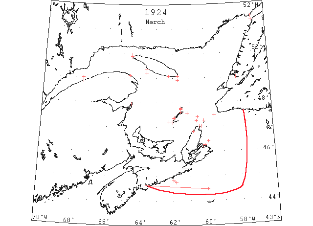
Mar (early) Pilotage officer, Father Point: No more ice in river. (CIS IC0708_2)
Mar 1 Matane: heavy close-packed ice everywhere. Fame Point: heavy close-packed ice everywhere. West Point: light close-packed ice everywhere. Southwest Point: heavy close-packed ice everywhere. South Point: light close-packed ice everywhere. St. Paul Island: light close-packed ice everywhere. (HB 1801 Mar 12 CSS)
Mar 1 M. G. Sheppard of Lark Hr. was in Curling yesterday, having come in by motor. He told the STAR that no drift ice has been seen from Lark Hr. since 1st March. (TWS 23 April 1924 p.2)
Mar 3 Fame Point: heavy close-packed ice everywhere. West Point: light close-packed ice everywhere. Southwest Point: heavy close-packed ice everywhere. South Point: light close-packed ice everywhere. Heath Point: heavy open ice everywhere. Grosse Isle, M.I.: close-packed ice. West Point, M.I.: packed ice. Flat Point: light open ice distant. Point Amour: heavy close-packed ice everywhere. Belle Isle: heavy open ice everywhere. (HB 1801 Mar 12 CSS)
Mar 4 Schooner “Gordon E. Moulton” from New York to Burgeo was badly damaged in the ice 25m off coast and abandoned in sinking condition off Burgeo. (NYMR)
Mar 4 Fame Point: heavy close-packed ice everywhere. West Point: light open ice inshore. Southwest Point: light close-packed ice distant. Heath Point: heavy open ice everywhere. West Point, M.I.: open ice. Point Amour: heavy close-packed ice everywhere. (HB 1801 Mar 12 CSS)
Mar 5 Fame Point: heavy close-packed ice everywhere. Southwest Point: light open ice distant. West Point, M.I.: close-packed ice. St. Paul Island: east and southeast, ice still moving. Flat Point: heavy close-packed ice everywhere, stationary. Point Amour: heavy close-packed ice everywhere. (HB 1802 Mar 19 CSS)
Mar 6 Fame Point: heavy open ice everywhere. Southwest Point: heavy close-packed ice distant. West Point: light close-packed ice everywhere. Heath Point: heavy close-packed ice everywhere. Flat Point: heavy close-packed ice everywhere, stationary. (HB 1802 Mar 19 CSS)
Mar 7 Her bow scraped clean of paint near the waterline, through continually coming in contact with ice fields, the Red Cross liner “Silva,” from St. John’s, Nfld, Friday morning. The strength and speed of this steamer was clearly demonstrated, for notwithstanding the fact that she encountered fields of ice miles in length, she made the trip to Halifax in the fast time of 33 hours. Officers of the ship stated that as soon as the ship passed through one ice field and met with clear water, another would be encountered. Through all this ice the “Silva” went with her engines at full speed, and the continual growling caused by the ice striking the ship’s bow, and the slight slackening of speed, were the only noticeable changes aboard the ship. (HH 08/03/1924 p16#4)
Mar 7 Matane: heavy close-packed ice inshore. Fame Point: heavy open ice everywhere. Flat Point: heavy close-packed ice everywhere, stationary. HB 1802 Mar 19 CSS)
Mar 8 Matane: heavy close-packed ice distant. Southwest Point: heavy close-packed ice distant. West Point, M.I.: close-packed ice. Flat Point: heavy close-packed ice everywhere, stationary. (HB 1802 Mar 19 CSS)
Mar 9 St John’s, Nfld, the sealing fleet is today held in port by the ice blockade. The fleet started for the fields at noon Friday, but was unable to get out. The “Neptune” Captain George Barbour, made for the narrow, but became jammed. The gulf fleet has already gone into action, the “Stella Maria” having left Port aux Basque on Thursday morning at 9 o’clock, while the “Sable I” sailed on Wednesday. The “Viking” which sailed from St. John’s direct was last reported as being 35 miles south east of Bird Rock with the ice open and making easy progress. (HH 10/03/1924 p3#8)
Mar 10 Fame Point: heavy open ice everywhere. West Point: North Channel light open ice, South Channel no ice in sight. Grosse Point, M.I.: close-packed ice. West Point, M.I.: ice 2 miles from shore. Flat Point: heavy close-packed ice everywhere, stationary. (HB 1802 Mar 19 CSS)
Mar 11 “Trelyon” 44°50’N 62°W thence to 44°45’N 61°50’W large quantities of slob ice. (NYMR)
Mar 11 Fame Point: heavy open ice everywhere. West Point: North Channel heavy open ice inshore. Grosse Point, M.I.: close-packed ice. Flat Point: heavy close-packed ice everywhere. Point Amour: heavy close-packed ice everywhere. (HB 1802 Mar 19 CSS)
Mar 11 SS “Trelyon”: 44°50’N 62°00’W, thence to 44°45’N 61°50’W, large quantities of slob ice. (HB 1803 Mar 26 CSS)
Mar 12 In the Gulf, the “Kyle” is encountering very little ice between Port aux Basques and North Sydney, except some in Sydney Bight. (TWS, p.2).
Mar 12 At Bay of Islands there has been no drift ice in sight for some time. On Saturday two young men came in dory from Chimney Cove to Crabbs. They state that it is weeks since the ice went off. They report seals plentiful in the water all along from Chimney Cove to Bay of Islands. (TWS, p.2).
Mar 12 Parties harvesting ice from the Humber Arm find it is not of a very good quality. There is only about five inches of solid ice, the balance being comprised of hard snow. (TWS, p.2).
Mar 12 St. George’s Bay is free of ice and has been for some time. (TWS, p.3)
Mar 12 Fame Point: heavy open ice everywhere. Pleasant Bay: close-packed ice. Heath Point: heavy close-packed ice everywhere. Money Point: heavy close-packed ice. Flat Point: heavy close-packed ice everywhere. (HB 1803 Mar 26 CSS)
Mar 13 Pleasant Bay: close-packed ice. Money Point: heavy close-packed ice. Flat Point: heavy close-packed ice everywhere. (HB 1803 Mar 26 CSS)
Mar 14 Fame Point: heavy open ice everywhere. West Point: North Channel, light, close-packed ice everywhere. Money Point: light ice inshore, clear in distance. Flat Point: heavy close-packed ice everywhere. (HB 1803 Mar 26 CSS)
Mar 15 Fame Point: heavy open ice everywhere. West Point: North Channel, 1 mile wide, light, broken ice along shore. Pleasant Bay: close-packed ice. Grosse Isle, M.I.: open ice distant. Flat Point: heavy close-packed ice, moving southeast. (HB 1803 Mar 26 CSS)
Mar 18 Fame Point: heavy open ice everywhere. Grosse Isle, M.I.: open ice distant. Money Point: light, close-packed ice inshore. St. Paul Island: light, open ice to the southwest and northwest. Flat Point: heavy, open ice distant. (HB 1803 Mar 26 CSS)
Mar 19 It was reported on Monday that the ice had broken up inside of Grassey Island and that the schooners at Woods Island were in clear water. (TWS, p.2)
Mar 19 Fame Point: heavy open ice everywhere, moving east. Money Point: scattered ice offshore. Flat Point: heavy open ice distant, moving southeast. (HB 1804 Apr 2 CSS)
Mar 20 The Canadian Signal Service reports ice as follows: Fame Point, heavy open ice everywhere; Grosse Isle, MI, ice about 10 miles from shore; Money Point, light close packed ice everywhere; Flat Point, heavy open ice moving southeast. (NYMR, p.13, col.5)
Mar 20 Fame Point: heavy open ice everywhere. Grosse Isle: ice about 10 miles from shore. Money Point: light close-packed ice everywhere. Flat Point: heavy open ice distant, moving southeast. (HB 1804 Apr 2 CSS)
Mar 21 Fame Point: heavy open ice everywhere. Grosse Isle: about 6 miles of broken ice. Étang du Nord: close-packed ice everywhere. Flat Point: heavy close-packed ice everywhere. Point Amour: heavy close-packed ice distant. Belle Isle: heavy open ice. (HB 1804 Apr 2 CSS)
Mar 22 Fame Point: heavy open ice everywhere. West Point, M.I.: ice 10 miles from shore. Grosse Isle: ice 7 miles from shore, broken ice inshore. Étang du Nord: close-packed ice everywhere. Money Point: a narrow strip of ice along shore. Flat Point: heavy close-packed ice everywhere, stationary. Cape Ray: heavy open ice distant. (HB 1804 Apr 2 CSS)
Mar 25 Fame Point: light broken ice inshore. Grindstone: Pleasant Bay to Grindstone West Bay, full loose ice; eastern side clear, ice moving southeast. Grosse Isle: broken ice about 8 miles inshore, moving east. Étang du Nord: close-packed ice everywhere. Money Point: heavy close-packed ice to southeast. Flat Point: heavy close-packed ice everywhere, moving southeast. Point Amour: heavy close-packed ice everywhere. Belle Isle: string of ice moving south. (HB 1804 Apr 2 CSS)
Mar 26 The crop of ice this winter has been very poor, in fact the worse for many years. (TWS, p.2).
Mar 26 The ice on Humber Arm is becoming dangerous. Last week several horses broke through at different places. Mar 26 Should weather continue favorable in a few days time we will have open navigation. (TWS, p.2).
Mar 26 The schooner “Electric Flash”, held at Woods Island by ice since the middle of January, got clear on Friday, and sailed for Gloucester, with over fourteen hundred barrels of herring. (TWS, p.3).
Mar 26 The SS “Kyle” on her last trip westward across Cabot Strait she encountered ice heavily packed in on the Sydney coast, and she had to go to Louisburg. She was due back to Port aux Basques last midnight. (TWS, p.3)
Mar 26 Fame Point: light open ice everywhere. Grindstone: Pleasant Bay eastern entrance clear of ice. St. Paul Island: heavy close-packed ice inshore to west and southwest, moving south. Money Point: heavy open ice, moving east. Point Amour: heavy close-packed ice stationary. Belle Isle: heavy open ice distant. (HB 1805 Apr 9 CSS)
Mar 27 Fame Point: light open ice inshore. Heath Point: heavy close-packed ice everywhere. West Point: North Channel, light open ice everywhere. Grindstone: Pleasant Bay western side full of loose ice; Old Harry, open ice distant; Grosse Isle, ice moving west; Étang du Nord, loose ice; West Point, close-packed ice. St. Paul Island: heavy close-packed ice distant to west and southwest. (HB 1805 Apr 9 CSS)
Mar 27 Cape St. Lawrence, C.B.: a lot of ice to be seen from here, but a considerable distance from shore. (HB 1805 Apr 9 CSS)
Mar 27 Money Point: light open ice inshore. Flat Point: heavy close-packed ice everywhere, stationary. Point Amour: heavy close-packed ice stationary. Belle Isle: heavy open ice distant. (HB 1805 Apr 9 CSS)
Mar 28 Fame Point: light open ice inshore. Heath Point: heavy close-packed ice everywhere. Point Amour: heavy close-packed ice distant. (HB 1805 Apr 9 CSS)
Mar 29 Grindstone: Pleasant Bay, loose ice, drifting east; Grosse Isle, about 8 miles broken ice, moving east; West Point, close-packed ice everywhere; Étang du Nord, close-packed ice. Heath Point: heavy open ice distant. Point Amour: heavy close-packed ice everywhere. (HB 1805 Apr 9 CSS)
Mar 30 “John W. McKay” Small patches field ice, Halifax to 60th meridian in 44°29’N (IIP p85#45)
Mar 30 The following radiogram [was] received from the U.S. Coast Guard cutter “Tampa”: small patches of St. Lawrence field ice between Halifax and 44°30’N 60°00’W. (HB 1805 Apr 9)
Mar 31 St. Paul Island: packed ice to southwest, west, and northwest. Money Point: heavy close-packed ice, stationary. Flat Point: heavy close-packed ice everywhere. Point Amour: heavy open ice distant. Belle Isle: heavy open ice inshore; one berg. (HB 1805 Apr 9 CSS)
Apr 1 J.A. Ward, Lightkeeper, Miscou Point, New Brunswick: Opening date. (CIS IC0756_2)
Apr 1 Étang du Nord: open ice. Heath Point: heavy close-packed ice inshore, moving south. Grosse Isle: close-packed ice. West Point: ice 10 miles from shore. Money Point: light open ice inshore, moving south. Flat Point: heavy close-packed ice everywhere. Point Amour: heavy close-packed ice distant. Belle Isle: heavy close-packed ice inshore. (HB 1806 Apr 16 CSS)
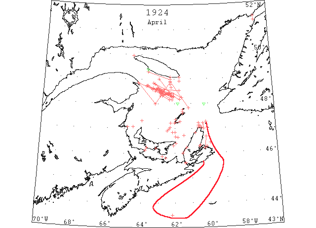
Apr 2 The Canadian Signal Service, H S Grevy Superintendent, is in operation for the season of 1924 and reports daily the ice and navigation conditions on the Canadian coast. The ice breaker “Mikula” will be on ice patrol duty in the Gulf of St. Lawrence between Heath Point and Cape Ray from the opening of navigation until the route is clear of ice. (NYMR, p.13, col.5)
Apr 2 Heath Point: heavy close-packed ice everywhere. Money Point: light open ice inshore. Flat Point: heavy close-packed ice everywhere. Point Amour: heavy close-packed ice distant. Belle Isle: three bergs. (HB 1806 Apr 16 CSS)
Apr 3 Flat Point, heavy close packed ice everywhere, stationary. St. Paul’s, no ice. Money Point, light open ice, moving to north. Cape Ray, no ice. (HH 03/04/1924 p15#6)
Apr 3 Word has also been received from the Gulf fleet that the steamer “Viking” “Sable I” and “Stella Maris” are still jammed owing to prevailing easterly winds. (HH 03/04/1924 p18 #1)
Apr 3 South Point: heavy close-packed ice everywhere. Heath Point: heavy close-packed ice everywhere. Heath Point: heavy close-packed ice everywhere. West Point: close-packed ice. (HB 1806 Apr 16 CSS)
Apr 4 Gloucester: With her Canadian colors at half staff, the former Gloucester fishing schooner “Electric Flash,” crept into port late last evening, reporting the loss of two of her crew on Thursday last, while the craft was off Shelburne bound to Gloucester with a cargo of salt herring. The schooner after being frozen in the ice at Bay of Islands all winter, managed to work clear and sailed for Gloucester on March 25. (HH 05/04/1924 p13#5)
Apr 4 West Point, Anticosti: broken ice everywhere in North Channel. Heath Point: heavy close-packed ice everywhere. Étang du Nord: close-packed ice everywhere. West Point: close-packed ice everywhere. St. Paul Island: heavy close-packed ice to west and northwest. Money Point: heavy close-packed ice northwest; no ice eastward. Flat Point: heavy open ice distant. Point Amour: heavy close-packed ice distant. Belle Isle: heavy close-packed ice everywhere. (HB 1806 Apr 16 CSS)
Apr 5 South Point: light open ice distant. Heath Point: heavy close-packed ice everywhere. Grindstone, M.I.: Pleasant Bay, loose scattered ice, moving east. Étang du Nord: light open ice everywhere. West Point: close-packed ice everywhere. St. Paul Island: heavy close-packed ice everywhere. Money Point: light close-packed ice everywhere. Point Tupper: loose ice passing down; heavy close-packed ice from Inverness to Port Hood. Flat Point: heavy open ice distant. (HB 1806 Apr 16 CSS)
Apr 7 North Sydney, The icebreaker, “Montcalm,” left here this afternoon to assist two Ingonish coasting schooners, the “Hawley Brothers” and the “Beatrice D,” which are in a perilous position in the ice pack off Englishtown, Victoria county. The schooners, which left here on Sunday morning for North Victoria points, a half days run, and had only a small supply of provisions and stores, are in danger of being driven ashore and crushed by the weight of ice or being carried out to sea, according to a message received from one of the crew who walked ashore over miles of heavy close packed ice. (HH 08/04/1924 p1 bottom last)
Apr 7 Point Escuminac: heavy close-packed ice everywhere. South Point: heavy close-packed ice everywhere. Heath Point: heavy close-packed ice everywhere. West Point: close-packed ice everywhere. St. Paul Island: heavy close-packed ice distant west and northwest, also to the southward on the 7th. Point Amour: heavy close-packed ice distant. Belle Isle: heavy open ice inshore. Cape St. Lawrence: scattered ice. (HB 1806 Apr 16 CSS)
Apr 8 A. Beck, Lightkeeper, Cap d’Espoir, Quebec: Latest date of spring break-up. [range?] (CIS IC0775)
Apr 8 St. Paul’s, heavy close packed ice all around, moving east. Money Point, heavy and close packed ice distant to south and west and northwest. Point Tupper, loose ice. Flat Point, heavy open ice distant. Cape Ray, no ice. (HH 8/04/1924 p11#8)
Apr 8 Point Escuminac: heavy close-packed ice everywhere. South Point: heavy close-packed ice everywhere. Heath Point: heavy close-packed ice everywhere. Grindstone, M.I.: Pleasant Bay, the bay was full of close-packed ice. West Point: close-packed ice everywhere. St. Paul Island: heavy close-packed ice distant west and northwest. Point Amour: heavy close-packed ice distant. Belle Isle: heavy open ice inshore. Cape St. Lawrence: scattered ice. (HB 1806 Apr 16 CSS)
Apr 8 Sealing Steamer “Viking”: position, 15 miles southwest of West Point, M.I., in heavy close-packed ice. (HB 1806 Apr 16)
Apr 9 Point Escuminac: heavy close-packed ice everywhere. South Point, Anticosti: heavy close-packed ice everywhere. Pleasant Bay: close-packed ice. Money Point: heavy close-packed ice to the south and east, open to the north. Flat Point: heavy open ice distant northward. (HB 1807 Apr 23 CSS)
Apr 9-15 Sealing Steamer “Viking” reports from positions 20 to 27 miles southwestward of West Point, M.I., that she was in heavy close-packed ice. (HB 1807 Apr 23)
Apr 10 Point Escuminac: heavy close-packed ice everywhere. South Point, Anticosti: heavy close-packed ice distant. Heath Point: heavy close-packed ice. Pleasant Bay: close-packed ice. Grosse Isle: about 8 miles broken ice inshore. Money Point: light close-packed ice inshore. (HB 1807 Apr 23 CSS)
Apr 11 Point Escuminac: heavy close-packed ice everywhere. South Point, Anticosti: heavy open ice stationary. Pleasant Bay: loose ice. Grosse Isle: 3 miles of broken ice inshore. Flat Point: light close-packed ice inshore. (HB 1807 Apr 23 CSS)
Apr 12 Point Escuminac: heavy close-packed ice distant. South Point, Anticosti: heavy open ice stationary. Heath Point: heavy open ice everywhere. Pleasant Bay: large patches of drift ice. Grosse Isle: 1 mile of broken ice inshore. Money Point: ice distant. Flat Point: heavy open ice distant. Point Amour: light close-packed ice inshore. (HB 1807 Apr 23 CSS)
Apr 14 Point Escuminac: heavy close-packed ice everywhere. Heath Point: heavy open ice distant. St. Paul Island: scattered ice to west and southwest. Flat Point: light close-packed ice everywhere; distant ice to the eastward. (HB 1807 Apr 23 CSS)
Apr 15 CGS “Lady Grey”: at Port St. Francis, as far as can be seen, ice is coming down. Lake ice passed down all night opposite Three Rivers. (HB 1808 Apr 30 CSS)
Apr 15 CGS “Montcalm”: reports 8 miles off Ingonish, thence to Sydney, two small strings of broken ice. (HB 1808 Apr 30 CSS)
Apr 16 Point Escuminac: heavy close-packed ice everywhere. Cape St. Lawrence, C.B., N.S.: considerable ice to be seen. Port Hood: ice inshore. Point Amour: light close-packed ice inshore. Belle Isle: heavy close-packed ice everywhere, 5 bergs. (HB 1808 Apr 30 CSS)
Apr 17 First arrival of season at Quebec. (WBB)
Apr 17 46°40’N 61°58’W close packed ice. (NYMR)
Apr 17 The Canadian Signal Service reports ice as follows: Montreal to Sorel, very little ice passing down; ice jammed in North Channel of Lavaltrie; Sorel to Quebec, considerable broken ice passing; Lake St. Peter Channel clear, but considerable ice passing down; one small batture on north side still holding; Cape St. Lawrence, considerable ice to be seen from here; Point Escuminac, heavy close packed ice everywhere; Heath Point, heavy close packed ice everywhere; Money Point, light close packed ice distant; Point Amour, light close packed ice inshore. (NYMR, p.13, col.2&5).
Apr 17 Viking, sealing steamer, reports: jammed in heavy rafted ice, 10 miles SW by S of East Cape, PEI; open water 1 mile southwest. (NYMR, p.13, col.5)
Apr 17 Point Escuminac: heavy close-packed ice everywhere. Heath Point: heavy close-packed ice everywhere. Money Point: light close-packed ice distant. Cape St. Lawrence, C.B., N.S.: considerable ice to be seen. Point Amour: light close-packed ice inshore. (HB 1808 Apr 30 CSS)
Apr 17 CGS “Montcalm” 46°40’N 61°58’W, close-packed ice. (HB 1808 Apr 30 CSS)
Apr 18 CGS “Montcalm” 46°39’N 61°50’W, in close-packed ice, open water about 4 miles northward, extending east and west as far as could be seen; 46°51’N 62°00’W, working through close-packed ice. (HB 1808 Apr 30 CSS)
Apr 19 The car ferry which left Borden on 19th is still fast in the ice about a mile from the pier. This is the longest tie up (54 hours) since the steamer began running. The Straits are jammed from shore to shore with heavy ice. (Pat 21 Apr p5 c4)
Apr 19 Point Escuminac: heavy close-packed ice everywhere. Heath Point: heavy close-packed ice everywhere. Flat Point: light open ice coming out of St. Ann Bay. Money Point: light close-packed ice to the northwest, open water from north to east. Cape St. Lawrence, C.B., N.S.: considerable ice to be seen. Summerside, P.E.I.: strait still filled with drift ice. Belle Isle: 8 bergs. (HB 1808 Apr 30 CSS)
Apr 21 Charlottetown Harbour clear of ice except for a few floes. (Pat 21 Apr p5 c3)
Apr 21 SS “Stella Maris” one of sealing fleet is in Souris for supplies. Souris Harbour is comparatively clear of ice. (Pat 21 Apr p6 c3)
Apr 21 Point Escuminac: heavy close-packed ice inshore. Heath Point: heavy close-packed ice everywhere. Summerside, P.E.I.: strait still filled with drift ice. Point Amour: heavy close-packed ice. Belle Isle: heavy close-packed ice everywhere, 35 bergs. (HB 1808 Apr 30 CSS)
Apr 22 Grindstone, Magdalen Islands, narrow strip shore ice, extending from Amherst to Entry Island, moving east. No ice elsewhere. (HH 23/04/1924 p11#6)
Apr 22 PEI car ferry still fast in the ice. Ice conditions worst for 20 years. (Pat 22 Apr p1 c5)
Apr 22 The British steamer “Airdale” which was the 1st ocean vessel to reach Quebec this year suffered damage while bucking ice on the way here from Sydney. Quebec April 22nd. (Pat 22 Apr p1 c8)
Apr 22 Point Escuminac: heavy close-packed ice inshore. Heath Point: heavy close-packed ice everywhere. Flat Point: light open ice inshore. Money Point: light open ice inshore. Summerside, P.E.I.: strait still filled with drift ice. Point Amour: heavy close-packed ice. Belle Isle: heavy close-packed ice everywhere, 50 bergs. (HB 1808 Apr 30 CSS)
Apr 22 SS “Cornishman”: 48°17’N 62°05’W to 48°39’N 63°02’W, field ice. (HB 1808 Apr 30)
Apr 22 Sealing Steamer “Viking”: 40 miles west by south [inland?]of East Cape, P.E.I., in heavy rafted ice. (HB 1808 Apr 30 CSS)
Apr 22 Sealer [steamer] “Viking”: position 3 miles SSE of East Cape, P.E.I., in heavy close-packed ice. (HB 1809 May 7)
Apr 22 CGS “Montcalm”: now in (approximately) 48°20’N 62°15’W; going through some open ice. (HB 1809 May 7 CSS)
Apr 23 Two years ago [1922] the ice in the Humber went out on 24th April. Last year [1923] it was 13th May before the Humber became clear of ice. This year [1924] navigation on the Humber open on 20th April. (TWS 1924 p.2).
Apr 23 The ice went out on Easter Sunday morning. (TWS, p.2).
Apr 23 Point Escuminac: heavy close-packed ice everywhere. South Point: heavy close-packed ice distant. Summerside, P.E.I.: Strait still packed with ice. Cape St. Lawrence: scattered ice distant. St. Paul Island: heavy open ice distant from southwest to west and northwest. Money Point: light open ice. Point Amour: heavy close-packed ice everywhere. Belle Isle: heavy close-packed ice everywhere, 65 bergs. (HB 1809 May 7 CSS)
Apr 23 CGS “Montcalm”: in (approximately) 48°26’N 62°23’W, working slowly toward northwest edge of ice; ice very soft and opened. (HB 1809 May 7 CSS)
Apr 24 The Canadian Signal Service reports ice as follows: Point Escuminac, heavy close packed ice everywhere; Summerside, PEI, Strait still packed with ice; Cape St. Lawrence, scattered ice distant; Flat Point, NS, Sydney Harbor and Spanish Bay clear; St. Ann’s Bay, light open ice inshore; St. Paul Island, light open ice inshore; Point Amour, heavy close packed ice everywhere; numerous bergs and growlers. (NYMR, p.13, col.3&5)
Apr 24 Point Escuminac: heavy close-packed ice everywhere. Summerside, P.E.I.: Strait still packed with ice. Cape St. Lawrence: scattered ice distant. Flat Point, N.S.: Sydney Harbour and Spanish Bay clear; St. Ann Bay, light open ice inshore. St. Paul Island: light open ice inshore. Point Amour: heavy close-packed ice everywhere. Belle Isle: heavy close-packed ice everywhere, many bergs and growlers. (HB 1809 May 7 CSS)
Apr 24 CGS “Montcalm” 48°39’N 62°12’W: in scattered open broken ice and slob. (HB 1809 May 7 CSS)
Apr 24 SS “Brandon”: 48°15’N 61°35’W to 48°51’N 63°15’W, passed through broken ice fields. (HB 1809 May 7)
Apr 24 Sealer [steamer] “Viking”: about 25 miles S. by E. from Dead Man Island, ice lighter and open. (HB 1809 May 7)
Apr 25 Point Escuminac: heavy close-packed ice everywhere. Summerside, P.E.I.: Strait still blocked with heavy drift ice. Cape St. Lawrence: scattered ice distant. Heath Point: heavy close-packed ice everywhere. Point Amour: heavy close-packed ice everywhere. (HB 1809 May 7 CSS)
Apr 25 SS “Mont Royal” 48°24’N 62°05’W: field ice; numerous growlers thence to 48°34’N 62°52’W. Ice detached and easily navigated. (HB 1809 May 7)
Apr 25 SS “Carmania” 47°58’N 60°13’W: a small growler. (HB 1809 May 7)
Apr 25 SS [unnamed] 48°20’N 62°10’W: sighted string of field ice with growlers; thence to 48°24’N 62°25’W, passed several large pieces; thence to 48°33’N 62°54’W, skirted south of a small field of open ice with some dangerous pieces. (HB 1809 May 7)
Apr 26 The lobster season will open on the 26th but owing to the heavy ice all along the coast, it is not likely that any lines will be run until the 10th or 15th of May. Last year the fishing began on May 6th. (Pat 22 Apr p6 c4)
Apr 26 Bad ice conditions in the Strait delaying car ferry. (Pat 26 Apr p6 c3)
Apr 26 Point Escuminac: heavy close-packed ice everywhere. Summerside, P.E.I.: Strait still blocked with heavy drift ice. Money Point: scattered ice. Point Amour: heavy close-packed ice everywhere. (HB 1809 May 7 CSS)
Apr 26 CGS “Montcalm”: 48°32’N 61°42’W to 48°36’N 63°06’W, passed through some strings of broken ice and slob with some growlers. (HB 1809 May 7 CSS)
Apr 26 Tug “Ocean King”: 48°10’N 62°09’W to 48°39’N 63°18’W, encountered strings of broken ice and growlers. (HB 1809 May 7)
Apr 26 SS “Canadian Mariner”: 48°25’N 62°18’W to 48°30’N 62°55’W, field ice; thence to 48°45’N 63°35’W, passed long string of loose ice with large pieces and growlers. (HB 1809 May 7)
Apr 26 SS “Borden”: 48°24’N 62°10’W to 48°20’N 62°50’W, passed the edge of an ice field and slob ice with some large, dangerous pieces. (HB 1809 May 7)
Apr 26 SS “Andania” 48°18’N 62°03’W: small growlers; thence to 48°34’N 62°59’W, passed through fields of slob ice with occasional large, hard pieces. (HB 1809 May 7)
Apr 26 SS “Canada”: 48°11’N 61°42’W to 48°31’N 62°45’W, loose field ice containing large, dangerous pieces. (HB 1809 May 7)
Apr 26 SS “Montreal”: 48°17’N 62°09’W to 48°24’N 62°33’W, field ice and scattered ice to Cap des Rosiers. (HB 1809 May 7)
Apr 26 SS “Melona”: met field ice in 48°18’N 62°10’W, consisting of open ice and strings of slob with many heavy pieces in 48°28’N 62°56’W; last of field [ice] in 48°38’N 63°00’W, thence growlers. (HB 1809 May 7)
Apr 26 SS “Rose Castle”: from Bird Rocks to Cap des Rosiers, passed a considerable quantity of field ice and numerous growlers. (HB 1809 May 7)
Apr 27 Point Escuminac: heavy close-packed ice everywhere. Summerside, P.E.I.: drift ice packed solid on the mainland side of the Strait. Point Amour: heavy open ice with many bergs. (HB 1809 May 7 CSS)
Apr 27 CGS “Montcalm”: 48°27’N 62°17’W to 49°00’N 62°55’W, strings of ice, slob, and a few growlers. (HB 1809 May 7 CSS)
Apr 27 SS “Canadian Planter”: from 48°23’N 62°20’W, field ice with some very heavy pieces scattered through the loose ice; thence to 48°48’N 63°10’W, numerous pieces, some large. (HB 1809 May 7)
Apr 27 SS “Cairntorr”: passed through heavy packed ice from 48°23’N 62°20’W to 48°23’N 62°46’W; detached growlers for 20 miles to the southwestward. (HB 1809 May 7)
Apr 28 Mail for the Magdalenes – The steamer “R.W. Henry” will sail from Halifax for the Magdalenes direct on the 28th. (Pat 25 Apr p6 c3)
Apr 28 Point Escuminac: heavy close-packed ice everywhere. Point Amour: heavy close-packed ice everywhere; many bergs. (HB 1809 May 7 CSS)
Apr 28 CGS “Montcalm”: cleared the upper end of ice strings in 48°24’N 62°47’W, thence to 48°32’N 63°10’W, a few growlers. (HB 1809 May 7 CSS)
Apr 28 SS “Welland County” 48°00’N 61°50’W: occasional growlers; from 48°10’N 62°18’W to 48°20’N 62°43’W, passed through large ice field with plenty of clear water; from 48°35’N 63°20’W to 48°43’N 63°40’W, passed through open field ice and growlers. (HB 1809 May 7)
Apr 28 The first arrival in the port of Charlottetown this spring was the schooner “Lady May” from Pinette. The captain reports the Straits full of ice east and west of Point Prim. (Pat 28 Apr p6 c4)
Apr 28 SS “San Felix”: from 48°24’N 62°20’W, to within about 20 miles of Cape Gaspé, met continuous fields of pack, floe, and drift ice dangerous to navigation, especially in the night-time. (HB 1809 May 7)
Apr 29 Point Escuminac: heavy close-packed ice everywhere. Cape St. Lawrence: considerable ice in sight. Point Amour: heavy close-packed ice everywhere; many bergs. (HB 1809 May 7 CSS)
Apr 29 SS “Imperoyal” 48°35’N 62°38’W: encountered scattered broken ice and growlers; heavy close-packed ice to the southwestward. (HB 1809 May 7)
Apr 29 SS “Balfour”: about 18 miles off South Point, Anticosti, many growlers and small pieces. (HB 1809 May 7)
Apr 29 SS “Canadian Commander”: about 12 miles south of South Point, Anticosti, slob ice with many hard pieces and growlers extending north and south as far as could be seen; these conditions prevailed to 48°00’N 63°10’W; from thence to Cap des Rosiers, a few growlers dangerous at night. (HB 1809 May 7)
Apr 29 Sealer [steamer] “Viking” 47°19’N 63°58’W: light close-packed ice. (HB 1809 May 7)
Apr 29 SS “Grey County”: 49[48?]°22’N 62°15’W to 48°30’N 62°40’W, packed drift ice with occasional large pieces scattered among the broken ice. (HB 1810 May 14)
Apr 29 SS “Balfour”: extensive ice fields between Bird Rocks and Anticosti; 12 miles off Southwest Point, 6 large growlers. (HB 1810 May 14)Apr 30 Sealer “Viking” about 25 miles S by E from Dead Man Island [Magdalens]; ice light and open. (NYMR, p.13, col.5).
Apr 30 Coast Guard Steamer “Montcalm” 43°30’N 62°12’W, in scattered open broken ice and slob. (NYMR, p.13, col.5)
Apr 30 Point Escuminac: heavy close-packed ice everywhere. Summerside, P.E.I.: Straits clear on the island side, but mainland shore packed with drift ice. St. Paul Island: narrow strip of slob ice distant to the westward and northwestward. Cape St. Lawrence: very little ice in sight. Money Point: light open ice inshore. Point Amour: heavy close-packed ice everywhere; many bergs. Belle Isle: heavy close-packed ice, 70 bergs, and many growlers. (HB 1810 May 14 CSS)
Apr 30 CGS “Tyrian”: loose ice in the Gut of Canso; northern entrance blocked with ice. (HB 1810 May 14 CSS)
Apr 30 SS “Lingan”: from Bird Rocks to 10 miles off South Point, Anticosti, encountered numerous growlers; from South Point to Southwest Point, heavy field ice 5 miles off land. (HB 1810 May 14)
Apr 30 SS “Blackheath”: between 47°00’N 60°16’W and 47°13’N 60°20’W, passed through heavy broken ice. (HB 1810 May 14)
May 1 Point Escuminac: heavy open ice, moving north. West Point, M.I.: close-packed ice distant. Étang du Nord: ice 10 miles offshore to the southwest. St. Paul Island: light close-packed ice everywhere. Cape St. Lawrence: light open ice everywhere. Money Point: light scattered ice offshore to the northward. Point Amour: heavy close-packed ice everywhere; many bergs. Belle Isle: heavy close-packed ice everywhere, 75 bergs. (HB 1810 May 14 CSS)
May 1 SS “Blackheath”: from 48°40’N 62°10’W to 48°48’N 62°40’W, heavy open ice and growlers; heavy packed ice to the north and growlers to the south of the latter position; from 48°50’N 63°10’W to 49°04’N 63°10’W, a few large growlers, very dangerous at night or in fog. (HB 1810 May 14)
May 1 Sealer [steamer] “Viking” 47°23’N 63°35’W: light open ice with scattered growlers. (HB 1810 May 14)
May 1 SS “Canadian Otter”: heavy loose ice between Cape North and St. Paul island; from 48°20’N 62°24’W to 48°33’N 63°07’W, steamed through scattered growlers. (HB 1810 May 14)
May 1 SS “Montcalm” 48°19’N 72°56’W[sic, probably 62°56’W?]: two large growlers; 48°41’N 63°47’W, three small growlers. (HB 1810 May 14 CSS)
May 2 The river is filled today with drift ice and owing to these conditions, the SS “Harland” did not make her trip up the East River. (Pat 2 May p8 c3)
May 2 Point Escuminac: heavy open ice distant. Summerside, P.E.I.: Strait filled with drift ice. Point Amour: heavy close-packed ice everywhere; many bergs. Belle Isle: heavy close-packed ice everywhere, 75 bergs. (HB 1810 May 14 CSS)
May 2 SS “Manchester Spinner”: a very large growler in 48°39’N 62°13’W; thence to 48°45’N 63°12’W, numerous small growlers; about 20 miles 20° from Cap des Rosiers, one very large and one small growler. (HB 1810 May 14)
May 2 SS “Metagama”: growler 82° 20 miles from Fame Point. (HB 1810 May 14)
May 2 SS “Dunaff Head”: from 48°27’N 62°23’W to 48°33’N 62°32’W, growlers and scattered pieces; 48°40’N 62°54’W, small growler, and 5 miles north large growler; 48°46’N 63°14’W, a growler; 48°47’N 63°20’W, a growler; and 48°46’N 63°24’W, a large growler. (HB 1810 May 14)
May 2 SS “Welshman”: between 48°42’N 62°50’W and 48°51’N 63°10’W, three bergs and several growlers. (HB 1810 May 14)
May 2 SS “Minnedosa”: dangerous growlers in 48°57’N 63°50’W; 48°51’N 63°35’W; and two in 48°23’N 63°10’W. (HB 1810 May 14)
May 2 SS “Wabana”: about 6 miles southwest from Cape North, loose-packed ice. (HB 1810 May 14)
May 2 SS “Athenia”: several growlers on track off Cap des Rosiers. (HB 1810 May 14)
May 3 Point Escuminac: heavy open ice distant. West Point, M.I.: close-packed ice everywhere. Étang du Nord: scattered ice everywhere. Summerside, P.E.I.: considerable drift ice in the Strait. Old Harry: light open ice distant. Old Harry: scattered ice distant. Cape St. Lawrence: considerable ice in sight. Point Amour: heavy close-packed ice everywhere; many bergs. Belle Isle: heavy close-packed ice everywhere, many bergs and growlers. (HB 1810 May 14 CSS)
May 3 SS “Empress of Scotland”: 48°28’N 62°26’W; 48°35’N 62°51’W; 48°49’N 63°44’W; and 48°56’N 63°35’W, growlers. (HB 1810 May 14)
May 3 SS “Carmania”: 48°31’N 62°44’W and 48°29’N 62°35’W, two large growlers. (HB 1810 May 14)
May 4 SS “Canadian Forester”: May 5 reports some open field ice southeast of Bird Rocks on May 4. (HB 1810 May 14)
May 4 The following radiograms [was] received from the U.S.C.G. cutters “Tampa” and “Modoc”: our position, 45°16’N 56°41’W. No ice seen or reported. “Modoc relieved “Tampa” to-day. (HB 1810 May 14)
May 5 The prevailing heavy winds have filled the east river and harbour with heavy packed drift ice. (Pat 5 May p5 c4)
May 5 Point Escuminac: heavy open ice distant. West Point, M.I.: heavy open ice everywhere. Point Amour: heavy close-packed ice everywhere; many bergs. Belle Isle: heavy close-packed ice everywhere. (HB 1810 May 14 CSS)
May 5 SS “Canada” 49°00’N 64°00’W: growler and two pieces of ice; and 48°56’N 63°49’W, a growler and a piece of ice. (HB 1810 May 14)
May 5 SS “Andania” 49°16’N 64°22’W: a growler. (HB 1810 May 14)
May 5 SS “Herman Frasch” 48°38’N 63°04’W: small berg; thence to Cap des Rosiers several growlers. (HB 1810 May 14)
May 5 SS “Montral” 49°03’N 64°00’W: a small berg and three growlers. (HB 1810 May 14)
May 5 SS “Calgary” 48°38’N 62°08’W: dangerous growlers; also a long strip of close-packed ice 6 miles long about 5 miles north of Bird Rock. (HB 1810 May 14)
May 6 “Manchester Brigade” (Br), 48°02’N 57°00’W [cf. HB=60°57’W], light scattered ice; 48°39’N 62°56’W, a berg, and 48°47’N 62°35’W, a berg. (NYMR, p.13, col.2).
May 6 “Montcalm” (CGS), a few growlers between South Point and Heath Point; a medium sized berg about 7 miles 160° (mag) [cf.HB=186° (mag)] from Heath Point; 48°07’N 63°18’W, the steamer “Canadian Sapper” surrounded by heavy ice. Not advisable for any ship to attempt the Strait of Canso. (NYMR, p.13, col.2)
May 6 Having completed her ice breaking duties in North Sydney, the CG steamer “Montcalm” has sailed for ice patrol duty in the Gulf. The ship will likely remain on patrol for a few days and later proceed to Charlottetown. (Pat 6 May p8 c3)
May 6 Point Escuminac: heavy open ice distant. West Point, M.I.: heavy open ice distant. Étang du Nord: heavy open ice everywhere. Summerside, P.E.I.: considerable drift ice in the Strait. Old Harry: scattered ice distant. Belle Isle: heavy close-packed ice everywhere, many bergs and growlers. Grosse Isle: scattered ice distant. St. Paul Island: light open ice to the west and southwest. Cape St. Lawrence: scattered ice everywhere. Money Point: light open ice everywhere. Point Amour: heavy close-packed ice everywhere; many bergs. (HB 1810 May 14 CSS)
May 6 SS “Cairntorr” 48°38’N 63°08’W: a dangerous growler. (HB 1810 May 14)
May 6 SS “Montcalm” 47°41’N 60°47’W: passed a string of open ice and several growlers. (HB 1810 May 14 CSS)
May 6 CGS “Montcalm”: a few growlers between South Point and Heath Point; a medium-sized berg about 7 miles 186° (mag.) [cf. NYMR above]from Heath Point; 48°07’N 63°18’W, the steamer “Canadian Sapper” surrounded by heavy, close ice. Not advisable for any ship to attempt the Strait of Canso. (HB 1811 May 21 CSS)
May 6 SS “Manchester Brigade” 48°02’N 60°57’W[cf. NYMR above]: light scattered ice; 48°39’N 62°56’W, a berg; 48°47’N 63°35’W, a berg. (HB 1810 May 14)
May 7 The Canadian Signal Service reports ice as follows: Point Escuminac, heavy open ice everywhere; Grosse Isle, MI, about 2 miles of scattered ice; West Point, MI, scattered ice everywhere; Etang du Nord, scattered ice everywhere; Summerside, PEI, Strait still blocked with ice; St. Paul Island, scattered ice to the westward; Cape St. Lawrence, scattered ice everywhere, Money Point, light close packed ice everywhere; Point Amour, heavy open ice distant; many bergs and growlers. (NYMR, p.13, col.2)
May 7 Point Escuminac: heavy open ice everywhere. Grosse Isle, M.I.: about 2 miles of scattered ice. West Point, M.I.: scattered ice everywhere. Étang du Nord: scattered ice everywhere. Summerside, P.E.I.: Strait still blocked with ice. St. Paul Island: scattered ice to the westward. Cape St. Lawrence: scattered ice everywhere. Money Point: light close-packed ice everywhere. Point Amour: heavy open ice distant, many bergs and growlers. Belle Isle: many bergs and growlers. (HB 1811 May 21 CSS)
May 7 CGS “Montcalm”: a few growlers along the shore between Heath Point and Cormorant Point. (HB 1811 May 21 CSS)
May 7 SS “Canadian Inventor” 48°40’N 68°44’W: a medium-sized berg. (HB 1811 May 21)
May 7 SS “Bothwell” 48°33’N 62°39’W: a growler. (HB 1811 May 21)
May 7 SS “Tento”: from Heath Point to Southwest Point, several small bergs and growlers. (HB 1811 May 21)
May 7 SS “Rose Castle”: from Ingonish to St. Paul Island, field ice which extended westward as far as could be seen. (HB 1811 May 21)
May 8 Point Escuminac: heavy open ice inshore. Étang du Nord: scattered ice everywhere. Summerside, P.E.I.: considerable drift ice in the Strait, but well scattered. St. Paul Island: heavy open ice distant, southwest to northwest. Cape St. Lawrence: considerable scattered ice in sight; scattered ice everywhere. Money Point: light open ice. Flat Point: heavy open ice distant. Point Amour: open ice distant, many bergs and growlers. Belle Isle: heavy open ice with many bergs. (HB 1811 May 21 CSS)
May 8 SS “Melita” 48°35’N 62°32’W: an iceberg. (HB 1811 May 21)
May 8 SS “Caronia” 48°33’N 62°34’W: a small berg. (HB 1811 May 21)
May 8 SS “Arkansas” 48°33’N 62°32’W: an iceberg; and 48°57’N 63°44’W, a small berg. (HB 1811 May 21)
May 9 The SS “Sapper” was off North Cape with a large quantity of drift ice. The SS “Montcalm” on ice patrol has been sent to the assistance of the “Sapper”. (Pat 9 May p8 c3)
May 9 The steamer “Winora” arrived in the city this morning. This is the first steamer to arrive in Charlottetown this season. (Pat 9 May p8 c4)
May 9 Point Escuminac: heavy open ice inshore. Summerside, P.E.I.: Strait gradually clearing of drift ice. St. Paul Island: light close-packed ice distant, south and west. Cape St. Lawrence: scattered ice everywhere. Money Point: light close-packed ice inshore. Flat Point: heavy open ice extending across Spanish Bay. Point Amour: light open ice distant. Belle Isle: heavy open ice with many bergs and growlers. (HB 1811 May 21 CSS)
May 9 CGS “Montcalm” 47°37’N 63°26’W: heavy open ice; 47°25’N 62°38’W: heavy open ice. (HB 1811 May 21 CSS)
May 9 SS “Antonia” 48°33’N 62°36’W: a small berg. (HB 1811 May 21)
May 9 SS “Megantic” 48°31’N 62°40’W: a medium-sized berg; 48°52’N 63°26’W, a low-lying growler; 48°56’N 63°27’W, a growler; and 48°55’N 63°37’W, a small growler. (HB 1811 May 21)
May 9 SS “Afghanistan” 48°33’N 62°37’W: a small berg; and 48°39’N 63°30’W, a small berg. (HB 1811 May 21)
May 9 SS “Mont Laurier” 48°30’N 62°23’W: a medium-sized berg. (HB 1811 May 21)
May 9 SS “Welland County” 48°51’N 63°24’W: passed small berg. (HB 1811 May 21)
May 9-10? SS “Azov”: [on] May 16, reports proceeded inbound through the Gut of Canso on May 9; met first ice in northern end of St. George Bay. Ice fairly heavy in Northumberland Strait right up to Miscou Bank, particularly in the eastern end of the Strait. Sighted a berg about 75 feet out of water off l’Anse au Griffin. (HB 1812 May 28)
May 10 Richmond Bay is now entirely clear of ice. (Pat 10 May p8 c3)
May 10 Point Escuminac: heavy open ice inshore. Grosse Isle, M.I.: about 1 mile of broken ice inside. West Point, M.I.: ice about 4 miles offshore. Étang du Nord: about ½ mile ice along shore. Summerside, P.E.I.: Strait gradually clearing of drift ice. Old Harry: scattered ice distant. St. Paul Island: light close-packed ice distant, south and west. Cape St. Lawrence: scattered ice everywhere. Money Point: light close-packed ice inshore. Flat Point: heavy open ice everywhere. Point Amour: light open ice everywhere. Belle Isle: heavy open ice with many bergs. (HB 1811 May 21 CSS)
May 10 CGS “Montcalm” 47°06’N 62°18’W: heavy close-packed ice; and 48°50’N 63°31’W, and 48°29’N 62°36’W, a small berg; 46°49’N 62°07’W, heavy sheet ice; thence to 10 miles off East Point, open and scattered sheet and string ice. From East Point steered north (mag.) through and around large sheet and strings extending north and south as far as could be seen. Ships bound to and from St. Lawrence ports intending to pass by Gut of Canso cannot get through without considerable ice trouble and delay. (HB 1811 May 21 CSS)
May 10 SS “Cairndhu”: 48°32’N 62°32’W, and 48°53’N 63°29’W, a small berg. (HB 1811 May 21)
May 11 SS “Sapper” arrived here from Montreal. on May 11th and sailed yesterday for St. John’s, Newfoundland. (Pat 13 May p8 c4)
May 11 CGS “Montcalm”: from a position northward of East Point to 47°17’N 60°40’W, steered a zigzag course through large sheet of broken ice; thence to a position 12 miles north of Flint Island, strings of slob ice. (HB 1811 May 21 CSS)
May 11 SS “Dalmazia” 48°35’N 62°29’W: a berg. (HB 1811 May 21)
May 11 SS “Cabotia” 48°30’N 62°26’W: a small, low-lying berg. (HB 1811 May 21)
May 11 SS “Ariano” 48°32’N 62°36’W: passed a medium-sized berg. (HB 1811 May 21)
May 11 SS “Briarwood” 48°31’N 62°35’W: a berg; 48°53’N 63°15’W: a berg. (HB 1811 May 21)
May 12 Point Escuminac: heavy open ice distant. Étang du Nord: scattered ice inshore. Flat Point: heavy open ice distant. Point Amour: heavy open ice everywhere, with many bergs and growlers. Belle Isle: heavy open ice with many bergs. (HB 1811 May 21 CSS)
May 12 CGS “Montcalm”: open to heavy ice streaming into Glace Bay. (HB 1811 May 21 CSS)
May 12 CGS “Montcalm”: ice along the Cape Breton coast; from 46°54’N 59°50’W, to 8 miles off St. Paul Island, open ice. (HB 1811 May 21 CSS)
May 12 SS “Balfour” 48°50’N 62°31’W: a medium-sized berg; 48°31’N 62°27’W, a berg. (HB 1811 May 21)
May 12 SS “Warfield” 48°30’N 62°35’W: a growler. (HB 1811 May 21)
May 12 SS “Welshman” 48°31’N 63°30’W: a medium-sized berg. (HB 1811 May 21)
May 12 Fame Point: at dark yesterday berg 12 miles north. (HB 1812 May 28 CSS)
May 13 Montcalm reports Sydney harbor full of ice. (NYMR, p.13, col.2)
May 13 Point Escuminac: heavy open ice everywhere. Summerside, P.E.I.: considerable ice in the Strait. St. Paul Island: scattered ice everywhere. Money Point: light open ice everywhere. Flat Point: heavy open ice everywhere. Point Amour: heavy open ice with many bergs. Belle Isle: heavy open ice with many bergs. (HB 1811 May 21 CSS)
May 13 CGS “Montcalm”: Sydney Harbour full of ice. (HB 1812 May 28 CSS)
May 14 Fame Point, large berg 10 miles east-southeast of here; Point Escuminac, heavy open ice distant; Pictou, considerable ice in Strait; Souris, PEI, considerable scattered ice; Old Harry, ice distant; Cape St. Lawrence, scattered ice; Flat Point, heavy open ice everywhere; Point Amour, heavy open ice distant and many bergs. (NYMR, p.13, col.1&2).
May 14 “Manchester Hero” (Br) reports, 48°16’N 63°08’W, small dangerous growler. (NYMR, p.13, col.2).
May 14 “Black Heath” (Br) reports between 48°05’N 61°20’W and 48°30’N, passed a small field of loose ice and some growlers. (NYMR, p.13, col.2)
May 14 Fame Point: large berg 10 miles east-southeast. Point Escuminac: heavy open ice distant. Pictou: considerable ice in Strait. Souris, P.E.I.: considerable scattered ice. Old Harry: open ice distant. Cape St. Lawrence: scattered ice. Flat Point: heavy open ice everywhere. Point Amour: heavy open ice everywhere and many bergs. (HB 1812 May 28 CSS)
May 14 SS “Manchester Hero” 48°46’N 63°08’W: small dangerous growler. (HB 1812 May 28)
May 15 Fame Point, iceberg now about 6 miles northeast of station; West Point, ice about 5 miles from shore; Old Harry, open ice as far as can be seen; Cape St. Lawrence, some ice in sight westward; Flat Point, heavy open ice everywhere; St. Paul Island, light close packed ice everywhere; Point Amour, heavy open ice distant, numerous bergs; Belle Isle, heavy open ice everywhere, with numerous bergs and growlers. (NYMR, p.13, col.2).
May 15 “Vistula”, Danzic, reports from Scatari to St. Paul Island, field ice. (NYMR, p.13, col.2).
May 15 “Montcalm” reports from Flat Point to 46°46’N 60°01’W, passed through open ice with some heavy pieces. (NYMR, p.13, col.2)
May 15 CGS “Montcalm”: from Sydney to St. Paul Island, open broken ice and slob with some large hard pieces. The ice is moving off the east coast of Cape Breton with a west wind; it now extends 15 to 25 miles off. It is pounding up in swell and scattering in all directions. The largest part of the western ice has probably passed down. (HB 1812 May 28 CSS)
May 16 Fame Point: iceberg about 10 miles north-northwest of this station. Point Escuminac: heavy open ice distant. Summerside, P.E.I.: considerable ice in Strait to-day. West Point: scattered ice distant. Old Harry: scattered ice distant. Cape St. Lawrence: scattered ice everywhere. Flat Point: heavy open ice distant. St. Paul Island: scattered ice east and southeast. (HB 1812 May 28 CSS)
May 16 SS “Canadian Harvester”: light ice to the south and west of Bird Rock. (HB 1812 May 28)
May 16 SS “Vesuvio”: passed through Gut of Canso and Northumberland Straits with considerable difficulty; soft drift ice in the Gut; Northumberland Straits full of ice. From North Point, P.E.I. to Shippigan Island, considerable open ice with large heavy sheets, making it impossible for vessels to navigate. (HB 1812 May 28)
May 16 SS “Regina”: 15 miles SSW of Cape Ray, field ice; off Bird Rock, heavy slob ice. (HB 1812 May 28)
May 17 Summerside, P.E.I.: still some drift ice in the Strait. Point Amour: heavy open ice everywhere and many bergs. Belle Isle: scattered ice to the eastward, many bergs. (HB 1812 May 28 CSS)
May 17 SS “Conus”: field ice off St. Paul Island; about 3 miles northeast of Bird Rocks, field ice. (HB 1812 May 28)
May 17 SS “Canadian Runner”: light and heavy open ice from Low Point to 2 miles northward of Flint Island; from 46°12’N 59°41’W to 46°14’N 59°32’W, light ice and slob; from 46°14’N 59°32’W to 47°13’N 59°16’W, light ice and slob; in 48°59’N 63°34’W, passed two growlers. (HB 1812 May 28)
May 17 SS “Hypathia”: between 46°47’N 59°40’W and 47°13’N 60°00’W, passed through five distinct patches of drift ice each from 2 to 3 miles across, all open; about 7 miles east of St. Paul Island, heavy ice with one large growler. (HB 1812 May 28)
May 17 SS “Virginia”: about 15 miles east of Bird Rocks, ice extending north and south as far as could be seen; from 5 to 6 miles northward of St. Paul Island, ice as far as could be seen. (HB 1812 May 28)
May 18 Summerside, P.E.I.: Straits clear to-day with exception of little drift ice. West Point: close-packed ice. Flat Point: heavy open ice eastward. Point Amour: heavy open ice everywhere and many bergs. Belle Isle: heavy open ice everywhere eastward, many bergs and growlers. (HB 1812 May 28 CSS)
May 18 CGS “Montcalm”: from southwest to St. Paul Island to 6½ miles off Cape North, open ice with large pieces. (HB 1812 May 28 CSS)
May 18 SS “Comino” 49°51’N 63°59’W: a small berg and several pieces of ice. (HB 1812 May 28)
May 18 SS “Beemsterdijk” 48°56’N 63°38’W: a growler. (HB 1812 May 28)
May 18 SS “Oxonian” 48°51’N 63°37’W: a small growler. (HB 1812 May 28)
May 19 “Twickenham” (Br), reports heavy field ice between Sydney and St. Paul Island. (NYMR, p.13, col.2)
May 19 The following radiogram [was] received from the U.S.C.G. cutters “Modoc” and “Tampa”: our position, 45°20’N 55°35’W. No ice seen or reported to-day. “Tampa” relieves “Modoc” to-day. (HB 1812 May 28)
May 19 SS “Twickenham”: heavy field ice between Sydney and St. Paul Island. (HB 1812 May 28)
May 19 SS “Canadian Beaver” 47°30’N 60°30’W: a string of ice extending eastward; 47°03’N 59°50’W, and 46°50’N 59°40’W, strings of ice extending eastward with heavy pieces. (HB 1812 May 28)
May 19 SS “Lingan”: heavy loose ice 10 miles offshore along the Cape Breton coast, and 5 miles of heavy open ice between Cape North and West End. (HB 1812 May 28)
May 20 The Canadian Signal Service reports ice as follows: West Point, MI, scattered ice everywhere; Etang du Nord, scattered ice about 4 miles offshore; St. Paul Island, light open ice distant to south and southwest; Cape St. Lawrence, scattered ice everywhere; Money Point, light open ice everywhere; Flat Point, heavy open ice distant to northeast; Point Amour, heavy open ice everywhere, with many bergs; Belle Isle, scattered ice distant with many bergs and growlers. (NYMR, p.13, col.2).
May 20 “Montcalm” reports a few strings and scattered pieces between St. Paul Island and Cape North. String of broken ice with large pieces from a position eight miles southwest through Entry Island to a point eight miles north of Deadman Island. (NYMR, p.13, col.2)
May 20 The following radiogram [was] received from the U.S.C.G. cutters “Modoc” and “Tampa”: our position, 44°19’N 55°30’W. No ice seen or reported. (HB 1812 May 28)
May 20 West Point: scattered ice everywhere. Cape St. Lawrence: scattered ice everywhere. Flat Point: heavy open ice distant to northeast. St. Paul Island: light open ice distant to south and southwest. Étang du Nord: scattered ice about 4 miles offshore. Money Point: light open ice everywhere. Point Amour: heavy open ice everywhere and many bergs. Belle Isle: scattered ice distant with many bergs and growlers. (HB 1812 May 28 CSS)
May 20 CGS “Montcalm”: some scattered pieces and string of ice off Aspy Bay and between St. Paul Island and Cape North. (HB 1812 May 28 CSS)
May 21 St. Paul Island: narrow strip of ice distant to southwest and west. Money Point: scattered ice distant. Flat Point: scattered ice eastward. Point Amour: heavy, close-packed ice inshore, many bergs. Belle Isle: many bergs and growlers. (HB 1813 Jun 4 CSS)
May 21 SS “Wabana”: reports strips of scattered ice from Sydney to St. Paul Island. (HB 1813 Jun 4)
May 21 CGS “Montcalm”: a few strings and scattered pieces between St. Paul Island and Cape North. (HB 1813 Jun 4 CSS)
May 22 St Lawrence broadcasts show practically no ice as far as Montreal, which is unusual at this season. (IIP p34)
May 22 Flat Point: scattered ice distant. West Point: scattered ice distant. Étang du Nord: scattered ice distant. (HB 1813 Jun 4 CSS)
May 22 CGS “Montcalm”: string of broken ice with large pieces from a position 8 miles southwest through Entry Island to a point 8 miles north of Deadman Island. (HB 1813 Jun 4 CSS)
May 22 CGS “Montcalm”: off north coast of Cape Breton, passed strings of open ice; a few strings and pieces off St. Ann Bay. (HB 1813 Jun 4 CSS)
May 23 SS “San Guiseppe”: an ice field about 15 miles long between the Magdalen Islands and Prince Edward Island. (HB 1813 Jun 4)
May 24 Point Amour: many bergs and growlers. Belle Isle: many bergs. (HB 1813 Jun 4 CSS)
May 27 The following radiogram [was] received from the U.S.C.G. cutter “Tampa”: our position, entrance to Strait of Belle Isle. Twelve icebergs and 30 growlers from 51°44’N to Belle Isle. Twenty icebergs scattered in entrance to strait. A small field between the Labrador side and Belle Isle working offshore. (HB 1813 Jun 4)
May 27 Point Amour: many bergs and growlers. Belle Isle: 41 bergs. (HB 1814 Jun 11 CSS)
May 27 CGS “Montcalm”: strings of scattered open ice between Entry Island and East Point, P.E.I. (HB 1814 Jun 11 CSS)
May 28 Point Amour: many bergs and growlers. Belle Isle: strings of ice, about 45 bergs. (HB 1814 Jun 11 CSS)
May 29 The Canadian ice patrol of the Gulf of St. Lawrence was discontinued at about this date; this being earlier than usual. (IIP p41)
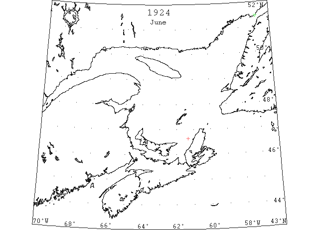
Jun 1 Belle Isle: 23 bergs and many growlers. (HB 1814 Jun 11 CSS)
Jun 2 Cheticamp, C.B., N.S.: ice in sight far off. Point Amour: many bergs and growlers. Belle Isle: many bergs. (HB 1814 Jun 11 CSS)
Jun 16 “Canadian Settler” first vessel of the season through the Strait of Belle Isle. (RG42 Vol.371)
June 16 First Westbound steamer through the strait of Belle Isle. (WBB)