Jan 1 Charlottetown, the closing year means more to the people of this city and island than to the people of other provinces because with the holiday season usually comes the close of open navigation. It is rare indeed that Charlottetown harbor remains open until Christmas day, though last year was an exception, when the ill-fated “Gaspesia” sailed on that date for England. This year the port had remained open not only until Christmas but until the New Year as well and the good steamer “Princess” of the Charlottetown Steam Navigation company has continued her daily trips up to date. Navigation Still Open. At the western end of the island when the SS “Northumberland” of the same line continued her trips this season to and from Point de Chene down to Christmas it was remarked upon as breaking all records within the memory of living persons. This steamer has also continued her trips down to the close of the year and both may run still longer should the mild weather continue. Usually from about the first of February and on to the end of March the old-fashioned ice boats service from Cape Traverse to Cape Tormentine across the narrowest part of the strait had been more certain to effect a daily crossing than has the winter steamer. (HH 03/01/1900 p5#2)
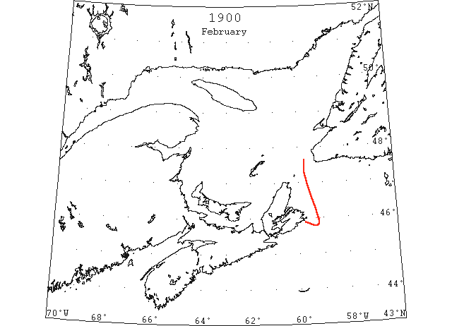
Feb 26 SS “St Joseph” at North Sydney reported encountered ice 20m E of Scaterie and damaged. (NYMR)

Mar? North Sydney: navigation is now open [missed date – sometime between start March and end May. Oops– BH]. (LL)
Mar Channel Head, no ice was sighted from Mar 1 to 19th. Drift ice appeared on the 20th and was seen daily 1 to 4 miles off shore till the 27th; none in sight on the 28th. (HB #555 Apr 18)
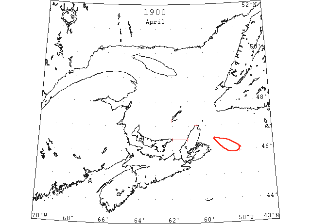
Apr 5 SS “Henrietta” 46°05’N 58°W passed drift ice in thick lines extending 7 miles to the southward. (HB #555 Apr 18)
Apr 16 Amherst Island and Meat Cove, say that the ice in that direction is light and open. There is no ice in the vicinity of St. Paul’s Island or Cape Ray. (HH 16/04/1900 p5#2)
Apr 26 Port Mulgrave, vessels arriving from the north report ice between East Point, PEI and Cape Breton, and snowing hard. (HH 27/04/1900 p7#2)
Apr 28 SS “Ella” 46°30’N 59°27’W passed large but thin flakes of drift ice for 5 hours. (HB #558 May 9)
Jul 4 SS “Lusitania” unable to get through Strait of Belle Isle because of ice floes and bergs. Local coast reports state that floes were forced through the strait into the Gulf. (NYMR)