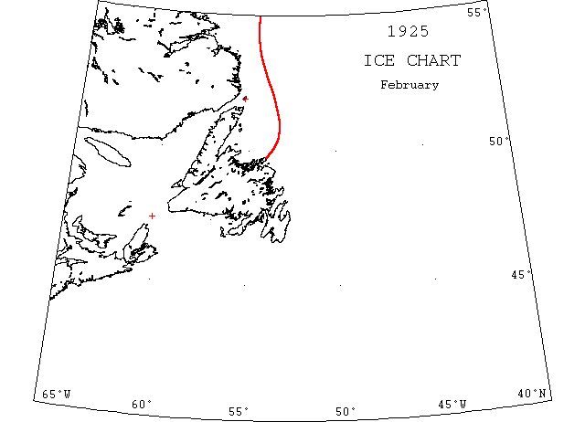
February

Feb 5 St. Paul Is.: heavy close packed ice everywhere. Belle Isle: Light close packed ice inshore.
Feb 19 SS “Canada” from Yarmouth, NS to Bermuda struck by ice floe and abandoned 130 m NW of Bermuda. (PR).
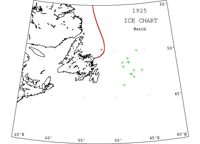
March

Mar 5 Belle Isle: light close packed ice distant, 4 growlers.
Mar 11 SS “Stella Maris” began to leak badly on way to ice fields. Just reached the ice when she went down. Crew rescued by “Prospero”. (NW).
Mar 13 SS “Stella Maris” 80m NNE of Cape Fogo in close packed ice and pinched the previous day, now running outside loose streams of ice, filled with water and sank. (GW).
Mar 14 “Stella Maris” crushed by ice and sank. (JEC).
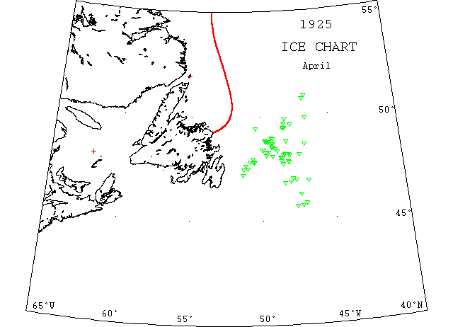
April

Apr 2 Belle Isle: Light open ice everywhere.
Apr 7 Belle Isle: Heavy open ice distant, 1 berg.
Apr 9 5056’N 4645’W, 2 small growlers; 5048’N 4656’W a large berg.
Apr 10 485’N 4912’W a berg; 4345’N 4938’W, 2 small bergs.
Apr 10 “Noreford” 4855’N 4912’W a large berg; 4845’N 4933’W a small one.
Apr 13 4845’N 29[?]24’W a berg and 5 growlers; 4850’N 4945’W a berg.
Apr 14 4830’N 4916’W small berg and 7 growlers.
Apr 20 4722’N 4828’W no ice.
Apr 21 4742’N 4826’W a berg; 4750’N 4807’W a berg; 4746’N 4804’W a berg; 4802’N 4836’W a large berg; 4809’N 4804’W a large berg.
Apr 22 Belle Isle: Some field ice and 1 berg.
Apr 23? 4934’N 4753’W a large berg; 4938’N 4824’W a large berg; 4952’N 4645’W a berg.
Apr 26 4653’N 4644’W a berg.
Apr 28 4847’N 4814’W a berg; 4750’N 5031’W a berg; 4748’N 5032’W, 2 bergs; 4728’N 5116’W a berg.
Apr 28 SS “Sagona” was dry docked at St. John’s, Apr 28 for Surry [sic] 30 plates damaged by ice.
Apr 30 Quite a few berg locations; also ice in gulf.
May — Several bergs.
Jun 23 SS “Saugus” hit berg on tail of Grand Banks and sank. (IIP59).