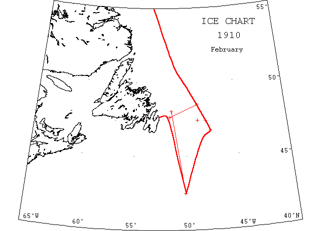
February

Feb 19 SS “Tabasco” 4228’N 5010’W encountered ice floes, steamed through until 4802’N 5124’W (?).
Feb 25 SS “Tabasco” at Halifax from Liverpool encountered heavy ice floes 100m off Newfoundland. Pushed through it for 5 hours then skirted the edge of floes.
Feb 26 4723’N 48W to 4644’N 4734’W field ice for distance of 50m.
Feb 27 SS “Vancouver” 4828’N 4849’W encountered large quantities of drift ice. Cleared Feb 28th in 4739’N 5133’W.
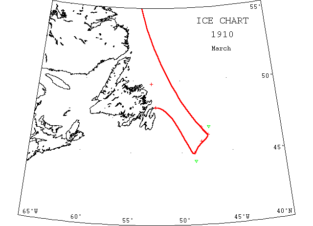
March

Mar — SS “Oscar II” 4545’N 48W passed through large quantities of ice.
Mar 2 SS “Montacalm” 4644’N 48W met large quantities of field ice extending as far north as visible and as far south as 4612’N 4720’W.
Mar 12 5420’N 39W berg 500′ long, 100′ high.
Mar 12 SS “Bellaventure” struck seals 38m off Goose Cove Head. Ship jammed Mar 20 and remained so till Apr 4 under Bacalhoa Is. (NW).
Mar 13 4423’N 4839’W a berg.
Mar 13 SS “Queen Wilhemina” 4458’N 4843’W some field ice fairly thick and ~¼m long.
Mar 30 SS “Iceland” crushed by ice off the Funk Islands. (SR).
Mar 31 SS “Iceland” (fired and) sank after being crushed in heavy ice. Crew reached SS “Eagle” 2m away and later transferred to SS “Florizel”. (NW).
Mar 31 4645’N 4714’W a small berg.
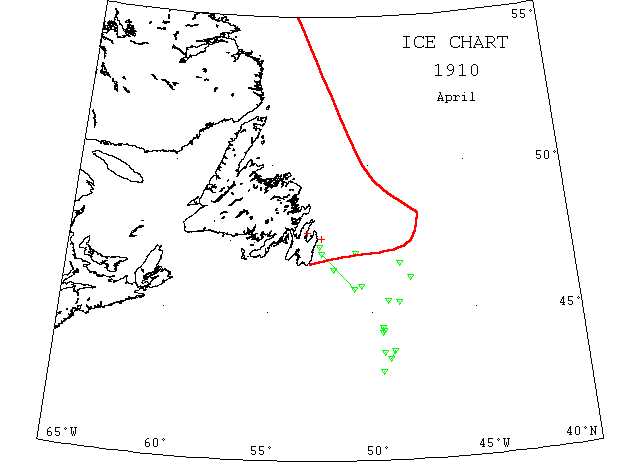
April

Apr — 4521’N 4841’W a small berg.
Apr 8 4752’N 4656’W to 4636’N 4855’W a quantity of broken ice field.
Apr 17 4610’N 4804’W a large berg.
Apr 18 4523’N 4912’W a large berg 200’high and 500′ long.
Apr 20 43N 4931’W a large berg ~ 270′ long and 112′ high.
Apr 20 4418’N 4929’W large berg and a small ice piece.
Apr 20 SS “Drumcondra” 4640’N 4835’W passed a berg ~ 40′ high; 4553’N 5030’W several pieces of ice; 4547’N 5050’W a berg ~60’high.
Apr 20 SS “Tabasco” from St. John’s between 47N 5225’W and 47N 5044’W, saw 4 small bergs.
Apr 21 4325’N 4910’W a berg 200′ long and 50′ high.
Apr 22 4342’N 4857’W to 4337’N 4925’W, 6 bergs ~200 meters long and 400 meters high.
Apr 24 SS “Nyassa” from New Orleans to Glasgow 4422’N 4926’W passed a berg ~1 acre in extent and 50′ high; 4428’N 4928’W passed another berg ~500′ long and 150′ high.
Apr 25 SS “Normandy” sank in thick fog apparently after hitting an iceberg. Would appear to be 15 miles or so from Tors Cove. (JPA).
Apr 25 Cape Race: light open ice moving south.
Apr 25 4627’N 4916’W a large piece of ice; 4627’N 5151’W a berg ~200′ long and 60′ high.
May 1 46N 5305’W a large berg.
May 1 4841’N 4915’W a berg 500′ long and 200′ high; 4850’N 4909’W, 2 small bergs.
May 1 4730’N 5202’W, 4 bergs one of which 250′ high & 550′ long.
May 2 SS “Sommerstad” ~10m ENE of Cape St. Francis passed 2 medium sized bergs.
May 3 4742’N 4934’W a small iceberg and a “growler”.
May 4 4808’N 4909’W, 4 large pieces of ice numerous small pieces.
May 7 St. John’s: SS “Normandy” struck a rock off Bay Bulls and sank. (cf JPA).
May 8 Point Amour: 4 bergs in sight.
May 9 Point Amour: 2 large bergs.