1941 Season
The ice season was one of the lightest on records and it was not necessary to inaugurate a continuous surface vessel patrol. (IIP p.V)
Dec 1 Last eastbound steamer through the Strait of Belle Isle. (WBB)
Dec 31 Last departure of the season from Quebec. (WBB)
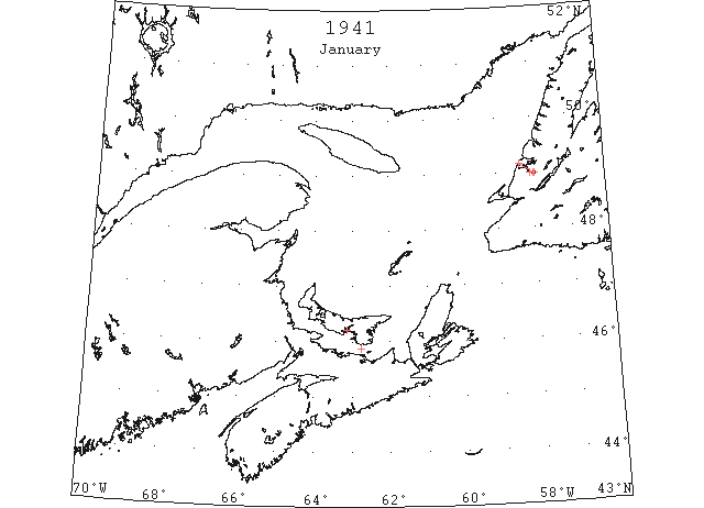
Jan 8 While shipping herring over the ice at Balantyne Cove on Saturday, the ice broke into pans resulting in loss of some eight barrels. Three horse teams hauling herring had narrow escape. (TWS, p.6)
Jan 8 First ice races at Victoria Park, Charlottetown (on harbour). (Pat 8 Jan p2 c6)
Jan 9 Mail flight to Magdalene Islands (so ferry stopped for season). (Pat 9 Jan p5 c3)
Jan 15 Ice in Humber Arm now extends well out beyond Meadow’s Point. (TWS, p.2).
Jan 15 First ice boat for the season was on Humber Arm off Curling yesterday. (TWS, p.2)
Jan 15 Ferry “Fairview” closed for the season. (Pat 21 Jan 1942 p5 c3)
Jan 29 Saturday afternoon the s. s. Portia, in the command of Capt. Barbour, who is an experienced ice captain, left the Company’s pier to open a channel through the harbor to South Head, a distance of 22 miles. From records kept it has been shown the movement of drift ice from South Head to Cape Ray does not warrant the closing of navigation along that section of the Newfoundland Coast every season. Occasionally the ice keeps well towards the Canadian Northshore. Keeping this port open throughout the year is within the realm of possibility. The management will have made a very important discovery if their try-out now proves successful, and there is a very good chance of success. (TWS, p.1)
Jan 30 Charlottetown: Heavy ice in the Northumberland Strait continues to delay the ice breaking ferry “Charlottetown” on the crossing between Tormentine and Borden. (HH 31/01/1941 p9#6)
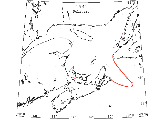
Feb 5 The drift ice surrounds the shores in Codroy. No seals captured up to date. (TWS, p.8)
Feb 9 Glace Bay: Caught in heavy drift ice while en route from St. John’s to Louisburg, Nova Scotia, for a cargo of coal, the 1,159 ton Norwegian freighter “Ciss” sank early today off Scatterie Island after it was believed to have struck Point Nova rock, treacherous shoal near the island, while being carried helplessly in the floes. All hands managed to escape in lifeboats. From what could be learned the vessel was trapped by the ice sometime Saturday night while heading for the Cape Breton port and unable to free itself had been carried on the rocky ledge which punctured its bottom. Fighting their way through the darkness in the frail craft – the “Ciss” sank at 2 am – the men rowed through ice-packed waters off Cape Breton and managed to reach Port Morien, small mining community near here, shortly after noon today. (HH 10/02/1941 p9#7,8)
Feb 12 Herring continues plentiful in Humber Arm and catches of from five to ten tubs are made daily with nets set through the ice. (TWS, p.7).
Feb 12 Owing to the mildness of the season the harbor ice has been very poor for traffic to Sandy Point. Although pedestrians have been crossing the lower part of the harbor for the past week, the ice is not too safe. (TWS, p.7)
Feb 17 Charlottetown: Strong south-west winds today packed drift ice in an almost solid barrier across the route of the car-ferry “Charlottetown,” which operates on the service between Tormentine on the New Brunswick mainland and Borden in this province. The powerful icebreaker took 5 ½ hours to batter her way to the mainland with mails and passengers this morning, a trip made in open water in slightly less than one hour. (HH 18/02/1941 p9#7)
Feb 19 The men of Trout River have made a number of trips to Woody Point to get food for their families. There is shortage of food and kerosene oil because the weather was stormy and the coastal steamer passed here on her way to Humbermouth and coming back. The ice made it impossible for motor boats to bring freight. (TWS, p.6).
Feb 19 Some very find codfish was caught through the ice at Main River last week, which found a ready sale at Stephenville Crossing and St. George’s. (TWS, p.7)
Feb 21 Heavy pack ice was reported sighted … also in 45°30’N 58°30’W. (HB 2686 Feb 26)
Feb 22 45°40’N 57°25’W drifting ice. (NYMR)
Feb 23 Between 47° and 48°N and 44° and 49(?)°W heavy pack ice was reported, also in 45° (?)N and 58°30’W. (NYMR)
Feb 24 U.S. Coast Guard [reports]: Ice conditions in the Upper Chesapeake Bay continue to be severe between Old Town Point and Howell Point with especially severe conditions between Turkey Point and Howell Point. Small and low-powered vessels cannot proceed between the two latter points without assistance, but full-powered vessels can transit the canal. It is believed that extremely severe ice conditions will extend over a greater area with prevailing low temperatures. (HB 2687 Mar 5)
Feb 27 45°20’N 57°40’W (approximately), heavy field ice was reported sighted in this position. (HB 2687 Mar 5)
Mar 1 U.S. Coast Guard [reports]: Ice offers no interference to traffic in the approaches to the Chesapeake and Delaware Canal, Upper Chesapeake Bay, Md., but a light skim of new ice is being formed as a result of the present low temperature. (HB 2687 Mar 5)
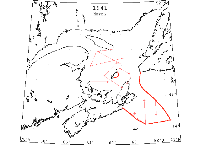
Mar 6 Halifax Radio Station: 44°50’N to 45°45’N along meridian of 58°W, thick packed ice was reported sighted. (HB 2688 Mar 12)
Mar 15 Ice reported around Montreal\St. Lawrence River. Ice breakers were beginning to break ice in the estuary of the river. (DN).
Mar 15 DOT aerial survey: Position 44°15’N 59°00’W, southward, southeastward and eastward open water, north and northwesterly extending to coast of Nova Scotia, heavy floe ice with many areas of open water. Open pack ice northward 60 miles from Sable Island. Position 44°35’N 60°40’W small area of floe ice observed close to Nova Scotia coastline, otherwise no ice sighted in all other directions. (CIS IC0915)
Mar 15 DOT aerial survey: Position 46°00’N 58°15’W approximately extending northeastward towards Newfoundland open water. (CIS IC0917)
Mar 15 DOT aerial survey: Between Cape Breton and St. Pauls close packed ice extending eastward southeastward and S; position 46°40’N 59°20’W floe ice extending E and SE to S. (CIS IC1041)
Mar 18 DOT aerial survey: 47°00’N 63°48’W close packed ice up to 60 miles radius with an area of 50 square miles open water E of Magdalen Islands. From 48°00’N 63°59’W to approximately 30 miles E of Cape des Rosiers heavy open packed ice extending to 43°80’[48°30’?]N 60°40’W becoming open water along S coast of Anticosti Island large type floe ice extending northeastward beyond visibility. From Bird Rocks close packed ice with open water S of Cape Ray for approximately 40 miles and eastward from 48°55’N 63°15’W open and close pack ice trends to Heath Point and beyond in a northerly and northeasterly direction and towards coast of Newfoundland becoming more open in vicinity of Cape Ray. From 48°55’N 63°15’W to 20 miles N of Bird Rocks to 25 miles N of Brion Island to 30 miles W of Grindstone towards N coast of Cape Breton, heavy close packed ice. (CIS IC0735 & 0818)
Mar 19 Good work has been done by the Portia. On Saturday only two and a half miles of ice remained to be opened to complete a channel to the outside edge of the barrier a short distance beyond Frenchman’s Head. The Humber River has not started to open up at the Eastern end of Humber Arm above the Railway wharf as yet. It usually takes the Humber about ten days in its natural course to open up the harbor as far as Summerside, that is after freezing weather has ceased. There is a possibility of the Portia advancing the opening a week early if that steamer breaks through the ice. This will help the ocean swell from the first strong breeze of wind thereafter to break up the bay ice much sooner. (TWS, p.1)
Mar 25 Field ice was reported encountered from 44°20’N 57°25’W to 44°25’N 56°45’W, extending to the northwest as far as could be seen. (HB 2691 Apr 2)
Mar 25 Close packed ice was reported sighted in Cabot Strait. (HB 2691 Apr 2)
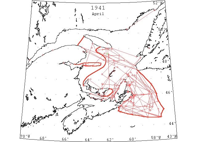
Apr 1 DOT aerial survey: Northumberland Straits from Hillsborough Bay westward to 25 miles eastward from Shippigan Gully, open water with exception of patch between North Point and West Point, PEI. (CIS IC0940)
Apr 1 DOT aerial survey: From Hillsborough eastward in Northumberland Straits to Cape Bear and Cape George, close packed ice. (CIS IC0940_2)
Apr 1 DOT aerial survey: From East Point to Cape George area, open water; from Cape George northeastward along Cape Breton coast approximately 10 miles in width, heavy close packed ice. (CIS IC0995)
Apr 1 DOT aerial survey: From North Point eastward sighted field ice close packed ice 10 miles in width trending towards St. Peters Bay, PEI. The area between this field and N coast PEI, slob and scattered ice 10 miles in width trending towards St. Peters Bay as far northward as could be seen and eastward toward Cape Breton coast, heavy close packed ice. (CIS IC0830)
Apr 1 The following ice information has been received by the Branch Hydrographic Office, New York: 44°40’N 51°20’W, ice was reported in this position. An ice field, consisting of heavy floes with occasional channels of open water, extending from Cape Ray to a position north of Sable Island, was also reported sighted. (HB 2691? Apr 2)
Apr 2 Last week one of the Corner Brook Woods Department Staff made a snowshoe trip from Stephenville Crossing up Harry’s River. One of the reasons for the trip was to see how the river had gone through the fall and winter and if certain structures put in by the Bowater Company to prevent breaking down of the river bank along the clay-belts had stood up. They were found in excellent shape. In certain rapid sections of the river, ice had rafted 10 to 12 feet high along its shores. Fortunately the center channel remained open so when the real break-up occurs, no damage to agricultural land along the river is anticipated by the stream going on a rampage. (TWS, p.1).
Apr 2 The first steamer for the season steamed up Humber Arm yesterday and docked at the Bowater’s pier at Corner Brook. Last year navigation opened 22nd March, which is the earliest in 38 years. There is little doubt the opening of navigation this year is fully two weeks ahead of what it would have been but for the Portia having kept a channel open during the winter. (TWS, p.1)
Apr 2 DOT aerial survey: From Cape Ray southeastward to 46°40’N 58°00’W to 60 miles E of Scatari and as far southward as could be seen, close pack and open ice. (CIS IC 0910)
Apr 2 DOT aerial survey: An area of open water extends from 10 miles E of Cape Smoke to 10 miles E of Scatari to 10 miles S of Scatari. From 10 miles S of Scatari ice extends southward as far as could be seen. (CIS IC0916)
Apr 2 DOT aerial survey: Route via Straits of Canso, Northumberland Straits and East Point, PEI not navigable. (CIS IC0940 & 0961)
Apr 2 DOT aerial survey: From Miscou Island southward towards Cape Tormentine along New Brunswick coast, a width of 20 miles open water. (CIS IC0952)
Apr 2 DOT aerial survey: From Scatari westward along Nova Scotia coast no ice sighted. (CIS IC1092)
Apr 2 DOT aerial survey: From 48°55’N 63°15’W open and close pack ice trends to Heath Point and beyond in a northeasterly direction and towards coast of Newfoundland becoming more open in vicinity of Cape Ray. From 48°55’N 63°15’W to 20 miles N of Bird Rocks to 25 miles N of Brion Island to 30 miles W of Grindstone towards N coast of Cape Breton, heavy close pack ice. (CIS IC0735_2)
Apr 2 DOT aerial survey: from 48°55’N 63°15’W to Southwest Point, Anticosti and vicinity and due S to 60 miles eastward of entrance to Bay of Chaleur occasional strings. A field 15 miles in width extends due E of Miscou Island. (CIS IC0771)
Apr 2 DOT aerial survey: From Miscou Island southward towards Cape Tormentine along New Brunswick coast, a width of 20 miles open water. (CIS IC0807)
Apr 3 DOT aerial survey: Large ice field extends from 20 miles S of Louisburg trending in a southeasterly direction to 44°55’N 59°00’W to 44°30’N 57°15’W. From this position ice trends northward to 57th meridian[?] thence to 70 miles E of Scatari and in a northwesterly direction as far as could be seen. (CIS IC0910)
Apr 3 Halifax: Clear water extends from Hillsborough Bay, PEI, westward through Northumberland Strait to 25 miles east of Shippegan Island, NB, the Department of Transport announced today. In the Gulf of St. Lawrence, an ice field 10 miles wide extends due east from North Point, PEI. Between this field and the north shore of Prince Edward Island there is slob ice. Eastward and northward in the Gulf of St. Lawrence heavy pack ice extends from St. Peter’s Bay, PEI. Eastward in Northumberland Strait, heavy pack ice extends from Hillsborough Bay to Cape George, Nova Scotia, and also northward along the Cape Breton coast. The northern entrance to the Strait of Canso is blocked and drift ice is found in the Strait. (HH 04/04/1941 p9#3)
Apr 4 DOT aerial survey: S coast of Newfoundland clear with ice extending southeastward from Cape Ray to 45°00’N 57°00’W to 44°30’N 57°20’W to 44°55’N 59°00’W to 20 miles S of Louisburg. (CIS IC0910)
Apr 4 DOT aerial survey: North side of Bay of Chaleur open to Paspebiac but ice at Dalhousie still holding. (CIS IC0925)
Apr 4 DOT aerial survey: Open water from Miscou southward through Northumberland Straits to Tormentine. (CIS IC0952)
Apr 4 DOT aerial survey: Strait of Canso navigable to Mulgrave but route northward through George Bay is not possible at present. (CIS IC0961)
Apr 4 DOT aerial survey: From Fame Point eastward N of the 48°20’N parallel occasional strings to the 62nd meridian while eastward from there to 20 miles N of Bird Rocks to Cape Ray open ice with lanes of open water becoming more open in vicinity of Cape Ray. Southward of these lines ice extends to the Magdalen and Cape Breton coast. (CIS IC0735_2)
Apr 4 DOT aerial survey: Westward of the 63rd meridian and northward of the 48th parallel, occasional strings. Ice field 10 miles in width extends 40 miles eastward of Miscou Island. (CIS IC0751)
Apr 4 DOT aerial survey: Field 15 miles in width from Miscou to 60 miles eastward; open water and occasional strings from this field to 70 miles E of Cape Gaspe and westward as far as could be seen. Ice field sighted from 49°06’N 63°40’W extending northeastward and southeastward. (CIS IC0783)
Apr 4 DOT aerial survey: Open water from Miscou southward through Northumberland Straits to Tormentine. (CIS IC0807)
Apr 4 The following information was broadcast from Louisburg, N.S., Radio Station: There are occasional strings of ice from 48°55’N 63°15’W to Southwest Point, Anticosti and vicinity, and thence due south to a position 60 miles eastward of the entrance to Chaleur Bay. A field, 15 miles wide, extends due east of Miscou Island. There is open water, 20 miles wide, from Miscou Island southward toward Cape Tormentine along the New Brunswick coast. There is open and close pack ice from 48°55’N 63°15’W to Heath Point and beyond which extends in a northerly and northeasterly direction and toward the coast of Newfoundland becoming more open in the vicinity of Cape Ray. There is heavy close pack ice from 48°55’N 63°15’W to 20 miles north of Bird Rocks, to 25 miles north of Brion Island, to 30 miles west of Grindstone Island and toward north coast of Cape Breton Island. There is close pack and open ice from Cape Ray southeastward to 46°40’N 58°00’W, to 60 miles east of Scatari extending as far southward as could be seen. An area of open water extends from 10 miles east of Cape Smoke[y] to 10 miles east of Scatari. Ice extends southward as far as could be seen from a position 10 miles south of Scatari. From Scatari westward along the Nova Scotia coast no ice was sighted. The route via Gut of Canso, Northumberland Strait, and East Point, Prince Edward Island, is not navigable. (HB 2692 Apr 9)
Apr 5 DOT aerial survey: as CIS IC0925 on Apr 4 above. (CIS IC0925)
Apr 5 DOT aerial survey: as 4 Apr. CIS IC0735_2. (CIS IC0735_2)
Apr 5 DOT aerial survey: As Apr. 4 CIS IC0807. (CIS IC0807)
Apr 5 DOT aerial survey: Northward of a line from Heath Point to Cape St. George, Nfld. Close packed. (CIS IC0844)
Apr 6 DOT aerial survey: Bay of Chaleur opening up, Paspebiac clear and channel to Bathurst open but ice at Dalhousie still holding. (CIS IC0925)
Apr 6 DOT aerial survey: Open water along N shore to Cape Bear; Pictou Harbour still solid. (CIS IC0940_2)
Apr 6 DOT aerial survey: From Fame Point eastward N of 48°20’ parallel, occasional strings to meridian of 62°30’ while eastward from there along steamer track to Cape Ray open ice with lanes of open water becoming more open in vicinity of Cape Ray; southward of these lines ice extends to the Magdalens and Cape Breton coast. (CIS IC0792)
Apr 6 DOT aerial survey: As Apr. 4 CIS IC0807. (CIS IC0807)
Apr 6 DOT aerial survey: Some open water S side of Magdalens, narrow strip of shore ice in Pleasant Bay. (CIS IC0818)
Apr 7 DOT aerial survey: Ice 12 miles off Cape Ray. Ice field off Cape Ray extends in a southeasterly direction to 45°00’N 57°30’W to 44°30’N 57°30’W to 44°55’N 59°00’W to 20 miles S of St. Esprit. (CIS IC0910_2)
Apr 7 DOT aerial survey: Heavy close pack along E Cape Breton coast to Scatari and S and E as far as can be seen westward from Scatari ice is 5 miles off shore at Mainadieu Passage to 10 miles off Louisburg to 20 off St. Esprit Island and trending southeastward. (CIS IC0916)
Apr 7 DOT aerial survey: Close packed ice in Northumberland Strait along S side with open water along N shore from Tormentine to Cape Bear and towards East Point. (CIS IC0940_2)
Apr 7 DOT aerial survey: Heavy close pack ice in George Bay and along W coast of Cape Breton. (CIS IC0954)
Apr 7 DOT aerial survey: Strait of Canso navigable to Mulgrave, northward blocked. (CIS IC0961)
Apr 7 DOT aerial survey: S coast of Cape Breton clear from Louisburg westward. (CIS IC1092)
Apr 7 DOT aerial survey: Pleasant Bay clear of ice. (CIS IC0818)
Apr 8 DOT aerial survey: Ice field off Cape Ray extends southeasterly to about 70 miles E and SE of Scatari and is close packed on E coast Cape Breton. Westward from Scatari ice 10 miles off Louisburg and 20 off St. Esprit. (CIS IC0910)
Apr 8 DOT aerial survey: Bay of Chaleur opening up, Paspebiac clear and channel to Bathurst and river ice breaking up at Dalhousie. (CIS IC0925)
Apr 8 DOT aerial survey: Northumberland Strait as Apr 7. (CIS IC0940_2)
Apr 8 DOT aerial survey: Open water from Miscou southward through Northumberland Straits to Tormentine. (CIS IC0952)
Apr 8 DOT aerial survey: Strait of Canso as Apr 7. (CIS IC0961)
Apr 8 DOT aerial survey: Heavy close pack ice in George Bay and along W coast of Cape Breton. (CIS IC0996)
Apr 8 DOT aerial survey: As on Apr. 6 CIS IC0792. (CIS IC0792)
Apr 8 DOT aerial survey: As Apr. 4 CIS IC0807. (CIS IC0807)
Apr 8 DOT aerial survey: Some open water S side of Magdalens, Pleasant Bay clear. (CIS IC0818)
Apr 8 Halifax: The Department of Transport reported today that conditions in the St. Lawrence River eastward from Quebec to Fame Point, Que., are ‘good’ and that Chaleur Bay is ‘opening up.’ Paspebiac, Que., is clear and the channel to Bathurst, NB is open but ice at Dalhousie, NB still holds. There is open water along the north shore of New Brunswick in Cape Bear. Pictou, Nova Scotia harbor is still solid. (HH 09/04/1941 p9#1)
Apr 9 The ice in Summerside seems to be getting bad. Mr. Leslie Penney had a bath in it during the week-a foot bath anyway. (TWS, p.7).
Apr 9 DOT aerial survey: Ice extends in a southeasterly direction to 46°00’N 58°00’W (from 10 miles NW of St. Pauls) and southward to the vicinity of Banquereau then in a northwesterly direction to the vicinity of White Head, N.S. and this afternoon was 5 miles off Canso and 15 off White Head. (CIS IC0910_2)
Apr 9 DOT aerial survey: Ice extends along coast westward from Scatari to St. Esprit and is 5 miles S of Cranberry and 15 miles S of White Head. (CIS IC0910_3)
Apr 9 DOT aerial survey: Narrow strip (of open water) along S shore Tormentine to Pictou Island and open water on N side to Cape Bear. (CIS IC0940_3)
Apr 9 DOT aerial survey: Open water from Miscou southward through Northumberland Straits to Tormentine. (CIS IC0952)
Apr 9 DOT aerial survey: Heavy close pack ice in George Bay and along W coast of Cape Breton. (CIS IC0954)
Apr 9 DOT aerial survey: From Cable Point, northward close packed ice extends to Brion Island with large area of open water S and E of Magdalens. (CIS IC0830)
Apr 9 DOT aerial survey: Northward of a line 48°40’N 62°00’W to Cape Anguille close packed ice, southward of this line to Bird Rocks and St. Pauls ice well open. (CIS IC0844)
Apr 9 Re International Ice Observation and Ice Patrol Services 1941: Due to existing circumstances the U.S. Coast Guard cutters “Chelan” and “Champlain” will not be utilized in the International Ice Patrol Service this year. The U.S. Coast Guard patrol boat “General Greene” will conduct the International Ice Observation Service and answer to the radio call NIDK (500 kc.) as well as her own international radio call. (HB 2692 Apr 9)
Apr 9 Re Opening of Navigation, Gulf of St. Lawrence: Information has been received from the Department of Transport, Ottawa, that daily ice observation flights will be made in the vicinity of Cabot Strait commencing March 29 and continuing until the opening of navigation. A Government Ice Breaker, Radio Call Sign VCQP, will work in conjunction with the Air Survey of Ice Conditions. (HB 2692 Apr 9)
Apr 9 The following ice information was received from Halifax, Nova Scotia: St. Lawrence River above Québec not navigable. Québec to Cap des Rosiers conditions good, scattered ice above Goose Cape and off Matine[sic = Matane?]. Saguenay still solid. Chaleur Bay opening up clear to Paspebiac, and ice at Dalhousie breaking up. Eastward from Cap des Rosiers occasional strings to meridian of 62°00’W, and from there along steamer track to Cape Ray open ice. Cape Ray and south coast of Newfoundland clear. Field ice off Cape Ray extends southeastward to about 70 miles east and southeast of Scatari and is close packed on east coast Cape Breton from Scatari northward. North Sydney Harbour blocked. Westward from Scatari ice 10 miles off Louisburg and 20 miles off St. Esprit, trending southeastward. Ships bound up the Gulf should pass south and east of this ice to Cape Ray. Gut of Canso navigable to Mulgrave, northward not passable. (HB 2693 Apr 16)
Apr 9 April 9, [ice] was 5 miles off Canso and 15 miles off Whitehead. Strait of Canso navigable to Mulgrave, northward blocked. (HB 2693 Apr 16)
Apr 10 DOT aerial survey: Westward from Scatari ice is close on Cape Breton coast and extends along Nova Scotia beyond White Head but is some distance off shore as not visible from Glasgow Head. (CIS IC1092)
Apr 10 The following ice information was received from Halifax, Nova Scotia: St. Lawrence River above Québec not navigable. Québec to Cap des Rosiers conditions good, and eastward from there to the meridian 62°00’W only occasional strings. Chaleur Bay open to Paspebiac, and ice at Dalhousie breaking up. Open water Miscou southward through Northumberland Strait to Cape Tormentine and along south shore of Prince Edward Island to Cape Bear and toward East Point. Close pack ice in St. Georges Bay and along west coast Cape Breton. Northward of a line 48°40’N 62°00’W, to Cape Anguille, Newfoundland, close pack ice, and southward of this line to Bird Rock. St. Paul [Island] and Cape Ray ice well open; south coast of Newfoundland clear. From off Cape Ray ice extends to 46°00’N 58°00’W, and southward to vicinity Banquereau, then in a northwesterly direction to vicinity Whitehead. Ice is close packed on east coast of Cape Breton from Scatari northward. Westward from Scatari ice is onshore to St. Esprit. (HB 2693 Apr 16)
Apr 11 DOT aerial survey: Quebec to Cape des Rosiers to Bird Rocks conditions good; occasional strings between Bird Rocks and Cape des Rosiers. From Bird Rocks to St. Pauls to Cape Ray ice very open; no ice in sight at Cape Ray, S coast of Newfoundland clear. (CIS IC0792)
Apr 11 The following ice information was received from Halifax, Nova Scotia: St. Lawrence River above Québec not navigable. Québec to Cap des Rosiers conditions good, but Saguenay River still frozen. Eastward from Cap des Rosiers to meridian 62°00’W, only occasional strings of ice. Chaleur Bay, open pans. Paspebiac and above that to Dalhousie breaking up. Open water Miscou southward through Northumberland Strait to Cape Tormentine and along the south shore of Prince Edward Island to Cape Bear and toward East Point. Close pack ice St. Georges Bay and along west coast Cape Breton. Northward of a line from 48°40’N 62°00’W, to Cape Anguille, Newfoundland, close pack ice. Southward of this line to Bird Rock, St. Paul [Island] and Cape Ray well open. South coast of Newfoundland clear. From off Cape Ray ice extends to 46°00’N 58°00’W, and southward to vicinity Banquereau, then in a northwesterly direction to the vicinity of Whitehead. Ice is close packed on east coast of Cape Breton from Scatari northward; North Sydney blocked. Westward from Scatari ice is close on Cape Breton coast and extends along Nova Scotia coast beyond Whitehead, but is some distance offshore, as it is not visible from Glasgow Head. Loose ice in Gut of Canso, but navigable to Mulgrave; northward blocked. (HB 2693 Apr 16)
Apr 12 DOT aerial survey: Northumberland Strait between Tormentine and Pictou Island scattered drift ice. Northeastward to Cape Bear and towards East Point open water with heavy close packed from there to Cape Breton coast. (CIS IC0940)
Apr 12 DOT aerial survey: Considerable loose ice in Strait of Canso. (CIS IC0961)
Apr 12 DOT aerial survey: Westward from Scatari ice is ½ mile off shore at Louisburg and extends up S coast of Cape Breton and Nova Scotia beyond White Head. (CIS IC1092_3)
Apr 12 DOT aerial survey: From W coast Magdalens southward to East Point, PEI some close packed on S and W shores of Magdalens with scattered to 15 miles N of PEI then open ice to shore. (CIS IC0829)
Apr 12 The following ice information was received from Halifax, Nova Scotia: St. Lawrence River above Québec not navigable. Québec to Cap des Rosiers to Bird Rock conditions good with occasional strings between Bird Rock and Cap des Rosiers. From Bird Rock to St. Paul [Island] to Cape Ray ice very open with no ice in sight at Cape Ray. South coast of Newfoundland clear. Chaleur Bay opening up, Paspebiac clear channel to Bathurst. Open ice Dalhousie breaking up. Open water Miscou southward through Northumberland Strait to Cape Tormentine with scattered drift ice eastward from there to Cape Bear and toward East Point. Pictou Harbour frozen. Close-packed ice St. Georges Bay and west coast Cape Breton. Off Cape Ray ice extends southeasterly direction to 46°00’N 58°00’W, and southward to vicinity of Banquereau then in northwesterly direction to vicinity Whitehead. This ice is close-packed off Coast of Cape Breton from Scatari northward. North Sydney blocked. Westward from Scatari ice onshore at Louisburg and up south coast of Cape Breton and extends along Nova Scotia coast beyond Whitehead but offshore in that vicinity, no ice in sight at Canso. Loose ice in Gut of Canso but navigable to Mulgrave, northward blocked. (HB 2693? Apr 16)
Apr 13 DOT aerial survey: Bay of Chaleur open, Paspebiac clear and Dalhousie Channel open. (CIS IC0925)
Apr 13 DOT aerial survey: Scattered drift ice eastward from Tormentine to Cape Bear and towards East Point; Pictou harbour frozen. (CIS IC0940_2)
Apr 13 DOT aerial survey: Open water from Miscou southward through Northumberland Straits to Tormentine. (CIS IC0952)
Apr 13 DOT aerial survey: Heavy close pack ice in George Bay and along W coast of Cape Breton. (CIS IC0996)
Apr 13 DOT aerial survey: Ice is close packed on E coast of Cape Breton from Scatari northward to White Point, northward from there open ice; North Sydney blocked. (CIS IC1022_2)
Apr 13 DOT aerial survey: As 10 Apr. CIS IC1092. (CIS IC1092)
Apr 13 DOT aerial survey: From 10 miles N of Brion Island along W coast of Magdalens open. (CIS IC0804)
Apr 13 DOT aerial survey: From Magdalens to East Point, PEI strings and patches while eastward to Cape Breton open. (CIS IC0829)
Apr 13 DOT aerial survey: From St. Pauls to Bird Rocks over steamer track; N of that line open and close packed. (CIS IC0844)
Apr 13 DOT aerial survey: Seven Islands to Natashqua to Wolf Bay clear; northeastward to Blanc Sablon blocked. (CIS IC0855)
Apr 14 DOT aerial survey: as on April 9. (CIS IC0910_2)
Apr 14 DOT aerial survey: Bay of Chaleur open, Paspebiac clear and Dalhousie Channel open. (CIS IC0925)
Apr 14 DOT aerial survey: Scattered ice eastward from Tormentine to Cape Bear and towards East Point; Pictou Harbour open. (CIS IC0940_2)
Apr 14 DOT aerial survey: Ice loosening in George Bay but northward along W coast of Cape Breton close packed. (CIS IC0954)
Apr 14 DOT aerial survey: Strait of Canso as Apr 12. (CIS IC0961_2)
Apr 14 DOT aerial survey: Cape Ray and S coast of Newfoundland clear. From 15 miles E of St. Pauls eastern edge of ice extends southeastward to ninety miles E of Scatari. (CIS IC1015_2)
Apr 14 DOT aerial survey: Westward from Scatari ice is 10 miles off Louisburg and extends up S coast of Cape Breton and Nova Scotia to vicinity of White Head. (CIS IC1092)
Apr 14 DOT aerial survey: Scattered ice around Bird Rocks and E coast of Magdalens, Pleasant Bay clear. (CIS IC0829)
Apr 14 DOT aerial survey: From Bird Rocks to St. Pauls to Cape Ray over steamer track practically clear S of a line from 48°20’N 62°00’W to Cape Anguille. (CIS IC0844)
Apr 14 DOT aerial survey: As Apr.13 CIS IC0855. (CIS IC0855)
Apr 14 The following ice information was received from Halifax, Nova Scotia: St. Lawrence River above Québec not navigable, but Richelieu [River] open and Lake St. Peter clearing. Québec to Cap des Rosiers to Bird Rock conditions good. Saguenay River solid, north shore, Seven Islands to Natashkwan to Wolf Bay clear. Chaleur Bay open and Paspebiac clear. Dalhousie channel open. Open water Miscou southward through Northumberland Strait with scattered ice eastward from Cape Tormentine to Cape Bear and toward East Point. Pictou Harbour opening up. Ice loosening St. Georges Bay, but northward along west coast Cape Breton close-packed ice. From Bird Rock to St. Paul [Island] to Cape Ray, over steamer track, practically clear south of the line 48°00’N 62°00’W, to Cape Anguille, Newfoundland. Cape Ray and south coast Newfoundland clear. From St. Paul [Island] ice extends southeastward of 46°00’N 58°00’W, and southward to vicinity Banquereau thence to vicinity Whitehead. This ice is close-packed on east coast Cape Breton from Scatari northward to White Point but moving offshore from North Sydney. Westward from Scatari ice 10 miles off Louisburg extending up south coast Cape Breton and Nova Scotia to vicinity Whitehead. Considerable loose ice in Gut of Canso. (HB 2693 Apr 16)
Apr 15 The following ice information was received from Halifax, N.S.: Montréal to Three Rivers channel open eastward to Goose Cape considerable broken ice, thence to Cap des Rosiers clear. Saguenay River ice breaking up. North shore Seven Islands to Natashkwan to Wolf Bay clear. Gaspé open to peninsula. Chaleur Bay open, Dalhousie, Bathurst channel clear, open water Miscou southward through Northumberland Strait to Cape Tormentine; some scattered ice eastward from there to Cape Bear. St. Georges Bay and west coast of Cape Breton close pack ice. Cap des Rosiers to Bird Rocks to Cape Ray conditions good over steamer track with some scattered strings. Cape Ray and south coast Newfoundland clear. From St. Paul [Island] ice extends southeastward and south to vicinity of Banquereau thence to vicinity Whitehead. Ships bound up Gulf pass south and east of this ice to Cape Ray. Close pack ice on east coast Cape Breton from Scatari northward but has moved off slightly. North Sydney Harbour open. Westward from Scatari ice extends up south coast to beyond Canso but is some distance off Louisburg and Canso. Considerable loose ice in Gut of Canso. (HB 2694 Apr 23)
Apr 16 Mr. Israel Hann of Summerside is shining up his boat in readiness for when the ice goes. (TWS, p.7).
Apr 16 DOT aerial survey: Bay of Chaleur open to Dalhousie including Bathurst. (CIS IC0925)
Apr 16 DOT aerial survey: Drift ice in Summerside Harbour; Pictou Harbour opening up. (CIS IC0940)
Apr 16 DOT aerial survey: Northumberland Strait as above [14th]. (CIS IC0940_2)
Apr 16 DOT aerial survey: From Scatari northward to Cape North with ice 10 miles off Ingonish to 20 off Cape Egmont. Eastward ice extends as far as can be seen. Cape Ray clear with large open water northward. (CIS IC1015_2)
Apr 16 DOT aerial survey: George Bay and W coast of Cape Breton close packed but some openings near Cape Jack.
Apr 16 DOT aerial survey: Large field S of White Head. Ice along S coast of Cape Breton from Basque Island eastward to Scatari about 5 miles off shore. From 7 miles E of Scatari ice extends as far as can be seen. Westward from Scatari ice extends up S coast to beyond Canso but is at least 5 miles off shore and ships may pass inside to Louisburg. (CIS IC1092&IC1092_2)
Apr 16 DOT aerial survey: Gaspe broken a ¼ mile inside peninsula. (CIS IC0764)
Apr 16 DOT aerial survey: From Cape des Rosiers to Bird Rocks conditions good over steamer track with patches of open ice S of Heath Point and scattered around Bird Rocks. (CIS IC0769)
Apr 16 DOT aerial survey: As Apr 14 CIS IC0829. (CIS IC0829)
Apr 16 DOT aerial survey: Narrow strip (of ice) along N shore of PEI. (CIS IC0830)
Apr 16 DOT aerial survey: Cape Ray clear with large open water northward towards Cape St. George. Open ice in vicinity of Bird Rocks appeared to be close packed further N. (CIS IC0844_2)
Apr 16 DOT aerial survey: As Apr.13 CIS IC0855. (CIS IC0855)
Apr 16 The following ice information was received from Halifax, N.S.: St. Lawrence River now navigable to Montréal. Some scattered ice between Québec and Father Point. Eastward to Cap des Rosiers clear. Saguenay River ice breaking up. North shore Seven Islands to Natashkwan to Wolf Bay clear. Chaleur Bay open, Dalhousie and Bathurst Channel ice clear. Open water Miscou southward through Northumberland Strait to Cape Tormentine. Some scattered ice eastward from there to Cape Bear. St. Georges Bay and west coast Cape Breton close pack ice. Cap des Rosiers to Bird Rocks to Cape Ray fairly good conditions over steamer track, with some scattered strings. Cape Ray and south coast Newfoundland clear. From St. Paul [island] ice extends southeastward and south to vicinity Banquereau thence to vicinity Whitehead. Ships bound up the Gulf pass south and east of this ice to Cape Ray. Ice has moved from Scatari and extends up south coast and beyond Canso but is at least 5 miles offshore. Considerable loose ice in Gut of Canso. Gaspé open to Peninsula. (HB 2694 Apr 23)
Apr 16 Halifax: The Department of Transport said today Pictou harbor is opening up but there is close packed ice in George Bay, Nova Scotia, and along the west coast of Cape Breton. From Cap des Rosiers to Bird Rock, north of the Magdalens, conditions are ‘good.’ Scattered ice is found around Bird Rock and the east coast of the Magdalens and scattered strings dot the steamer track from Bird Rock to Cape Ray, Nfld. Ice extends southeastward from St. Paul to 50 miles east of Scaterie, then southward to the vicinity of Banquereau and northeastward to the vicinity of White Head. Ships bound up the Gulf of St. Lawrence were advised to pass south and east of this ice. Ice is close packed on the east coast of Cape Breton from Scatarie northward, but has moved some distance offshore. The harbor at North Sydney is open. Westward from Scatarie the ice extends up the south coast of Cape Breton and the Nova Scotia mainland to beyond Canso, but is some distance off at Louisburg and Canso. There is considerable loose ice in the strait of Canso. (HH 17/04/1941 p9#7)
Apr 17 DOT aerial survey: Considerable loose ice in Strait of Canso but northward through George Bay and up W coast of Cape Breton close packed but loosening in vicinity of Harbour Bouchere. (CIS IC0961_2)
Apr 17 DOT aerial survey: From Pictou Island eastward through George Bay and along Cape Breton coast to Cape North, close packed ice 25 miles in width. (CIS IC0996 & 0953)
Apr 17 DOT aerial survey: Ice is close packed toward E coast of Cape Breton but has moved off the coast from Scatari northward and is 10 miles off Flat Point to 12 off Ingonish to 25 off Cape Egmont but is close packed between Cape North and St. Pauls and very open eastward of St. Pauls. (CIS IC1015_2)
Apr 17 DOT aerial survey: As 16 Apr. CIS IC1092_2. (CIS IC1092_2)
Apr 17 DOT aerial survey: Large patch S of South Point Anticosti extending to 48°30’N. (CIS IC0769)
Apr 17 DOT aerial survey: Scattered strings to 15 miles N from Brion Islands. (CIS IC0774)
Apr 17 DOT aerial survey: Eastward from the 62 meridian over steamer track to Bird Rocks and Cape Ray, clear water except for open strings and patches across track 30 miles E of Bird Rocks. (CIS IC0844_2)
Apr 17 Georgetown – ferry boat “Montague” made its first trip of the season on April 17th. The harbour is now clear of ice. (Pat 23 Apr p3 c8)
Apr 17 The following ice information was received from Halifax, N.S.: St. Lawrence River Montréal to Cap des Rosiers no ice. Buoy laying now in progress. Saguenay River ice breaking up. North shore Seven Islands to Natashkwan to Wolf Bay clear. Eastward to Blanc Sablon blocked. Gaspé open inside Peninsula. Chaleur Bay open to Dalhousie including Bathurst. Northumberland Strait open. Eastward from Miscou some drift ice in Summerside and between Cape Tormentine and Cape Bear. Pictou Harbour opening up, St. Georges Bay and west coast of Cape Breton close pack ice. From Cap des Rosiers to Bird Rocks conditions good over steamer track with patches south of Heath Point. Open ice around Bird Rocks and Magdalen Islands. Pleasant Bay clear. Bird Rocks to 30 miles northwest Cape Ray scattered strings then clear to Cape Ray and along south coast Newfoundland. From St. Paul [Island] eastern edge extends southeastward to 60 miles east of Scatari to vicinity Banquereau and northwesterly. Ice has moved off east coast Cape Breton from Scatari northwestward. From Scatari ice is at least 5 miles offshore and ships may pass inside to Louisburg and Sydney. Considerable loose ice in Gut of Canso. (HB 2694 Apr 23)
Apr 18 DOT aerial survey: From Scatari northward to Table Head ice is close inshore with area open water northward from Flat Point. (CIS IC1022_2)
Apr 18 DOT aerial survey: Ice has moved off E and S coast of Cape Breton and navigation is possible inside ice from Canso to North Sydney and Cape North. (CIS IC1092_2)
Apr 18 First arrival of season at Quebec. (WBB)
Apr 18 The following ice information was received from Halifax, N.S.: St. Lawrence River Montréal to Cap des Rosiers no ice. Buoy laying now in progress. Saguenay River ice breaking up. Western portion of Gulf west of 62°00’W, including north shore to Natashkwan and Wolf Bay, Chaleur Bay to Dalhousie, and Northumberland Strait, southward from Miscou to Cape Tormentine, and toward Cape Bear now navigable, with exception large patches off the south portion and coast extending to 48°30’N. Eastward from 62°10’W, over steamer track to Bird Rocks and Cape Ray clear water, except for open strings and patches across track 30 miles east of Bird Rocks. South coast of Newfoundland clear. From 15 miles east of St. Paul [Island] eastern edge of ice extends southeastward to 90 miles east of Scatari, and southward to vicinity Banquereau, thence to 10 miles off Whitehead. Ice has moved off east and south coast Cape Breton and navigation is possible inside from Whitehead to North Sydney and Cape North. Considerable loose ice Gut of Canso, but northward through St. Georges Bay and up west coast of Cape Breton close pack ice, loosening vicinity Havre Boucher. (HB 2694 Apr 23)
Apr 18 Halifax: The Department of Transport said today there is a large patch of ice south of the south point of Anticosti Island, Que., and said it extends to 48°30’N. Open strings and patches are found across the steamer track to Cape Ray, Nfld., 30 miles east of Bird Rock, north of the Magdalen Islands. From 15 miles east of St. Paul the eastern edge of the ice extends southeastward to 90 miles east of Scatarie, Nova Scotia, southward to the vicinity of Banquereau and from there to 10 miles off White Head. Only scattered strings are found around the Magdalens. There is close packed ice up the west coast of Cape Breton. (HH 19/04/1941 p9#6)
Apr 19 DOT aerial survey: Patches and strings from 25 miles S of Canso to 48 miles N of Sable Island. Large field extends eastward from Canso Bank crossing Missaine Bank to 57°30’N thence northward to 90 miles E of Scatari then northwestward as far as could be seen. (CIS IC0910_3)
Apr 19 DOT aerial survey: Ice in George Bay appears to be loosening drift ice in Gut of Canso. (CIS IC0961_2)
Apr 19 DOT aerial survey: Westward from Scatari ice is 15 miles off Louisburg to 10 of Guion Island to 25 miles S of Canso. (CIS IC1092_2)
Apr 19 DOT aerial survey: West of the 62nd meridian including the N shore to Natashqusan, Bay of Chaleur to Dalhousie and Northumberland Strait southward from Miscou to Tormentine and eastward to Cape Bear and to East Point now navigable. Eastward from 62nd meridian over steamer track to Bird Rocks and Cape Ray occasional strings. Northward of a line from South Point, Anticosti to Cape Anguille, Newfoundland, large area of ice while southward around the Magdalens conditions good with only scattered ice. Ice that was in the vicinity of St. Pauls has moved considerably southeastward and navigation via St. Pauls from North Sydney up gulf is now possible. (CIS IC0735_2-IC0735_3)
Apr 20 DOT aerial survey: Strait of Canso navigable and ice in George Bay has moved out of sight from Harbour Bouchere. (CIS IC0961_2)
Apr 20 DOT aerial survey: From Scatari northward ice has moved on coast and navigation is difficult without assistance. North Sydney harbour clear and reports no ice in sight. (CIS IC1022_2)
Apr 20 DOT aerial survey: St. Pauls, scattered ice E and S, all other directions clear. (CIS IC1041)
Apr 20 DOT aerial survey: Ships may pass inside the ice from Canso to Louisburg. (CIS IC1092_2)
Apr 21 DOT aerial survey: From St. Pauls eastern edge of ice extends to 46°00’N 58°00’W and southward in strings and patches to Artimon Bank to 48 miles N of Sable Island to vicinity of Canso but is widely scattered in southern area and closer packed off E coast of Cape Breton. Ships bound up gulf pass S and E of this ice but may pass inside from Canso to Louisburg. (CIS IC0910_2-IC0910_3)
Apr 21 DOT aerial survey: As Apr 20 CIS IC1022_2. (CIS IC1022_2)
Apr 21 DOT aerial survey: St. Pauls, scattered ice in all directions. Only light loose ice in George Bay but close packed up W coast Cape Breton. (CIS IC1041)
Apr 21 DOT aerial survey: West of the 61st meridian including N shore to Cape Whittle, Gaspe, Bay of Chaleur to Dalhousie Northumberland Strait and Magdalen Islands now navigable with exception of open ice off South Point, Anticosti and ice on W coast of Cape Breton also N of a line from South Point, Anticosti to Cape Anguille. (CIS IC0735_3)
Apr 21 DOT aerial survey: From Bird Rocks to Cape Ray over steamer track conditions good. (CIS IC0844_2)
Apr 22 DOT aerial survey: From 15 miles NE of St. Pauls eastern edge extends to 46°00’N 58°00’W to Artimon Bank thence to vicinity of Canso but is moving eastward and ships may pass inside from Canso to Louisburg and North Sydney. (CIS IC0910_3)
Apr 22 DOT aerial survey: Route through Strait of Canso via Northumberland Strait and East Point, PEI now navigable. (CIS IC0961)
Apr 22 DOT aerial survey: Loose ice in Gut of Canso and ice off Judique extends westward to 5 miles off Cape George. (CIS IC0961_2)
Apr 22 DOT aerial survey: Ice on W coast of Cape Breton from Judique northward 5 to 10 miles in width to Cape St. Lawrence. (CIS IC0996)
Apr 22 DOT aerial survey: Northward from Sydney ice is 15 miles off Ingonish and moving off shore in vicinity of Cape North. (CIS 1022_2)
Apr 22 DOT aerial survey: Ice is 15 miles off Flat Point to 5 off Ingonish and Cape Egmont. Aspy Bay clear and loose ice in vicinity of Cape North. (CIS IC1022_2)
Apr 22 DOT aerial survey: S coast of Cape Breton clear and ships may pass to Sydney via Scatari. (CIS IC1092_2)
Apr 22 The following ice information was received from Halifax, N.S.: The St. Lawrence River, Montréal to Cap des Rosiers, is clear. An ice breaker is working in Saguenay River. The western portion of the Gulf west of 61°00’W, including North Shore to Cape Whittle, Gaspé, Chaleur Bay, to Dalhousie, Northumberland Strait, and Magdalen Island, is now navigable with the exception of open ice off South Point, Anticosti, and ice on the west coast of Cape Breton, also north of the line from South Point, Anticosti, to Cape Anguille, Newfoundland. From Bird Rocks to Cape Ray, over steamer track, conditions are good. Cape Ray and the south coast of Newfoundland is [sic] clear. From St. Paul [Island] the eastern edge of the ice extends to 46°00’N, 58°00’W, and southward in strings and patches to Artimon Bank, to 48 miles north of Sable Island, to vicinity Canso, but it is widely scattered in the southern area and close-packed off the east coast of Cape Breton. Ships bound up the Gulf should pass south and east of this ice but may pass inside from Canso to Louisburg. From Scatari northward the ice is close inshore and navigation is difficult without assistance. The Gut of Canso is navigable and loose ice is reported off Havre Boucher in St. Georges Bay but it is close-packed off the west coast of Cape Breton. (HB 2695 Apr 30)
Apr 22 The Department of Transport said last night the eastern edge of the ice from the Gulf of St. Lawrence extends to 90 miles east of Scatarie, Nova Scotia, southward in strings and patches to the vicinity of Banquereau, westward to 48 miles north of Sable Island, and from there to the vicinity of Canso. Ships may pass inside this ice from Canso to Louisburg, but from Scatarie northward, ice had moved on the coast and navigation is difficult without assistance. At St. Paul, there is scattered ice in all directions. Light, loose ice is found in George Bay, but it is close packed up the west coast of Cape Breton. (HH 23/04/1941 p18#4)
Apr 23 It is thought yesterday’s heavy breeze of south-west wind has cleared the outer reaches of the Bay of ice, thus removing the last relics of winter. (TWS, p.7).
Apr 23 DOT aerial survey: Eastern edge of ice off E coast of Cape Breton extends from 25 miles E of St. Pauls to 90 miles E of Scatari to vicinity of Artimon Bank to 12 miles off Scatari. (CIS IC0910_3)
Apr 23 DOT aerial survey: Considerable drift ice in Strait of Canso; George Bay practically clear with very narrow strip along W coast of Cape Breton but clearing rapidly. (CIS IC0961_3 & 0996)
Apr 23 DOT aerial survey: Northward from Sydney ice has moved off coast, navigation up gulf via St. Pauls is possible. No ice in sight at St. Pauls. Northward of Sydney ice is at least 5 miles off coast. (CIS IC1022_3)
Apr 23 Steamer “Good Luck” expected to reach this port (Charlottetown) within the next few days. Been delayed 3 weeks waiting for ice to clear from the Strait. (Pat 23 Apr p5 c3)
Apr 24 DOT aerial survey: Ice extends southeastward to 90 miles E of Scatari to Artimon Bank to Scatari but is very open and scattered in southern and eastern areas. (CIS IC0910_3)
Apr 24 DOT aerial survey: Northward from Sydney ice is moving on coast and navigation difficult. (CIS IC1022_3)
Apr 24 DOT aerial survey: Ice off E coast of Cape Breton is close packed from St. Pauls westward toward Cape North and extends southeastward to 90 miles E of Scatari. (CIS IC1041)
Apr 24 DOT aerial survey: as 22nd Apr. CIS IC1092_2. (CIS IC1092_3)
Apr 24 DOT aerial survey: Northward of a line from South Point Anticosti to Cape Anguille there is a larger area of ice while southward around Magdalens and route over steamer track from Bird Rocks to Cape Ray conditions good. (CIS IC0944_3)
Apr 26 DOT aerial survey: From 5 miles N of St. Pauls along E coast of Cape Breton to 40 miles E and S of Scatari to 10 miles off St. Esprit but is very open with large areas of open water and navigation possible. (CIS IC0910_4)
Apr 26 DOT aerial survey: From St. Pauls southward along E coast of Cape Breton ice is in on shore but ice field has narrowed and is now 12 miles wide off Flat Point considerably wider in vicinity of Scatari, but quite open around Scatari and Louisburg. From Scatari northward to Sydney close packed and navigation not possible without assistance. (CIS IC1022_3)
Apr 26 DOT aerial survey: Westward from Louisburg to Canso navigation possible with scattered ice in Strait of Canso. (CIS IC1092_3 & 0961_3)
Apr 26 DOT aerial survey: Navigation to Montreal and all points in Gulf of St. Lawrence and Northumberland Strait west of 61st meridian now open including route through Strait of Canso via Northumberland Strait and East Point, PEI. Some scattered strings off W coast of Cape Breton and large field S of Heath Point between 48°15’N and 48°35’N and 61°00’W and 62°00’W with scattered strings 20 miles eastward. (CIS IC0735_3-IC0735_3)
Apr 26 DOT aerial survey: Over steamer track from Bird Rocks to Cape Ray clear with open water extending up W coast of Newfoundland to Cape St. George and beyond. (CIS IC0844_2)
Apr 27 DOT aerial survey: Ice has moved off shore and ships may pass inside to Louisburg and North Sydney from westward. (CIS IC1022_3)
Apr 27 The following ice information was received from Halifax, N.S.: Navigation to Montréal and all points in the Gulf of St. Lawrence and Northumberland Strait west of 61°00’W, including the route through Gut of Canso and via Northumberland Strait and East Point, Prince Edward Island, is now open. A large field exists south of Heath Point between 48°15’N and 48°35’N, and 61°00’W and 62°00’W, with scattered bergs[strings?] 20 miles eastward. Southward of this area the steamer track between Bird Rocks and Cape Ray is clear, with open water extending up the west coast of Newfoundland to Cape St. George and beyond. Ice extends from 5 miles north of St. Paul Island along the east Coast of Cape Breton to 40 miles east and south of Scatari to 10 miles off St. Esprit but it is very open, with large areas of open water, and navigation is possible. There is ice on the south coast of Cape Breton but it is some distance offshore, and ships may pass inside to Louisburg. There is some scattered ice in Gut of Canso. (HB 2696 May 7)
Apr 28 DOT aerial survey: Ice on E and S coast Cape Breton; ice on Cape Breton coast is close packed to shore, navigation difficult. (CIS IC1092_3)
Apr 28 Ice conditions are favourable (for lobster fishing). There is only a scattered ice cake floating around. On the north shore there is no ice or if there is, it is far off shore. (Pat 28 Apr p5 c5)
Apr 29 DOT aerial survey: Navigation to Montreal and all points in Gulf of St. Lawrence, Northumberland Strait and routes via Strait of Canso and Cabot Strait now open few scattered strings and heavy pieces 30 miles N of Brion Island. Ice that was on Cape Breton coast has moved seaward leaving only a few strings and scattered pans in bays and harbours and off S coast. (CIS IC0735_4)
Apr 29 DOT aerial survey: Ice sighted enroute; few strings 30 miles NW of Brion Island with 2 growlers, one on southern edge of strings and other 30 miles N of Brion Island; dangerous to navigation. (CIS IC0774)
Apr 29 DOT aerial survey: Only ice liable to obstruct navigation located in the NE portion of the Gulf N of a line from Heath Point to Cape St. George, some strings and patches N of Bird Rocks. (CIS IC0844)
Apr 29 CGS “Brant” arrived Charlottetown from Halifax, expects to place navigation buoys shortly. (Pat 29 Apr p10 c3)
Apr 30 DOT aerial survey: Open water 3 miles off Cape George in all directions. (CIS IC0953)
Apr 30 DOT aerial survey: Ice along NW coast Cape Breton; heavy drift ice in George Bay with exception on W side in a line from Cape George to Pomquet. (CIS IC0954)
Apr 30 DOT aerial survey: Heavy drift ice entrance Strait of Canso and considerable passing through strait. (CIS IC0961_2)
Apr 30 DOT aerial survey: Open water 3 miles off Cape George in all directions. (CIS IC0971)
Apr 30 DOT aerial survey: A growler 48°42’N 62°08’W, open and close packed ice from 6 miles S of Heath Point and along the coast with a width of from 6 to 8 miles to Point Bilodeau. Heavy close packed and open ice with occasional small growlers. (CIS IC0751)
Apr 30 DOT aerial survey: Ice along N coast PEI appears to be moving eastward and loosening up vicinity East Point. (CIS IC0830)
May 1 Drift ice in the Gulf. (DN)
May 1 Fine weather, no ice for first day of lobster season. (Pat 1 May p10 c3)
May 1 Ice reports: 49°10’N 58°26’W, a berg about 150 feet long and 20 feet high was reported in this position. (HB 2698 May 21)
May 4 Ice reports: 46°34’N 59°36’W, a berg was sighted in this position. (HB 2698 May 21)
Jun 27 First Westbound steamer through the strait of Belle Isle. (WBB)