An historical record of the incidence of sea ice on the Scotian Shelf and the Gulf of St. Lawrence of Atlantic Canada has been compiled on an annual basis from the early 1800’s to 1962. The ice for these regions from 1963 onwards is available and archived by the Canadian Ice Service. This current work was undertaken to lengthen that sea ice database and provide a means of testing statistical relationships being identified by the Bedford Institute of Oceanography (BIO) from analyses performed on the more recent data set. Reconstructed monthly ice charts along with the ice reports from which they were drawn are provided through the links in the table below. Also provided are links to the data files in latitude and longitude which permits the user to replot the ice sightings or the sea ice boundary on their own software should they so wish. Estimations of sea ice extents are available and trends in variation are shown and discussed.
A variety of data sources were used in the compilation of ice records including ice patrol and shipping reports, local newspapers, lighthouse records and other holdings in the U.S. and Canadian National Archives. In the order of 20,000 ice records, amounting to over 500 pages of re-typed print, were found spanning the years 1769 to 1962. Information for early years is sporadic but is continuous from 1817. All the ice records can be downloaded in a separate pdf document here. In addition, annual Canadian government Gulf of St. Lawrence ice survey reports were identified covering the period from the mid-1950’s so the emphasis in the search was for ice records prior to that time. All the available resources are described in the Bibliography.
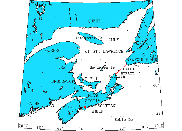
This project was initiated by BIO as part of the Department of Fisheries (DFO) Ocean Climate Program with Ken Drinkwater as project manager and principal researcher. The National Research Council’s Institute for Marine Dynamics was a partner in this project with Brian Hill as IMD’s investigator. Research was also performed and organized by Alan Ruffman of Geomarine Associates Ltd., Halifax, NS who led a team of researchers to hunt out relevant material. In these ice charts sightings of sea, field or pack ice is denoted by a red cross. If the sightings give sufficient information as to the extent or boundary of a field of ice then this is marked by an interconnecting red line. Icebergs, bergy bits and growlers, all glacial ice in origin by today’s definition, are marked as green triangles, and if interconnected by a green line denotes a number of these along that route. Occasional errors have been found which show ice well inland and these have been corrected where possible or deleted if not. In a mariner’s mind, ice encountered from A to B is the navigable waterway which if along a coast, for example, may mean rounding several headlands. When plotted simply as a straight line on a chart then this shows as an ice line crossing inland. Extreme examples of this have been edited but others have been left as is as the interpretation is fairly evident. A heavier line was then drawn to estimate the area covered by sea ice and the area the ice extending through Cabot Strait, between the Islands of Newfoundland and Cape Breton calculated.
This graph displays the annual area of sea ice coverage through the Cabot Strait and over the Scotian Shelf from 1815 to present (2026).
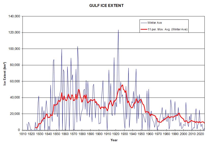
The whole time series from 1815 to present (2026) can be viewed here and the Excel file can be downloaded here.
Ice Reports & Charts
(Click on year to view)
See the Gulf Sea Ice References page for an explanation of the abbreviations used in the references for the ice reports as well as additional research material.
Gulf ice charts prior to 1815 (1769,1792,1805,1811,1812)
Ice Data Files
The data files contain the geographical coordinates in decimal degrees separately of the sea ice and iceberg reports used in compiling the charts, and also the digitized coordinates of the sea ice boundary line. Coordinates preceded by the number “1” indicate an individual sighting, and if preceded by a “0” indicates it was a line of sightings from the previous value as briefly described above in Ice Reports and Charts.